infodim_EN- DIGITAL
12
Tel: +30 2310 888 950 Fax: +30 2310 888 958 [email protected] www.infodim.gr 21, 25th Martiou Str. 54645 Thessaloniki Greece G EOGRAPHIC I NFORMATION S YSTEMS
-
Upload
asterios-kalivas -
Category
Documents
-
view
13 -
download
0
Transcript of infodim_EN- DIGITAL
Tel: +30 2310 888 950Fax: +30 2310 888 [email protected]
21, 25th Martiou Str. 54645 ThessalonikiGreece
GEOGRAPHIC INFORMATION SYSTEMS
I N F O δ η μ l 1 - 2
Corporate Profile
The company “P. Karamoschos – Κ.Liodaki & Associates» with the distinctive title “INFODIM”, was founded in 1992 being the first company in Greece involved solely with GIS. Its main activity concerns the implementation of projects for the public and private sector using Geographic Information Systems (GIS).
INFODIM uses state-of-the-art tools to carry out crisis management applications regarding Civil Protection. The company has also exclusively developed two innovative software applications: 1) INFOFIRE® which is a tool of prevention, confrontation and control against forest fires and 2) METADATA® which is a tool for creating and managing spatial metadata information respectively.
The company designs, develops and manages applications for:
• Smart Cities
• Real Estate Management
• Civil & Forest Fire Protection
• Networks Management
• Urban Planning
• Environmental Management
• Precision Agriculture
• Spatial Metadata Creation & Management
• Live Election Results on Dynamic Maps
• Portals and GeoPortals
“INFODIM” is accredited by a Quality Management
System Certification according to standards EN ISO
9001:2008 and an Information Security
Management System Certification according to
standards EN ISO 27001:2013.
I N F O δ η μ l 3
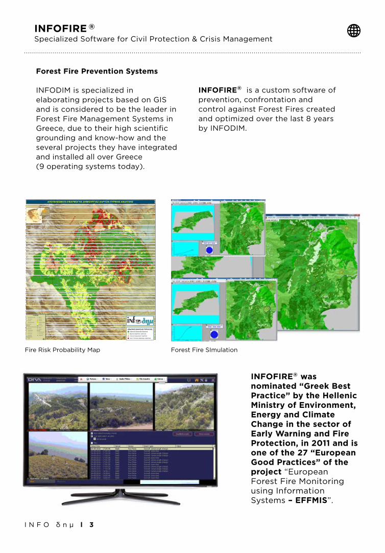
Forest Fire Prevention Systems
INFODIM is specialized in elaborating projects based on GIS and is considered to be the leader in Forest Fire Management Systems in Greece, due to their high scientific grounding and know-how and the several projects they have integrated and installed all over Greece (9 operating systems today).
INFOFIRE® is a custom software of prevention, confrontation and control against Forest Fires created and optimized over the last 8 years by INFODIM.
INFOFIRE ®
Specialized Software for Civil Protection & Crisis Management
INFOFIRE® was nominated “Greek Best Practice” by the Hellenic Ministry of Environment, Energy and Climate Change in the sector of Early Warning and Fire Protection, in 2011 and is one of the 27 “European Good Practices” of the project “European Forest Fire Monitoring using Information Systems – EFFMIS”.
$1
$1
$1
$1$1
$1
$1
$1$1
$1
$1$1
$1
$1
$1$1
$1
$1
$1
$1$1
$1
$1
$1
$1
41
41
41
41
!ª
!ª!ª!ª!ª
!ª!ª
!ª !ª!ª
!ª !ª!ª!ª !ª
!ª
!ª!ª !ª
!ª
!ª!ª!ª
!ª
!ª!ª
!ª!ª!ª
!ª!ª!ª !ª!ª !ª
!ª!ª !ª!ª !ª!ª!ª!ª
!ª!ª
!ª
!ª!ª
!ª
!ª !ª!ª
!ª!ª !ª
!ª
!ª
!ª!ª!ª
!ª!ª
!ª!ª!ª!ª
!ª
!ª!ª!ª!ª!ª!ª!ª!ª!ª!ª!ª!ª
!ª!ª!ª!ª!ª!ª!ª!ª
!ª !ª !ª
!ª!ª
!ª!ª!ª!ª!ª
!ª!ª!ª
!ª!ª !ª!ª!ª!ª !ª !ª!ª
!ª!ª !ª!ª!ª!ª!ª!ª!ª!ª !ª!ª !ª !ª!ª!ª!ª !ª!ª!ª!ª
!ª !ª!ª!ª!ª
!ª!ª!ª!ª!ª!ª !ª!ª
!ª!ª !ª!ª !ª !ª!ª !ª !ª
!ª!ª!ª !ª
!ª
!ª !ª!ª !ª !ª!ª!ª !ª!ª !ª!ª
!ª!ª!ª!ª !ª!ª !ª
!ª!ª !ª!ª!ª !ª!ª!ª!ª !ª!ª!ª
!ª
!ª!ª
!ª !ª!ª
!ª!ª
!ª
!ª
!ª!ª!ª
!ª
!ª
!ª
!"n
!!A
!!A
.F/
.F/
.F/
!"?
!"_
!"_
!"_
!"_
!"_
!"_
!"_
!"_
!"_
!"_
!"_
!"_
!"_
?
?
?
?
?
? ?
?
Δ. ΝΕΣΤΟΡΙΟΥ
Κ. ΑΡΡΕΝΩΝ
Δ. ΑΡΓΟΣ ΟΡΕΣΤΙΚΟΥ
Δ. ΑΚΡΙΤΩΝ
Δ. ΜΕΣΟΠΟΤΑΜΙΑΣ
Δ. ΑΓΙΑΣ ΤΡΙΑΔΑΣ
Κ. ΓΡΑΜΜΟΥ
Κ. ΚΑΣΤΡΑΚΙΟΥ
ΙΔΙΟΚΤΗΣΙΑ Κ. ΑΕΤΟΜΗΛΙΤΣΑΣ
Δ. ΙΩΝΟΣ ΔΡΑΓΟΥΜΗ
Δ. ΜΑΚΕΔΝΩΝ
Δ. ΚΑΣΤΟΡΙΑΣ
Στενά
Νεστόριο
Άργος ΟρεστικόΑυγή
Τσάκωνη
Μανιάκοι
Χιλιόδενδρο
Πεντάβρυσος
ΚαλοχώριΠορειά
Νίκη
Χιονάτο
Κορομηλιά
ΜεσοποταμίαΠτεριά
Ιεροπηγή
Λεύκη
Βέλος
Υψηλό
Πεύκο
Βράχος
Βοτάνι
Οινόη
Κρανοχώρι
Αγία Κυριακή
Πτελέα
Πολυάνεμο
Σπήλαια
Καστανόφυτο
Μελάνθιο
Ζούζουλη
Λάγκα
Κυψέλη
Ασπροκκλησιά
Ερ. Κοτύλης
Διαλεκτό
Λαχανόκηποι
Νόστιμο
Επταχώρι
Νέα Κοτύλη
Αμμουδάρα
Κολοκυνθού
Ομορφοκκλησιά
ΑμπελοχώριΑσπρονέρι
Μεσόβραχο
Αγία Άννα
Λακκώματα
Κομνηνάδες
Κρύα Νερά
Κρεμαστό
Ζευγοστάσιο
Πετροπουλάκι
Κάτω Πτεριά
Μελά Ρ.
Λάκκος
Ρ.
Γκιόλι Π.
ΑΛΙΑΚΜ
ΟΝΑΣ
Π.
Σκιερό
Ρ.
Στενόρρεμα
Φουντουκλή
Λοχαγού
Ρ.
Λαγγόρεμα
Ξηροπόταμος
Σουσίτσα Ρ.
Πηγαδάκι
ΑΛΙΑΚΜΟΝΑ
Σ Π.
Πτελέας Ρ
Βραχοπόταμος
ΣΑΡΑΝΤΑΠΟΡΟΣ Π.
Κρανιά Ρ.
Λιανόρεμα
Βρωμονέρι Ρ.
Άνω Ρ.
Ζουζουλιώτικο Ρ.
Βαθύρεμα
Πριόνι Ρ
.
Πηγές Α
λιάκμ
ονα
Στραβο
πόταμο
ς
Στενόποταμος
Λασπόρρεμα
Μπαρούκας Ρ.
Τριλόφου Ρ.
Βαθύ
Ρ.
Βαθύλακκος
Ρ.
Μαυριάς Ρ.
Βαλχέρ
η Ρ.
Γάργαρ
ο Ρ.
Βάλια
ς Ρ.
Ξηροπό
ταμος
Ζάμπια
νη Ρ.
Στάνης
Λάμπρ
ου Ρ
.
Σταριά Ρ.
Πετρίτσι
Ρ.
Μεγάλο Ρ.
Βρύσες Ρ.
Κλενίκα Ρ.
Ξεριά Ρ
.
Κατιν
ίστη
Ρ.
Κορφούλας Ρ.
Καλλιρόης Ρ.
Κυψε
λιώτικ
ο Ρ.
Αμμόρεμα
Λιαν
οτοπ
ίου Ρ.
Γκρουσώτικ
ο Ρ.
Σεβρένη Ρ.
Μύλου Ρ.
Κελαρίνα Ρ.
Πηγαδάκι
Γκίρτση Λιβάδι Ρ.
Τάμπας
Ρ.
Μουρμο
ύρα Ρ.
Δροσερό Ρ.
Σιγανόρρεμα
Πηγές Σαραντάπορου Π.
Δασόρρεμα
Ξηροπόταμος
ΑΛΙΑΚΜΟΝΑΣ Π.
Μεγάλο
Ρ.
Πηγές Σαραντάπορου Π.
Πηγές Α
λιάκμονα
Πηγές Α
λιάκμονα
Πηγές Σ
αραντάπο
ρου Π
.
Ζώνη
Οξυά
Δάφνη
Μόρφη
Βυθός
Πλαγιά
Λούβρη
Κορυφή
ΠύργοςΦούρκα
Τοιχίο
Πλακίδα
Χορηγός
Λαγκάδα
Αηδόνια
Δίλοφον
Μηλίτσα
ΑσπρούλαΔραγασιά
ΛευκοθέαΛικνάδες
Καστανέα
ΚυδωνίαιΧρυσαυγή
Βυσσινέα
Κεφαλάρι
Καστοριά
Δισπηλιό
Σήμαντρον
Βελανιδιά
Πληκάτιον
Τσοτίλιον
Αυγερινός
Δροσοπηγή
Κριμήνιον
Δασύλλιον
Τρίκορφον
Κρανιώνας
Απόσκεπος
Πολυκάρπη
Μαυροχώρι
Δαμασκηνιά
Μεσόλογγος
Κλεισώρεια
ΒούρμπιανηΚεφαλοχώρι
Ροδοχώριον
Πεντάλοφος
Ερ. Γάβρου
Σιδηροχώρι
Δενδροχώρι
Σκαλοχώριον
Αετομηλίτσα
Διχείμαρρον
Πυρσόγιαννη
Αγία Σωτήρα
Μαυρόκαμπος
Μεταμόρφωση
Αμπελόκηποι
Πολυκάστανον
Γοργοπόταμος
Άγιος Κοσμάς
Άνω Κρανιώνας
Νέο Κωσταράζι
Άγιος Θεόδωρος
Αγία Παρασκευή
Άγιοι Ανάργυροι
Ν. Οικισμός Κορεστίων
Χρυσή
Γράμος
Ανθηρό
Ακόντιο
Λάγουρα
Σπήλιος
Τρίλοφος
Περιβόλι
Κερασώνα
Διποταμιά
Πευκόφυτο
Καλή Βρύση
Ερ. Φούσιας
Λειβαδοτόπι
Άγιος Ηλίας
Ερ. Βέρτενικ
Ερ. Μονόπυλου
Κάτω Περιβόλι
Ερ. Μυροβλήτη
Ερ. Περιστέρας
Ερ.Γιαννοχωρίου
Ερ. Λιανοτοπίου
Ερ. Γλυκονερίου
Ερ. Αγίου Ζαχαρία
Ερ. Αγίου Δημητρίου
1800
1900
2000
1100
1000
1200
1300
1400
1500
2200
1600
1700
2300
800
900
700
2100
600
1600
1000
1200
1100
700
1200
900
1600
2100
700
700
1500
700
900
700
1100
800
700
800
1800
700
700
900
1200
1200
900
900
900
700
2000
10001200
1000
1000
1100
800
1400
1100
1200
700
1200
1500
1000
1200
700
700
1400
800
1300
1300
1300
900
1200
1400
700
800
1500
2200
1300
900
800
700
900
900
1600
900
1100
1400
1500
800
1000
1100
2000
1400
1700
1600
700
1400
1300
1400
1400
1600
800
700
1100
1000
900
1000
1200
1000
700
1200
1300
1000
700
800 900
1800
1100
800
1500
1400
1100
700
700
1000
2000
1500
800
1500
1400
800
2000
1000
1700
1300
1100
700
900
1100
700
1100
1200
1400
1000
1800
1100
700
900
700
1600
1900
800
1100
900
1400
1400
2300
700
1200
2000
1100
1700
900
1300
1400
700
2300
1700
1300
1300
1300
1200
1900
1300
2200
700
1400
1000
1100
1500
1600
1400
2200
700
800
1500
700
1300
1100
1600
1100
1200
1000
800
1600
2200
1000
1600
1300
900
1000
800
800
1800
1100
800
700
1500
700
1600
1500
800
1500
1300
1700
1400
700
1500
2000
1300
700
1000
900
700
1100
700
1100
1100
800
2300
900
1100
1300
2000
1200
1400
1100
1700
1100
900
1000
1000
1300
1200
900
1600
800
700
1700
2200
1300
1200
800
900
1000
800
2200
1600
700
1100
900
1300
700
1600 700
1200
800
1200
2200
700
1400
700
900
1000
700
700
1200
800
1900
1400
1300
1400
700
1600
1500
900
Βέλος Π.
Βέλος Π
.
Σουσίτσα Ρ.
Ζαμπουρα
ντιώζικο Ρ
.
Λεπτοκαρυάς Ρ.
Καλογέρι Ρ.
Κεφαλόβρυσο
Μακεδονομάχων Ρ.
Ζιάμπα Ρ.
Πηγές Σαραντάπορου Π.
ΥΠΟΜΝΗΜΑ
$1 Μη Οριοθετημενοι Οικισμοί
Όρια Οικισμών
Όρια Δήμων
Όρια Περιοχής Μελέτης
Όρια Νομών
Οδικό Δίκτυο
Εγνατία Οδός (Κάθετος Άξονας)
Εθνικό Δίκτυο
Επαρχιακό Δίκτυο
Δημοτικό Δίκτυο
Αγροτικό Δίκτυο
Δασικό Δίκτυο
Υδρογραφικό Δίκτυο
Ποτάμι
Ρέμα
? Δεξαμενές
!"_ Ελικοδρόμια
!"? Πυροφυλάκια
.F/ Πυροσβεστικοί Σταθμοί
Αεροδρόμια
!!A Δασικοί Πύργοι
!"n Φράγματα
41 Χωματερές
Ναρκοπέδια
!ª Δεν έχει διευκρινισθεί
!ª Κατά Προσωπικού
!ª Ύποπτοι Χώροι
ΚΙΝΔΥΝΟΣ ΕΝΑΡΞΗΣ ΠΥΡΚΑΓΙΑΣΧΑΜΗΛΟΣ ΚΙΝΔΥΝΟΣ ΕΝΑΡΞΗΣ
ΜΕΣΟΣ ΚΙΝΔΥΝΟΣ ΕΝΑΡΞΗΣ
ΥΨΗΛΟΣ ΚΙΝΔΥΝΟΣ ΕΝΑΡΞΗΣ
ΠΟΛΥ ΥΨΗΛΟΣ ΚΙΝΔΥΝΟΣ ΕΝΑΡΞΗΣµ
ΑΛΒΑΝΙ Α
Ν . ΙΩΑΝΝΙΝΩΝ
Ν . ΚΟΖΑΝΗΣ
Ν . ΚΑΣΤΟΡΙΑΣ
Ν . ΓΡΕΒΕΝΩΝ
Ν . ΦΛΩΡΙΝΑΣΑΠΟΤΕΛΕΣΜΑΤΑ ΕΦΑΡΜΟΓΗΣ ΔΗΜΙΟΥΡΓΙΑΣ ΧΑΡΤΩΝ ΠΥΡΙΚΗΣ ΑΝΑΛΥΣΗΣ
Fire Risk Probability Map Forest Fire SImulation
METADATA®
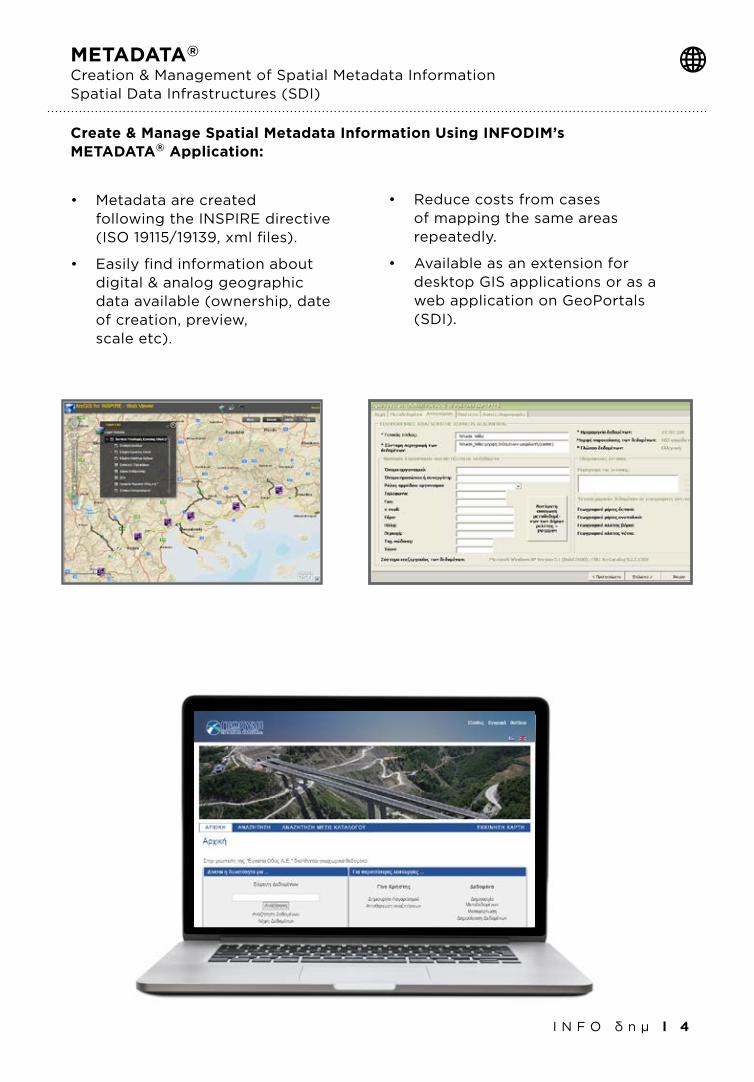
Creation & Management of Spatial Metadata InformationSpatial Data Infrastructures (SDI)
• Metadataarecreated following the INSPIRE directive (ISO 19115/19139, xml files).
• Easilyfindinformationabout digital & analog geographic data available (ownership, date of creation, preview, scale etc).
• Reducecostsfromcases of mapping the same areas repeatedly.
• Availableasanextensionfor desktop GIS applications or as a web application on GeoPortals (SDI).
I N F O δ η μ l 4
Create & Manage Spatial Metadata Information Using INFODIM’s METADATA® Application:
I N F O δ η μ l 5
Enterprise GIS Systems Development
& Cloud Services (Open Source - Commercial)
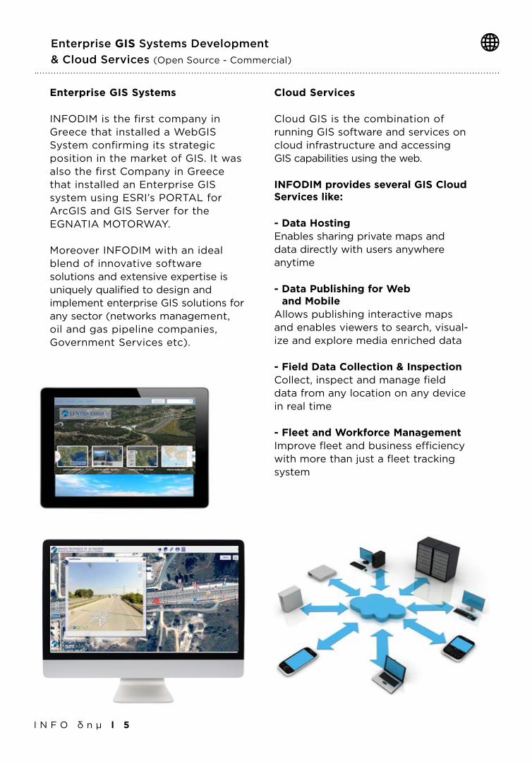
Enterprise GIS Systems
INFODIM is the first company in Greece that installed a WebGIS System confirming its strategic position in the market of GIS. It was also the first Company in Greece that installed an Enterprise GIS system using ESRI’s PORTAL for ArcGIS and GIS Server for the EGNATIA MOTORWAY.
Moreover INFODIM with an ideal blend of innovative software solutions and extensive expertise is uniquely qualified to design and implement enterprise GIS solutions for any sector (networks management, oil and gas pipeline companies, Government Services etc).
Cloud Services
Cloud GIS is the combination of running GIS software and services on cloud infrastructure and accessing GIS capabilities using the web.
INFODIM provides several GIS Cloud Services like:
- Data HostingEnables sharing private maps and data directly with users anywhere anytime
- Data Publishing for Web and MobileAllows publishing interactive maps and enables viewers to search, visual-ize and explore media enriched data
- Field Data Collection & InspectionCollect, inspect and manage field data from any location on any device in real time
- Fleet and Workforce ManagementImprove fleet and business efficiency with more than just a fleet tracking system
I N F O δ η μ l 6
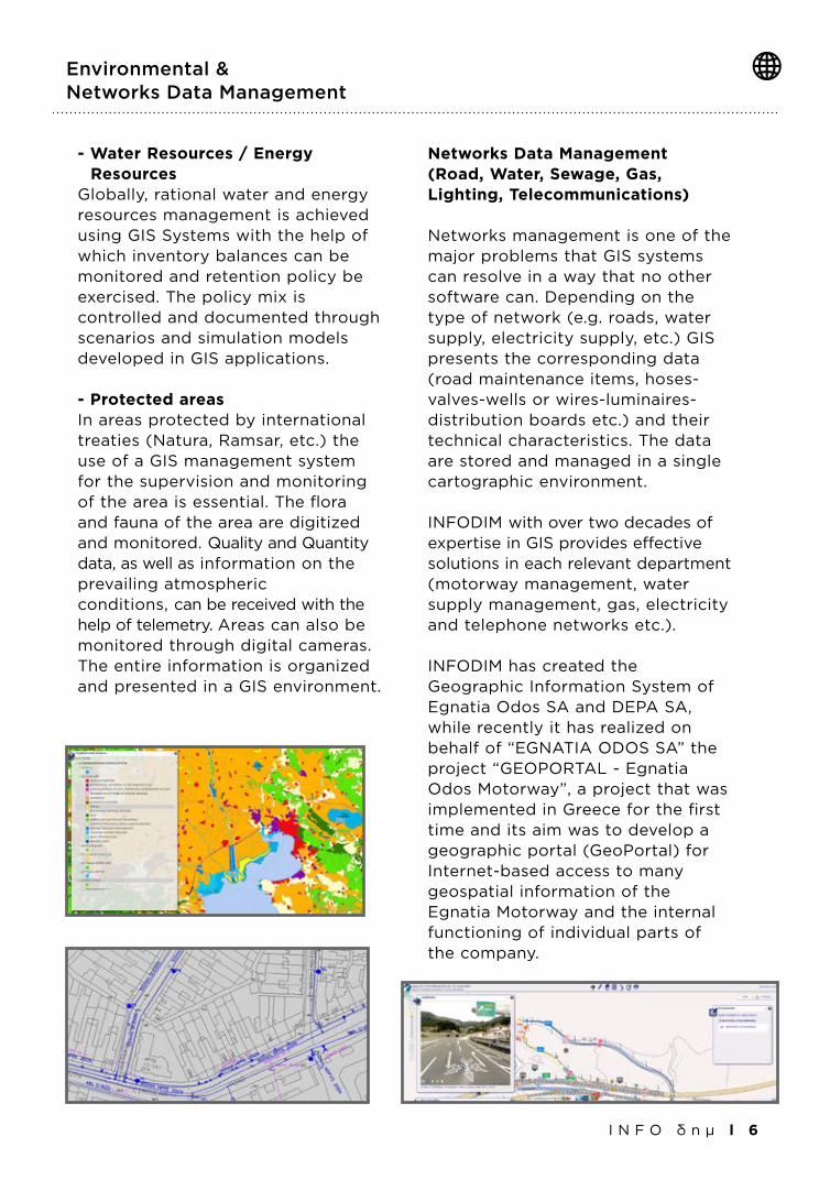
- Water Resources / Energy ResourcesGlobally, rational water and energy resources management is achieved using GIS Systems with the help of which inventory balances can be monitored and retention policy be exercised. The policy mix is controlled and documented through scenarios and simulation models developed in GIS applications.
- Protected areasIn areas protected by international treaties (Natura, Ramsar, etc.) the use of a GIS management system for the supervision and monitoring of the area is essential. The flora and fauna of the area are digitized and monitored. Quality and Quantity data, as well as information on the prevailing atmospheric conditions, can be received with the help of telemetry. Areas can also be monitored through digital cameras. The entire information is organized and presented in a GIS environment.
Networks Data Management (Road, Water, Sewage, Gas, Lighting, Telecommunications)
Networks management is one of the major problems that GIS systems can resolve in a way that no other software can. Depending on the type of network (e.g. roads, water supply, electricity supply, etc.) GIS presents the corresponding data (road maintenance items, hoses-valves-wells or wires-luminaires-distribution boards etc.) and their technical characteristics. The data are stored and managed in a single cartographic environment.
INFODIM with over two decades of expertise in GIS provides effective solutions in each relevant department (motorway management, water supply management, gas, electricity and telephone networks etc.).
INFODIM has created the Geographic Information System of Egnatia Odos SA and DEPA SA, while recently it has realized on behalf of “EGNATIA ODOS SA” the project “GEOPORTAL - Egnatia Odos Motorway”, a project that was implemented in Greece for the first time and its aim was to develop a geographic portal (GeoPortal) for Internet-based access to many geospatial information of the Egnatia Motorway and the internal functioning of individual parts of the company.
Environmental & Networks Data Management
Photogrammetry & Satellite Images Processing
I N F O δ η μ l 7
In the sector of Remote Sensing (Satellite Image Applications), INFODIM develops remote-sensing applications and processes both panchromatic images to produce topographic maps and multispectral to produce thematic maps and to support specific projects.
INFODIM is collaborating also with all European satellite images distributors and is able to instantly acquire images of recent reception with a resolution of less than 50 cm.
Photogrammetry and Satelite Images Processing services provided by INFODIM:
- Aerial Triangulation
- Orthorectification
- Digital Orthophotos Production
- DTM/DEM Surface Generation
- Digital Topographic Mapping
- Digital terrain modeling
- Controuring
- Feature Extraction
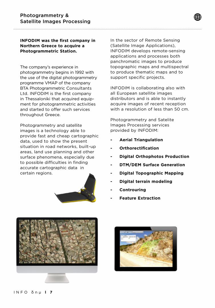
INFODIM was the first company in Northern Greece to acquire a Photogrammetric Station.
The company’s experience in photogrammetry begins in 1992 with the use of the digital photogrammetry programme VMAP of the company ΒΤΑ Photogrammetric Consultants Ltd. INFODIM is the first company in Thessaloniki that acquired equip-ment for photogrammetric activities and started to offer such services throughout Greece.
Photogrammetry and satellite images is a technology able to provide fast and cheap cartographic data, used to show the present situation in road networks, built-up areas, land use planning and other surface phenomena, especially due to possible difficulties in finding accurate cartographic data in certain regions.

I N F O δ η μ l 8
In every GIS system it is essential to design and develop a suitable GeoDatabase. Particular attention should be paid to the comprehension of user needs, specific workflows and the design of tables and relationships between them inside the GeoDatabase.
INFODIM has extensive experience in recording all the parameters necessary for designing and creating the appropriate GeoDatabase for each GIS System that needs to be developed.
Design & Development of Geographic Databases
Know the location of your fleet, and find the shortest routes.
INFODIM offers Fleet Management solutions to help you track vehicles, monitor drivers’ driving behavior and run vehicle diagnostics — re-motely.
A fleet management system helps you to get near real-time information to better manage schedules, delivery routes and potential trouble spots.
With Fleet Management solutions, you can:
•Improvefleetoperationsby controlling fuel use.
•Enhanceefficientvehicle utilization.
•Controlmaintenancecosts with vehicle diagnostics.
•Manageandimprovedriver behaviors.
Fleet Management & Logistics Services - AVL
I N F O δ η μ l 9
Real Estate GIS Applications
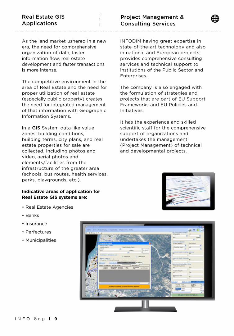
Project Management & Consulting Services
INFODIM having great expertise in state-of-the-art technology and also in national and European projects, provides comprehensive consulting services and technical support to institutions of the Public Sector and Enterprises.
The company is also engaged with the formulation of strategies and projects that are part of EU Support Frameworks and EU Policies and Initiatives.
It has the experience and skilled scientific staff for the comprehensive support of organizations and undertakes the management (Project Management) of technical and developmental projects.
As the land market ushered in a new era, the need for comprehensive organization of data, faster information flow, real estate development and faster transactions is more intense.
The competitive environment in the area of Real Estate and the need for proper utilization of real estate (especially public property) creates the need for integrated management of that information with Geographic Information Systems.
Ιn a GIS System data like value zones, building conditions, building terms, city plans, and real estate properties for sale are collected, including photos andvideo, aerial photos and elements/facilities from the infrastructure of the greater area (schools, bus routes, health services, parks, playgrounds, etc.).
Indicative areas of application for Real Estate GIS systems are:
•RealEstateAgencies
•Banks
•Insurance
•Perfectures
•Municipalities
Smart City WebGIS Applications: Waste Management - Light Management - Public Networks Management
I N F O δ η μ l 1 0
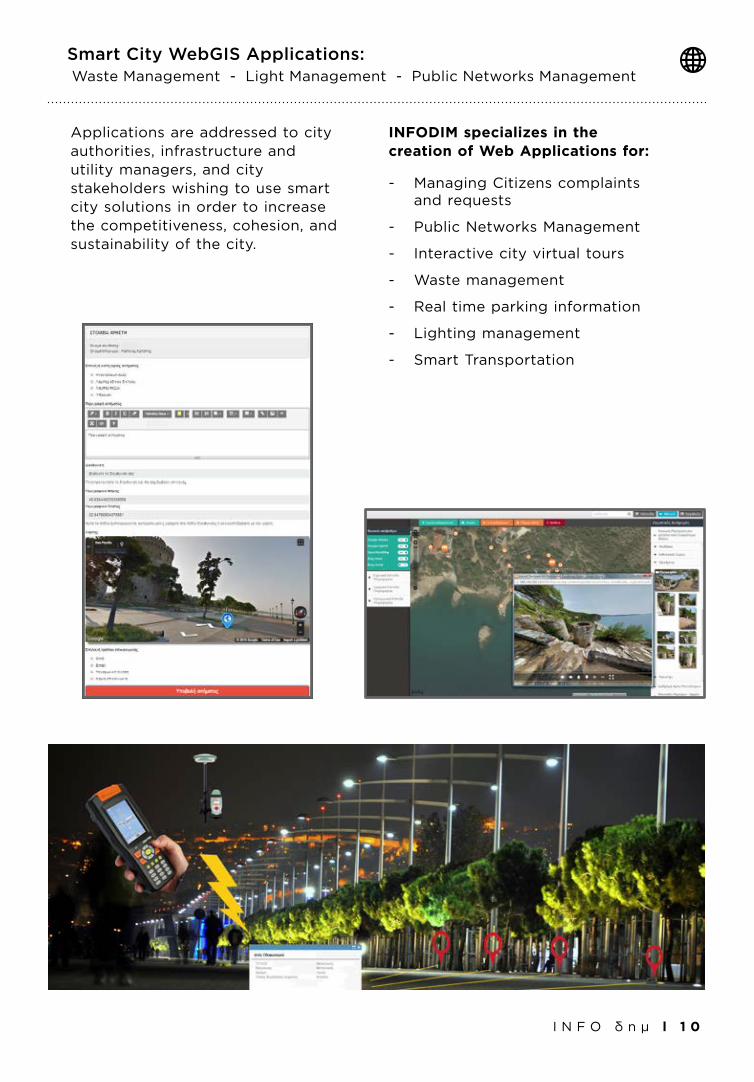
Applications are addressed to city authorities, infrastructure and utility managers, and city stakeholders wishing to use smart city solutions in order to increase the competitiveness, cohesion, and sustainability of the city.
INFODIM specializes in the creation of Web Applications for:
- Managing Citizens complaints and requests
- Public Networks Management
- Interactive city virtual tours
- Waste management
- Real time parking information
- Lighting management
- Smart Transportation
GEOGRAPHIC INFORMATION SYSTEMS