Paleoclimate of the Levant and the eastern Mediterranean during the Pleistocene.
23
Paleoclimate of the Levant and the eastern Mediterranean during the Pleistocene
-
Upload
charlene-little -
Category
Documents
-
view
216 -
download
0
Transcript of Paleoclimate of the Levant and the eastern Mediterranean during the Pleistocene.
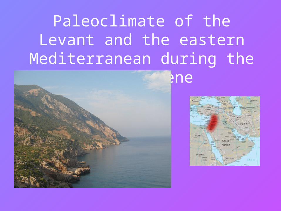
Paleoclimate of the Levant and the eastern Mediterranean during the
Pleistocene
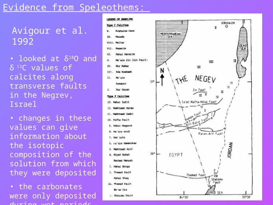
Avigour et al. 1992
• looked at δ18O and δ 13C values of calcites along transverse faults in the Negrev, Israel
• changes in these values can give information about the isotopic composition of the solution from which they were deposited
• the carbonates were only deposited during wet periods, so the results are only reflective of these times
Evidence from Speleothems:
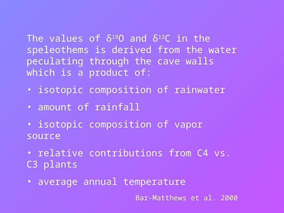
The values of δ18O and δ13C in the speleothems is derived from the water peculating through the cave walls which is a product of:
• isotopic composition of rainwater
• amount of rainfall
• isotopic composition of vapor source
• relative contributions from C4 vs. C3 plants
• average annual temperature
Bar-Matthews et al. 2000
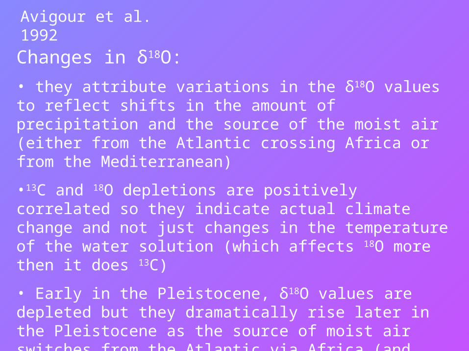
• they attribute variations in the δ18O values to reflect shifts in the amount of precipitation and the source of the moist air (either from the Atlantic crossing Africa or from the Mediterranean)
•13C and 18O depletions are positively correlated so they indicate actual climate change and not just changes in the temperature of the water solution (which affects 18O more then it does 13C)
• Early in the Pleistocene, δ18O values are depleted but they dramatically rise later in the Pleistocene as the source of moist air switches from the Atlantic via Africa (and therefore losing it’s heavier isotopes) to the Mediterranean (maybe a northward shift of the ITCZ during the early Pleistocene?).
Avigour et al. 1992
Changes in δ18O:
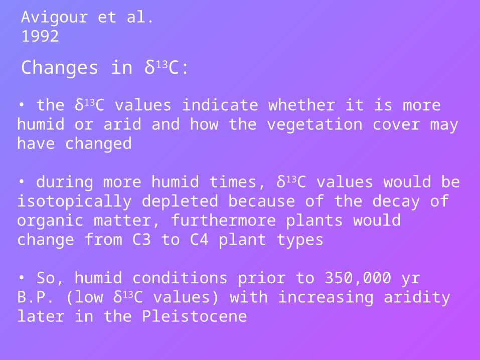
• the δ13C values indicate whether it is more humid or arid and how the vegetation cover may have changed
• during more humid times, δ13C values would be isotopically depleted because of the decay of organic matter, furthermore plants would change from C3 to C4 plant types
• So, humid conditions prior to 350,000 yr B.P. (low δ13C values) with increasing aridity later in the Pleistocene
Avigour et al. 1992
Changes in δ13C:
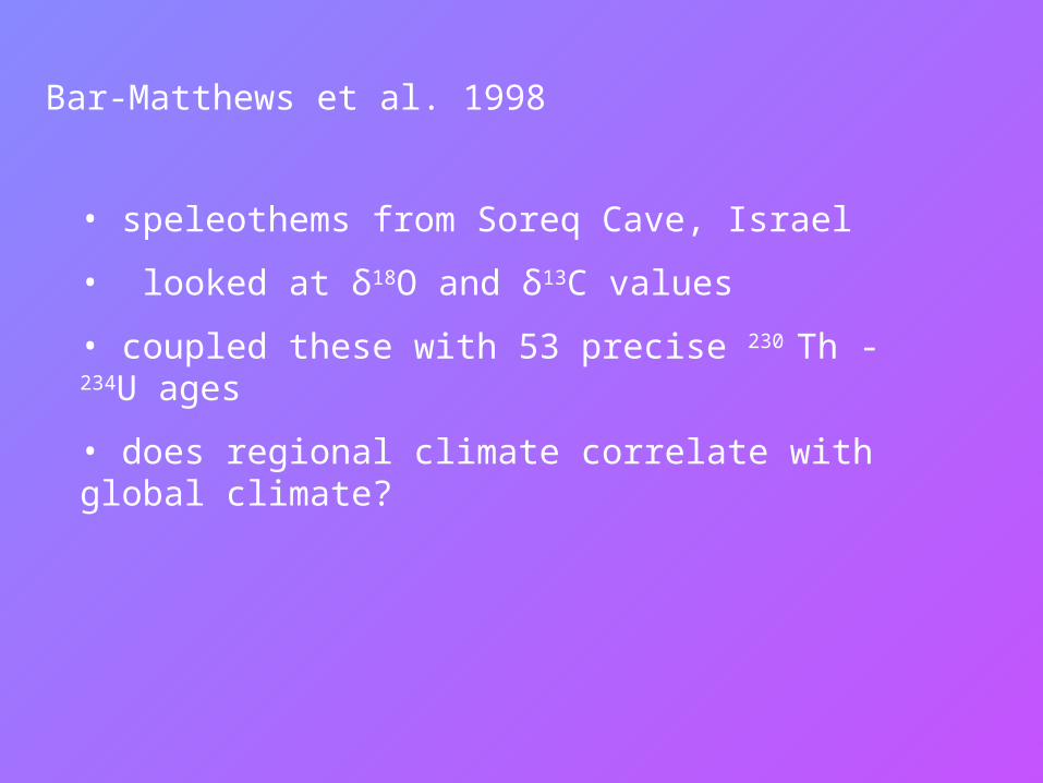
Bar-Matthews et al. 1998
• speleothems from Soreq Cave, Israel
• looked at δ18O and δ13C values
• coupled these with 53 precise 230 Th - 234U ages
• does regional climate correlate with global climate?
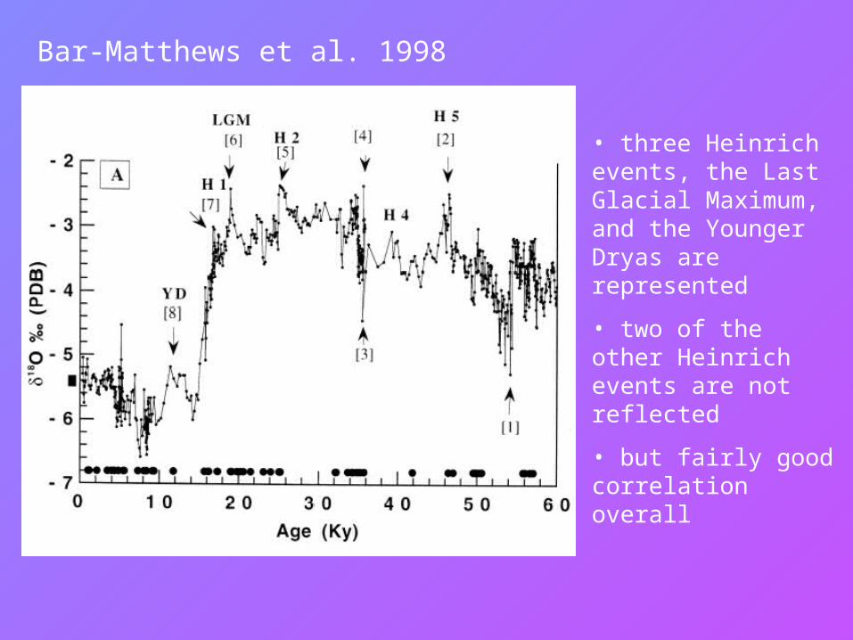
• three Heinrich events, the Last Glacial Maximum, and the Younger Dryas are represented
• two of the other Heinrich events are not reflected
• but fairly good correlation overall
Bar-Matthews et al. 1998
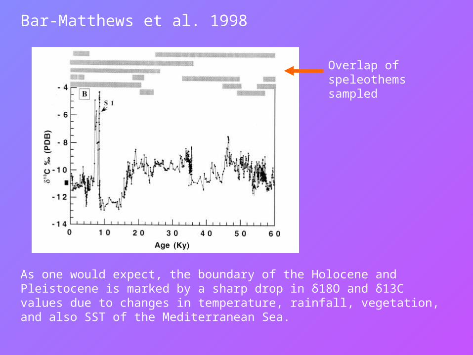
Overlap of speleothems sampled
As one would expect, the boundary of the Holocene and Pleistocene is marked by a sharp drop in δ18O and δ13C values due to changes in temperature, rainfall, vegetation, and also SST of the Mediterranean Sea.
Bar-Matthews et al. 1998
Evidence from Lake Sediments:
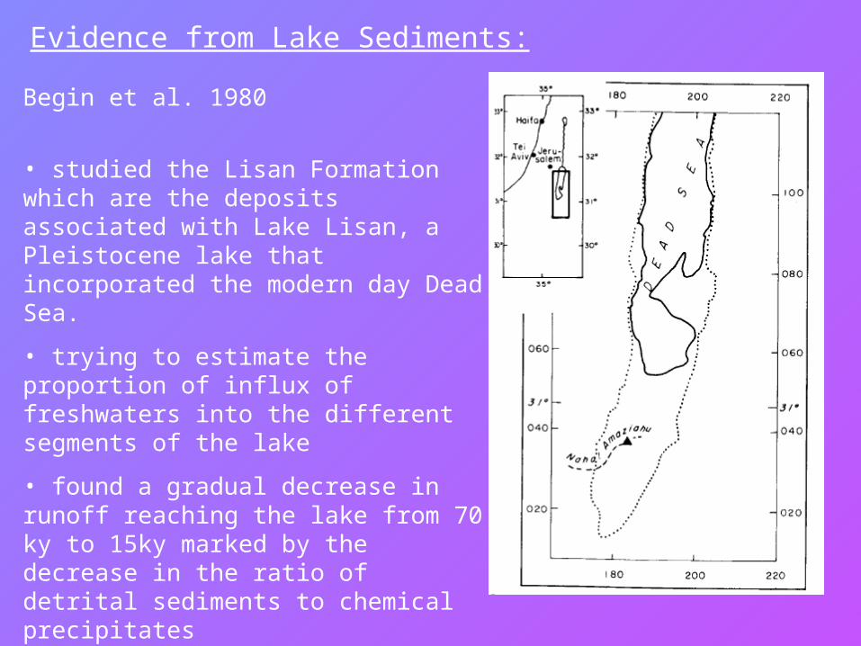
Begin et al. 1980
• studied the Lisan Formation which are the deposits associated with Lake Lisan, a Pleistocene lake that incorporated the modern day Dead Sea.
• trying to estimate the proportion of influx of freshwaters into the different segments of the lake
• found a gradual decrease in runoff reaching the lake from 70 ky to 15ky marked by the decrease in the ratio of detrital sediments to chemical precipitates
• Lake levels remained constant, however, so decrease in runoff must have been compensated by less evaporation
Evidence from Sapropels:
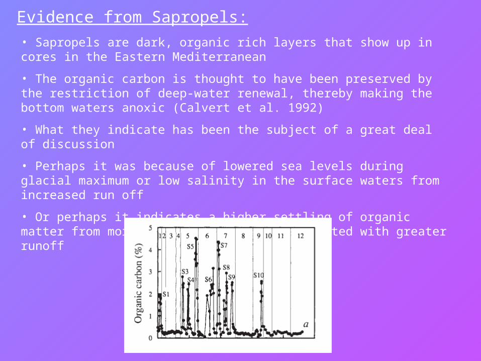
• Sapropels are dark, organic rich layers that show up in cores in the Eastern Mediterranean
• The organic carbon is thought to have been preserved by the restriction of deep-water renewal, thereby making the bottom waters anoxic (Calvert et al. 1992)
• What they indicate has been the subject of a great deal of discussion
• Perhaps it was because of lowered sea levels during glacial maximum or low salinity in the surface waters from increased run off
• Or perhaps it indicates a higher settling of organic matter from more primary production associated with greater runoff
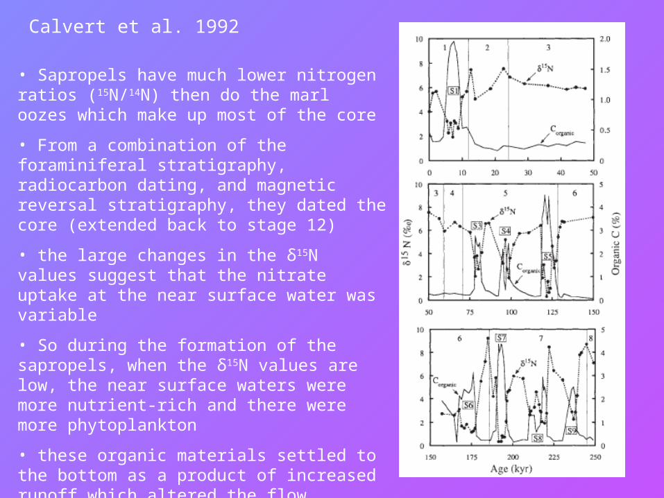
Calvert et al. 1992
• Sapropels have much lower nitrogen ratios (15N/14N) then do the marl oozes which make up most of the core
• From a combination of the foraminiferal stratigraphy, radiocarbon dating, and magnetic reversal stratigraphy, they dated the core (extended back to stage 12)
• the large changes in the δ15N values suggest that the nitrate uptake at the near surface water was variable
• So during the formation of the sapropels, when the δ15N values are low, the near surface waters were more nutrient-rich and there were more phytoplankton
• these organic materials settled to the bottom as a product of increased runoff which altered the flow directions of the surface and deep waters thereby making the deep waters depleted in oxygen
Rossignol-Strick and Paterne 1999
• the sapropels preserve both microfossils and pollen
• they looked at the pollen for all of the sapropels found in the core, representing the last million years
• pollon record is biased because of distance between emission and burial
• concentrated on three significant taxa: deciduous oak (Quercus), sage brush (Artemisia), and herbs/bushes (Chenopodiaceae)
• in the Mediterranean, the limiting factor is moisture, so that is what they concentrated on
• if there are deciduous forests, it means that it is moist year round with no seasonal dryness
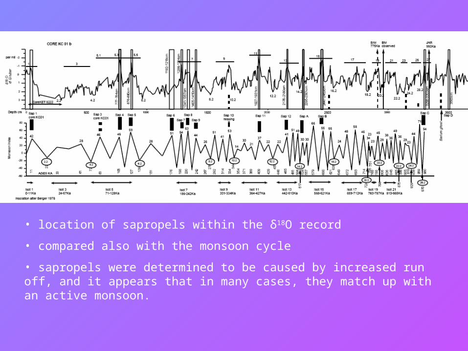
• location of sapropels within the δ18O record
• compared also with the monsoon cycle
• sapropels were determined to be caused by increased run off, and it appears that in many cases, they match up with an active monsoon.
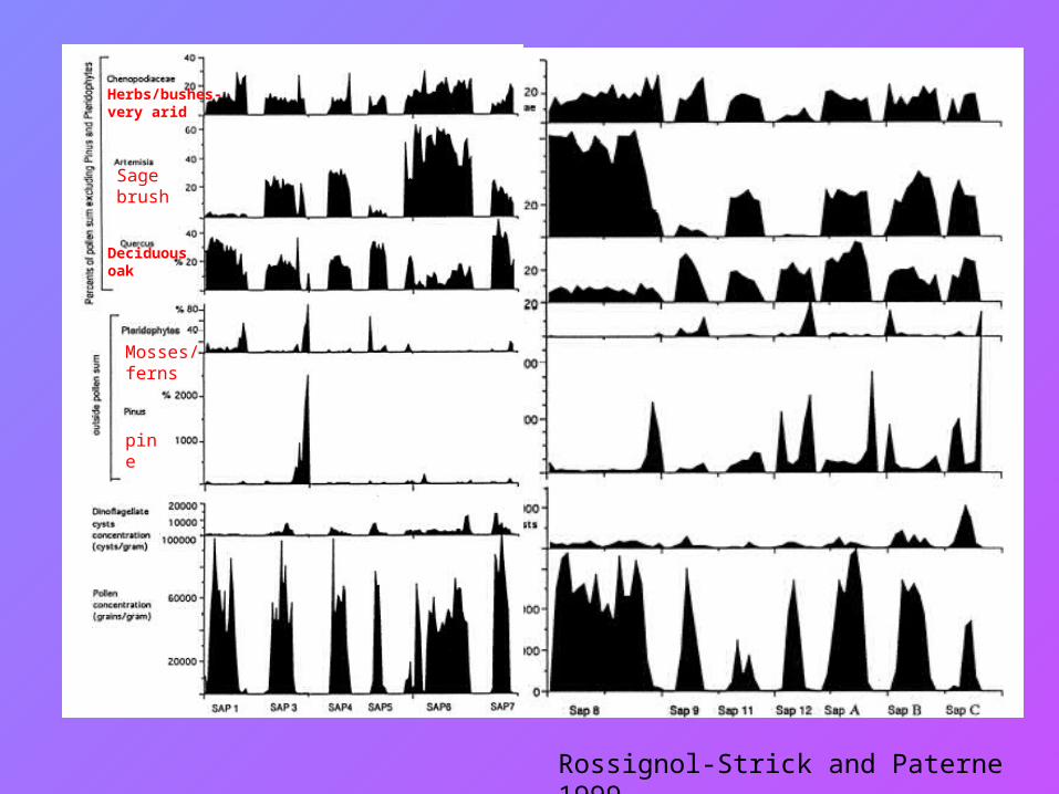
Deciduous oak
Sage brush
Herbs/bushes- very arid
Rossignol-Strick and Paterne 1999
Mosses/ ferns
pine
Evidence from Stratigraphic Profiles:
Zilberman (1993) identifies three types of climatic regimes:
1) Sedimentation- semi arid, abundant dust storms and low intensity rainfall
2) Stable Conditions (soil)- semi arid, low intensity rainfall but less dust
3) Erosion- arid climate, high intensity rainfall and flooding
• found that the Middle Paleolithic (prior to 40 ky B.P.) were much coarser and suggests higher intensity rainfall
• the late Pleistocene is dominated by fine silts and redeposited loess
• the Holocene appears to be the most arid period of all, with a great deal of erosion
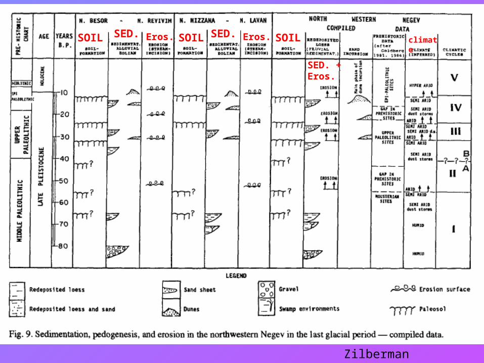
Zilberman 1993
SOIL SOIL SOILSED. SED.
SED. + Eros.
Eros. Eros. climate
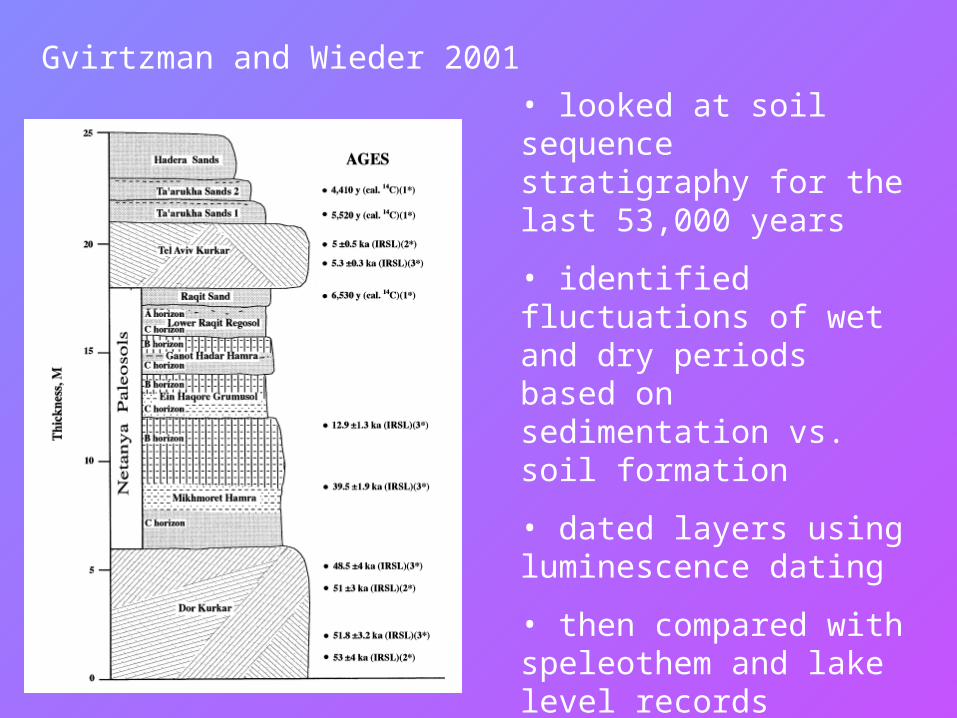
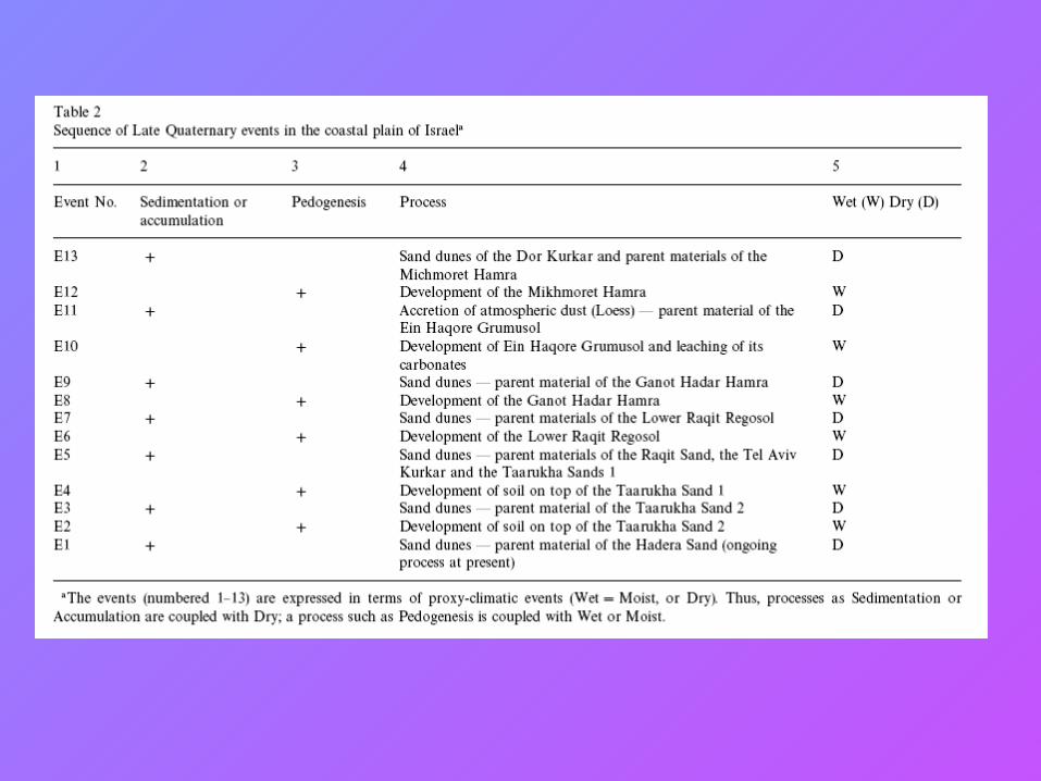
Gvirtzman and Wieder 2001
• looked at soil sequence stratigraphy for the last 53,000 years
• identified fluctuations of wet and dry periods based on sedimentation vs. soil formation
• dated layers using luminescence dating
• then compared with speleothem and lake level records
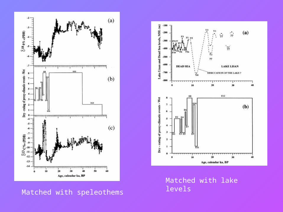
Matched with speleothems
Matched with lake levels
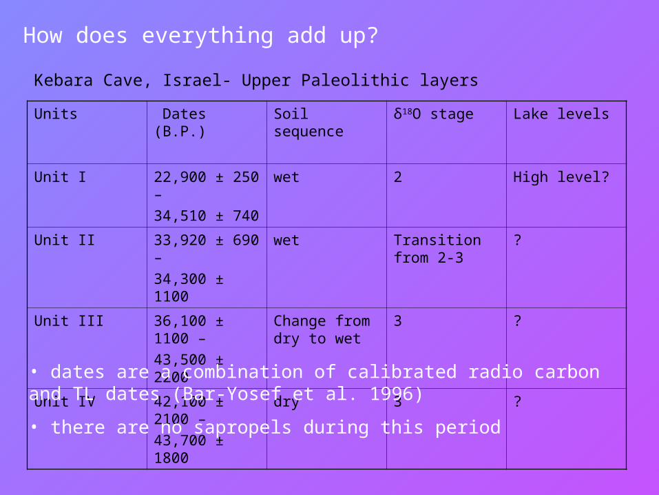
How does everything add up?
Kebara Cave, Israel- Upper Paleolithic layers
Units Dates (B.P.) Soil sequence δ18O stage Lake levels
Unit I 22,900 ± 250 –
34,510 ± 740
wet 2 High level?
Unit II 33,920 ± 690 –
34,300 ± 1100
wet Transition from 2-3
?
Unit III 36,100 ± 1100 –
43,500 ± 2200
Change from dry to wet
3 ?
Unit IV 42,100 ± 2100 –
43,700 ± 1800
dry 3 ?
• dates are a combination of calibrated radio carbon and TL dates (Bar-Yosef et al. 1996)
• there are no sapropels during this period
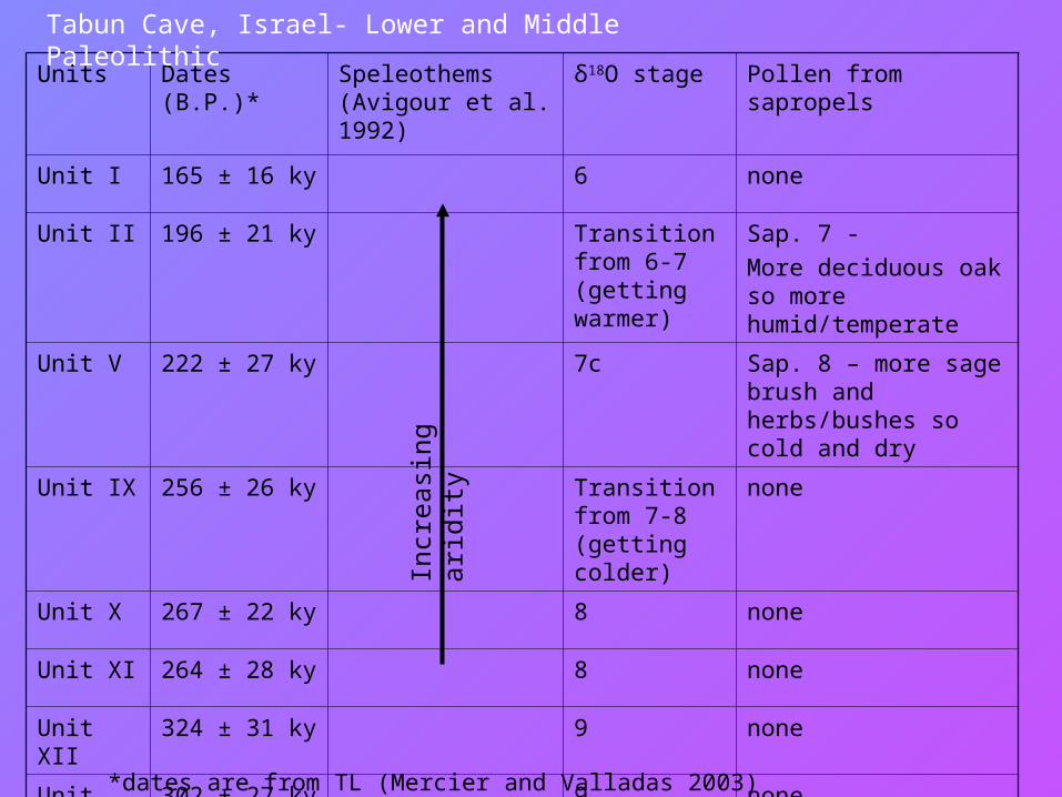
Units Dates (B.P.)* Speleothems (Avigour et al. 1992)
δ18O stage Pollen from sapropels
Unit I 165 ± 16 ky 6 none
Unit II 196 ± 21 ky Transition from 6-7 (getting warmer)
Sap. 7 -
More deciduous oak so more humid/temperate
Unit V 222 ± 27 ky 7c Sap. 8 – more sage brush and herbs/bushes so cold and dry
Unit IX 256 ± 26 ky Transition from 7-8 (getting colder)
none
Unit X 267 ± 22 ky 8 none
Unit XI 264 ± 28 ky 8 none
Unit XII 324 ± 31 ky 9 none
Unit XIII 302 ± 27 ky 9 none
Incr
easi
ng a
ridity
Tabun Cave, Israel- Lower and Middle Paleolithic
*dates are from TL (Mercier and Valladas 2003)
Conclusions
• Information is patchy but by integrating many sources, one can achieve a fairly good picture of the paleoclimate
• Particular caution should be used for δ18O and δ13C values from speleothems because they could mean different things
• Local climatic changes appear to match up well with global changes (the oceanic δ18O record, for instance)
Bibliography
Avigour, A., et al. 1992. Pleistocene Paleoclimate of the Arid Region of Israel as Recorded in Calcite Deposits along Regional Transverse Faults and in Veins. Quaternary Research 37: 304-314.
Bar-Matthews, M., et al. 2000. Timing and hydrological conditions of Sapropel events in the Eastern Mediterranean, as evident from speleothems, Soreq cave, Israel. Chemical Geology 169: 145-156.
Bar-Matthews, M., et al. 1998. The Eastern Mediterranean paleoclimate as a reflection of regional events: Soreq cave, Israel. Earth and Planetary Science Letters 166: 85-95.
Bar-Yosef, O., et al. 1996. The Dating of the Upper Paleolithic Layers in Kebara Cave, Mt Carmel. Journal of Archaeological Science 23:297-306.
Begin, Z.B., et al. 1980. Stratigraphy and facies distribution in the Lisan Formation: New evidence from the area south of the Dead Sea, Israel. Israel Journal of Earth Sciences 29: 182-189.
Calvert, S.E., et al. 1992. Evidence from nitrogen isotope ratios for enhanced productivity during formation of eastern Mediterranean sapropels. Nature 359: 223-225.
Gvirtzman, G. and M. Wieder. 2001. Climate of the last 53,000 Years in the eastern Mediterranean, based on soil-sequence Stratigraphy in the coastal plain of Israel. Quaternary Science Reviews 20: 1827-1849.
Mercier, N. and H. Valladas. 2003. Reassessment of TL age estimates of burnt flints from the Paleolithic site of Tabun Cave, Israel. Journal of Human Evolution 45: 401- 409.
Rossignol-Strick, M. and M. Paterne. 1999. A synthetic pollen record of the eastern Mediterranean sapropels of the last 1 Ma: implications for the time-scale and formation of sapropels. Marine Geology 153: 221-237.
Zilberman, E. 1993. The late Pleistocene sequence of the northwestern Negrev flood plain: a key to reconstructing the paleoclimate of southern Israel in the last glacial. Israel Journal of Earth Sciences 41: 155-167.


![Chapter 5.ppt - Eastern Mediterranean University · 2011. 9. 27. · Title: Microsoft PowerPoint - Chapter 5.ppt [Compatibility Mode] Author: Administrator Created Date: 9/26/2011](https://static.fdocument.org/doc/165x107/60eca53fd2c50427700292f7/chapter-5ppt-eastern-mediterranean-university-2011-9-27-title-microsoft.jpg)