


![1. Introduction · 100 μl of CPOB was added drop wise onto test samples and laid at ambient temperature ... Baskar R, Mauclaire L, Mckenzie J A 2006 Current Sci. 90 58. [9] Holt](https://static.fdocument.org/doc/165x107/5ccfee9688c993ea048d4b5a/1-introduction-100-l-of-cpob-was-added-drop-wise-onto-test-samples-and-laid.jpg)

γλώσσες
Σελίδες
Νομικός

NYC SEA BREEZE EVENT 2004.08.09
William T. Thompson, Teddy Holt, and Julie PullenNaval Research Laboratory
Monterey, CA
NYC SEA BREEZE EVENT 2004080912
• Results are shown for nest 5• Δx = 444 m
• Period is preceded by 5 days of data assimilation
• Urban canopy parameterization is used on nests 4 and 5 (more later)
• High resolution, time dependent SST from NYHOPS data on nests 4 and 5
NYC SEA BREEZE EVENT 2004080912
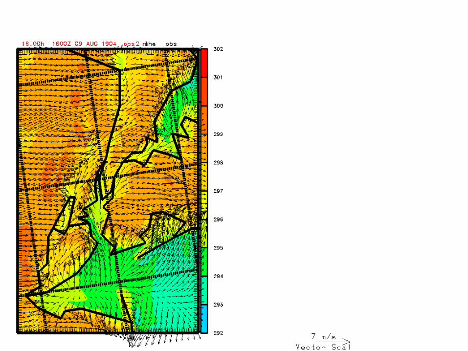
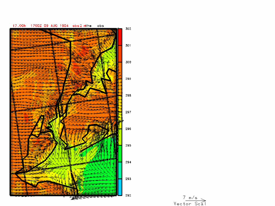
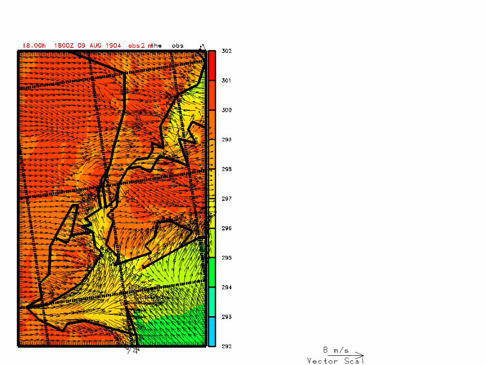
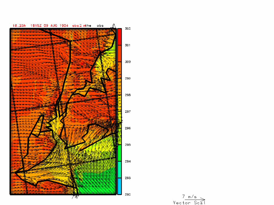
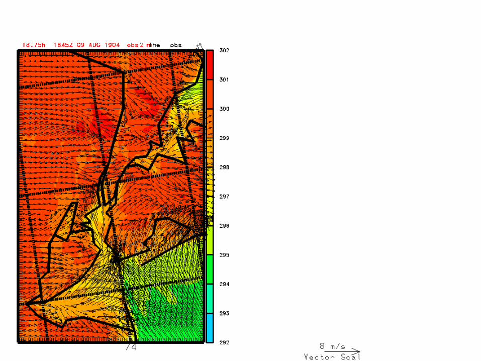
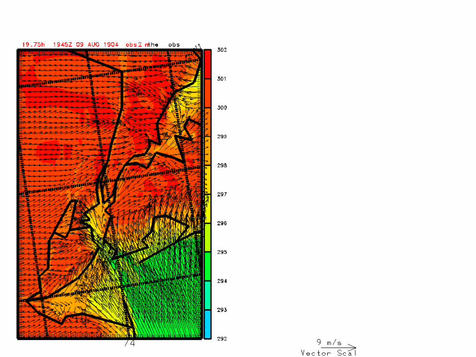
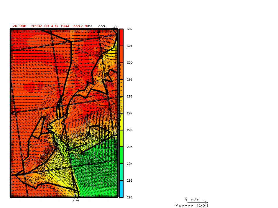
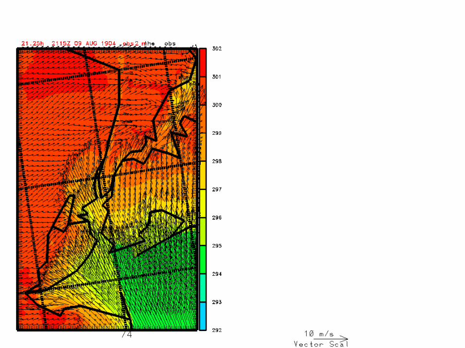
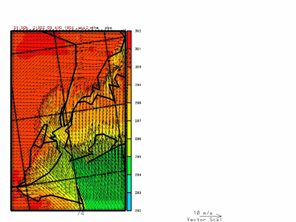
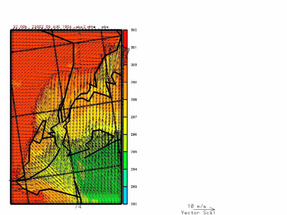
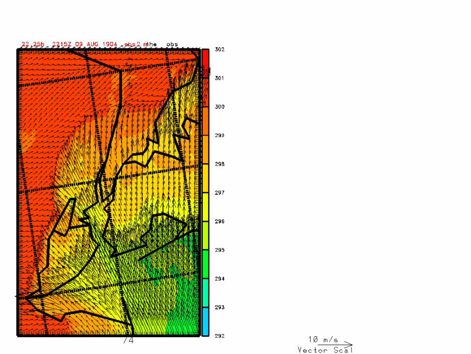
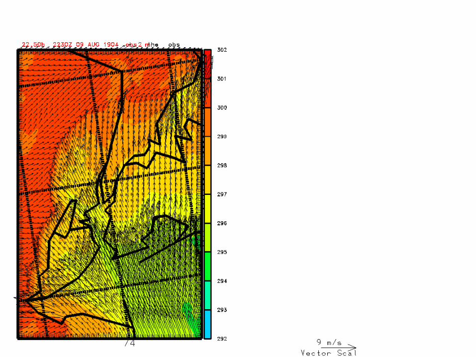
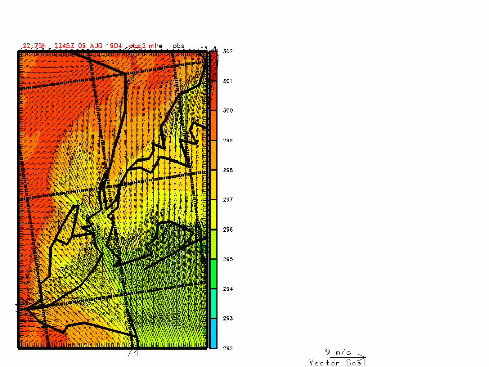
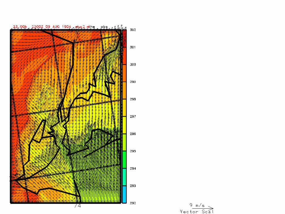
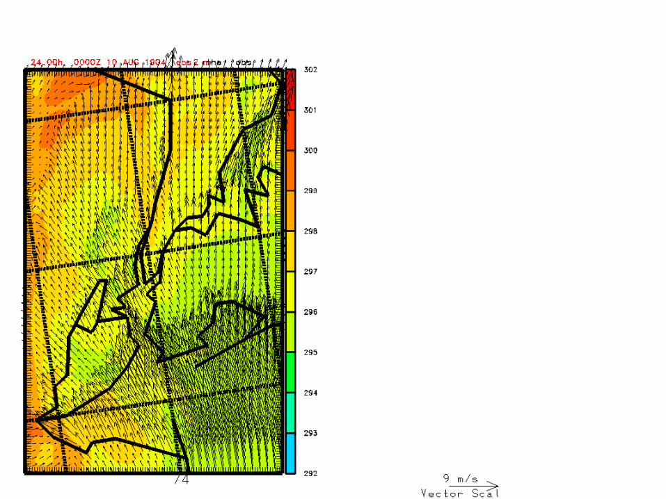
• Animation* from 1200 UTC 9 August to 0000 UTC 10 August 2004, showing 2 m wind (m/s) and potential temperature (K)*hourly from 12-18; 15 min thereafter
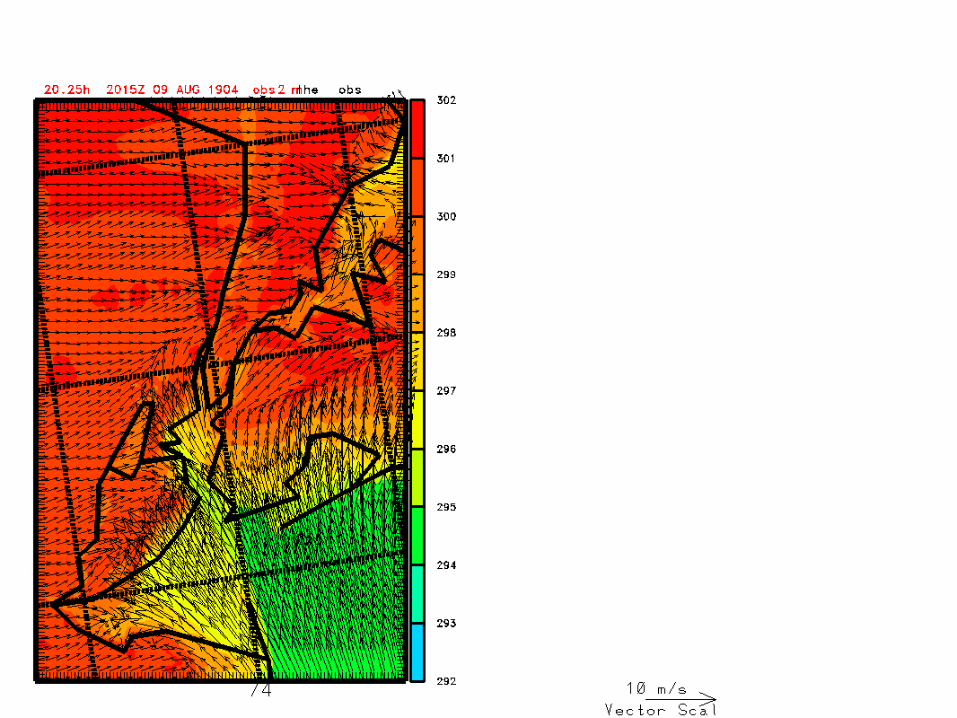
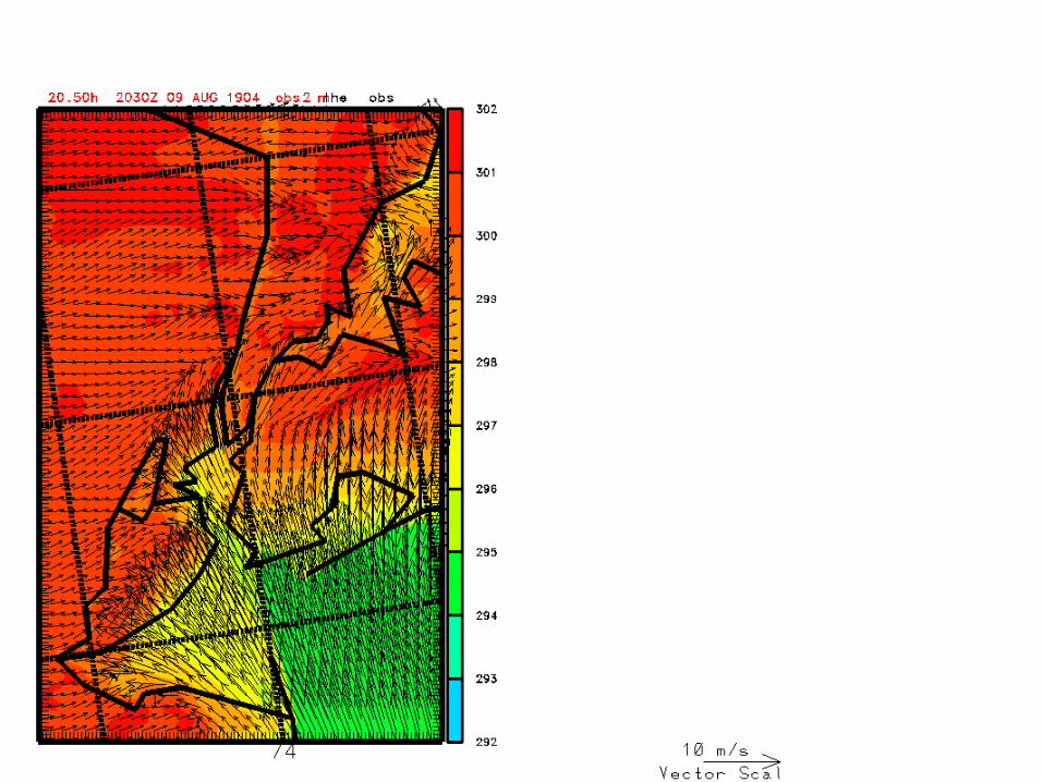
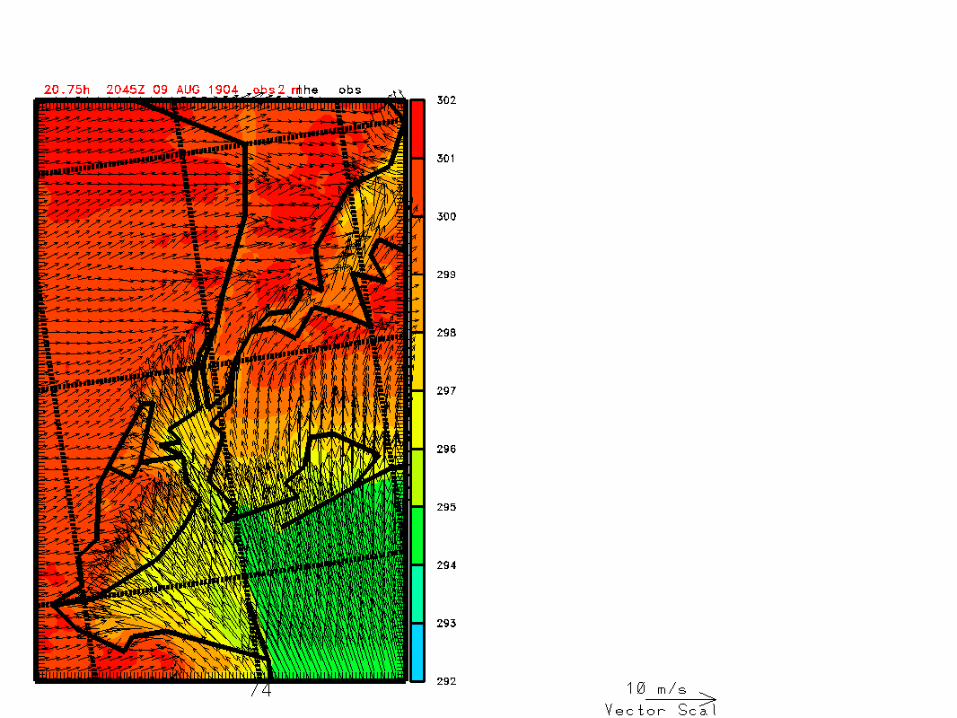
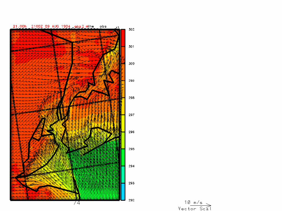
• Wind turns onshore at ~1600 UTC or 1400 LT and slowly advances over Brooklyn and Queens
• Sea breeze front reaches Manhattan at ~1700 LT• Front continues into New Jersey• Wind over Manhattan Island remains light throughout
the period
NYC SEA BREEZE EVENT 2004080912
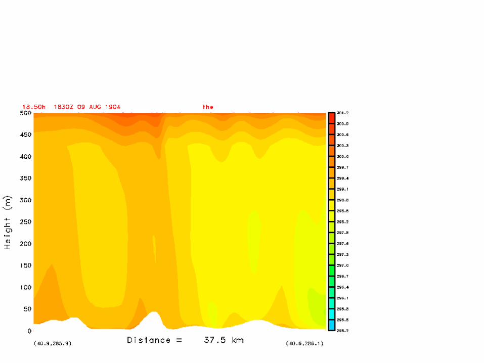
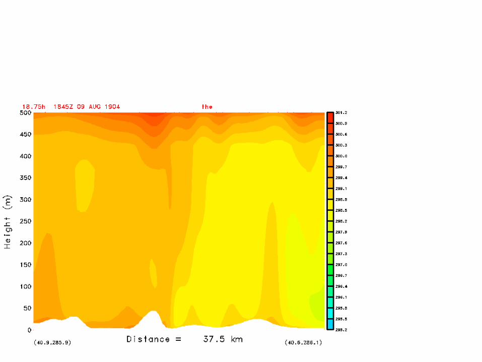
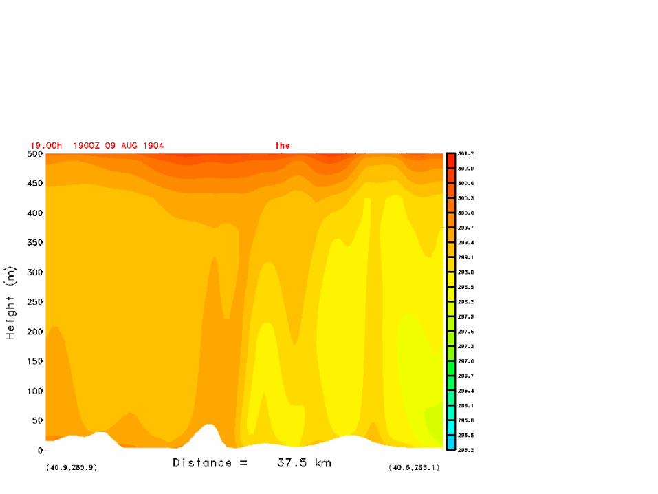
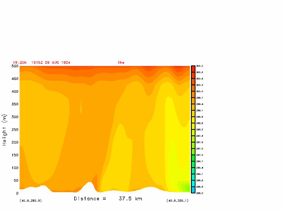
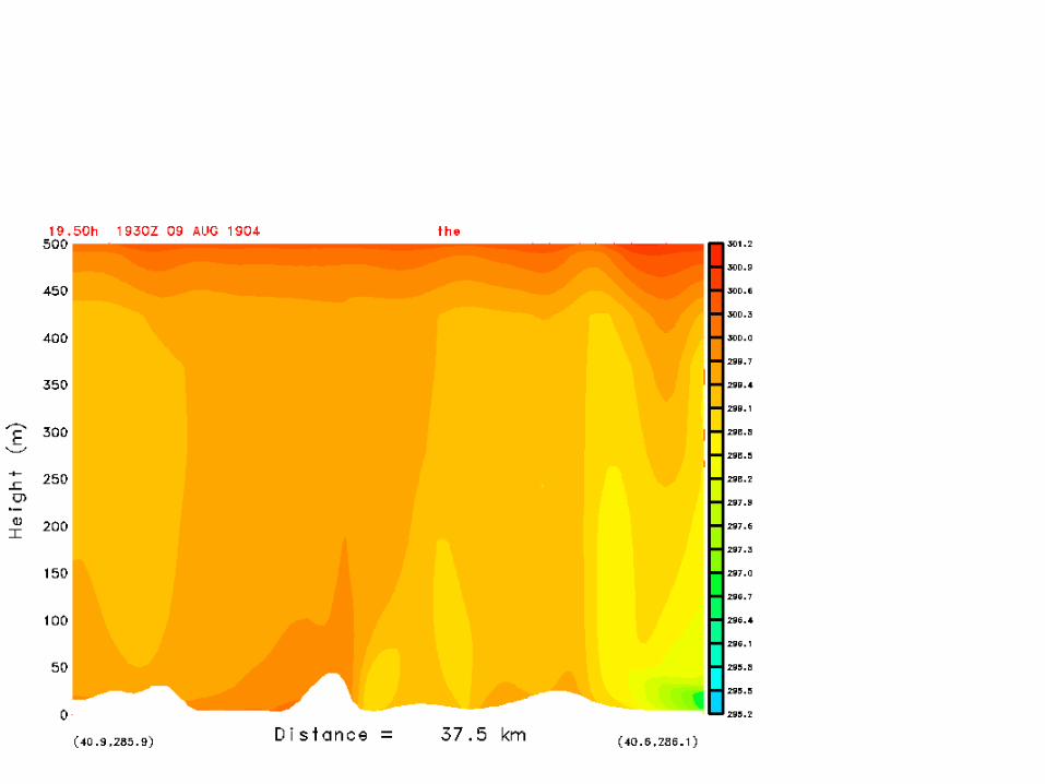
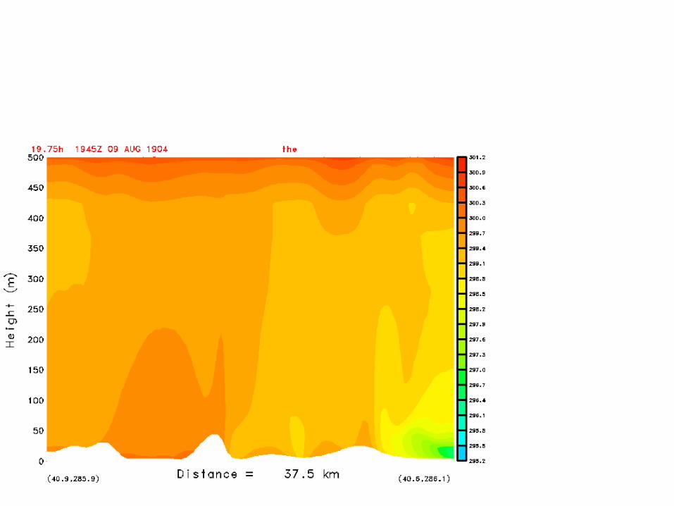
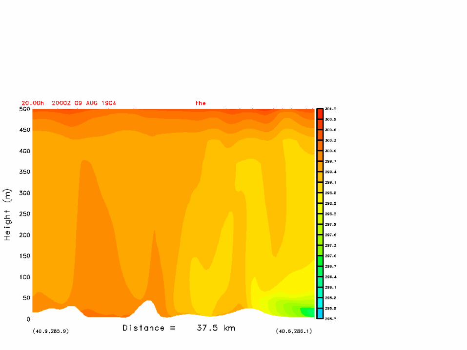
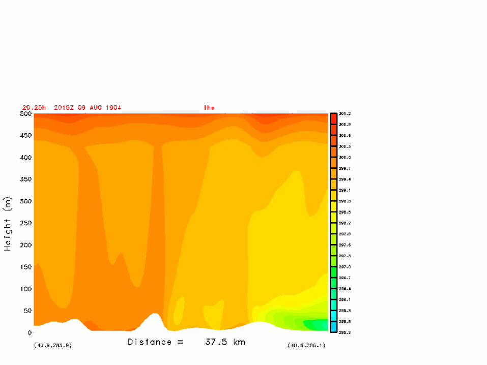
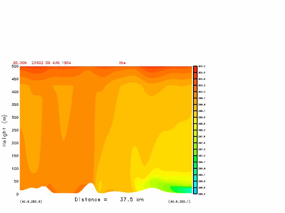
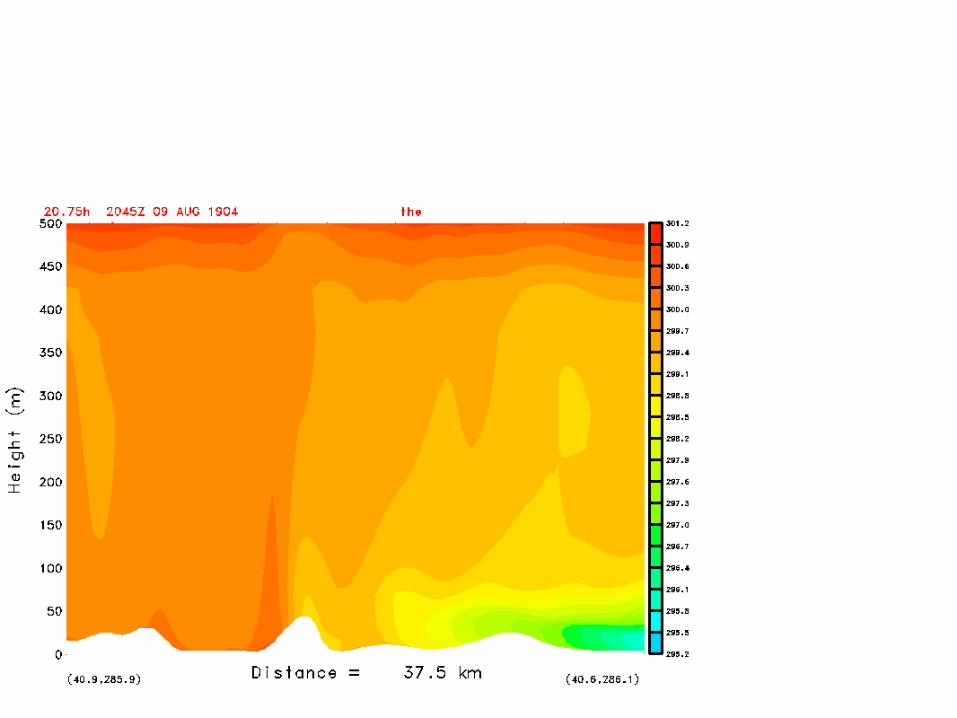
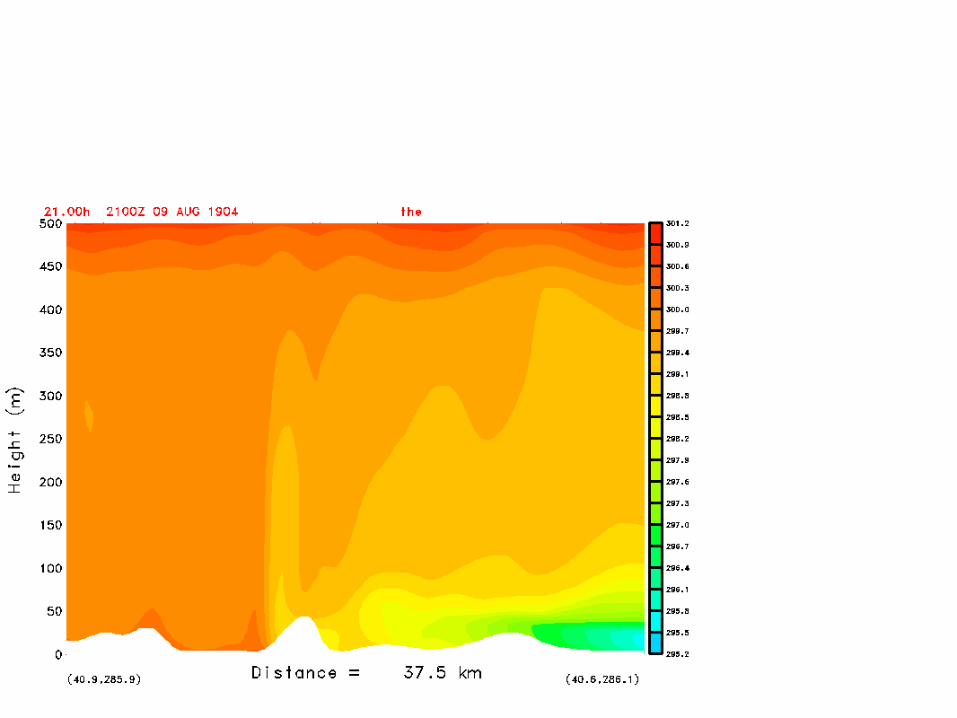
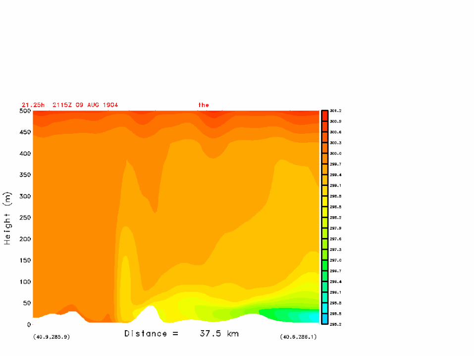
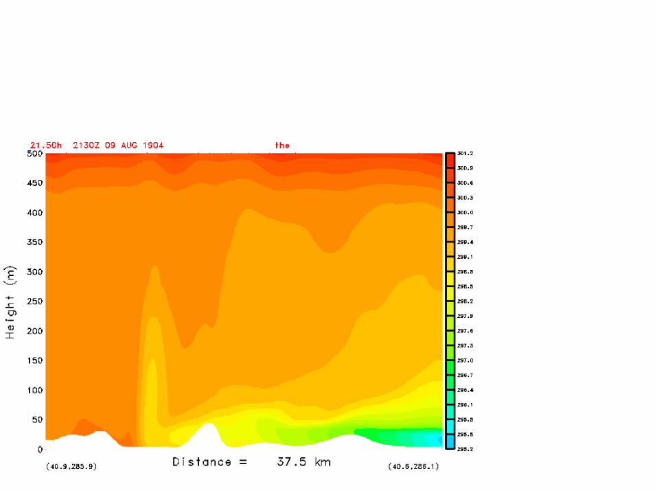
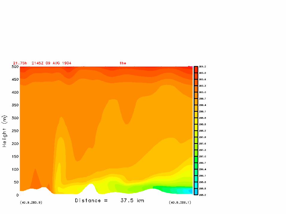
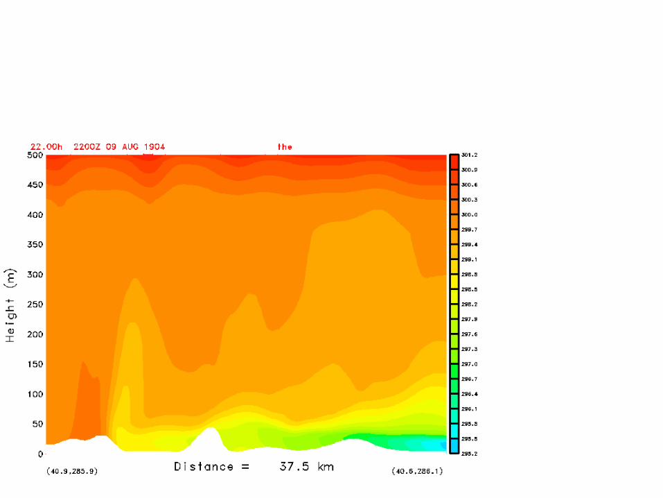
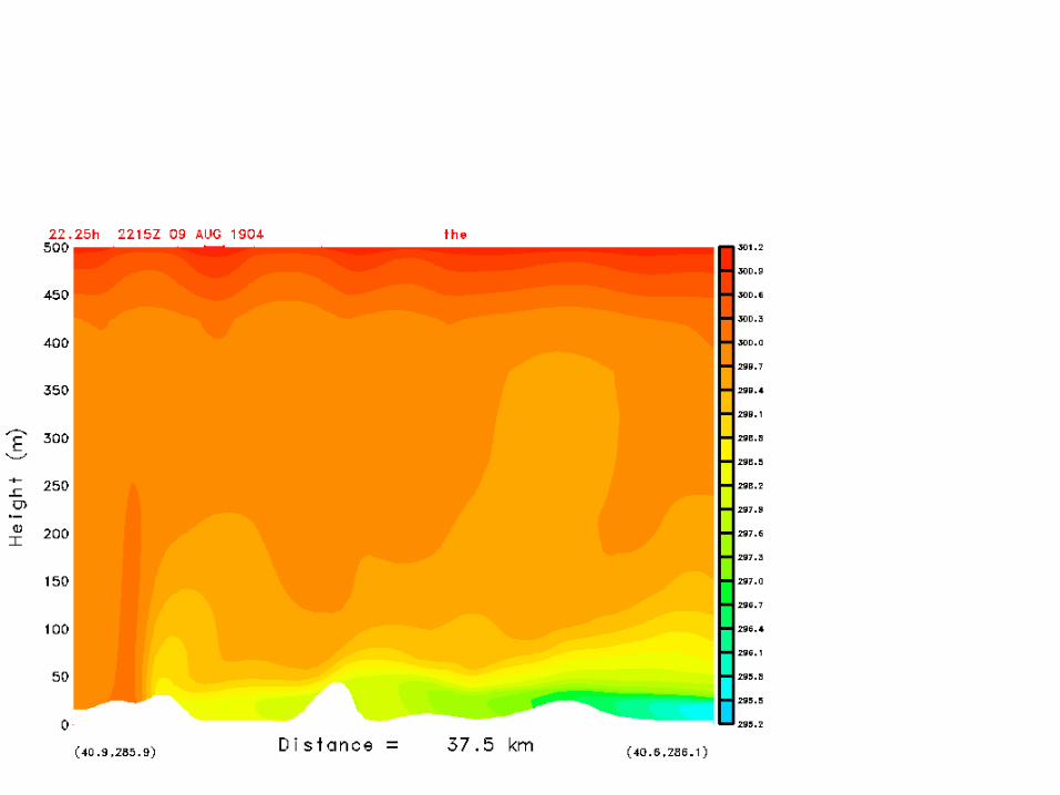
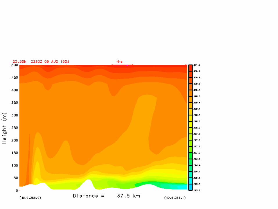
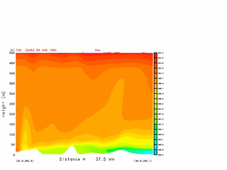
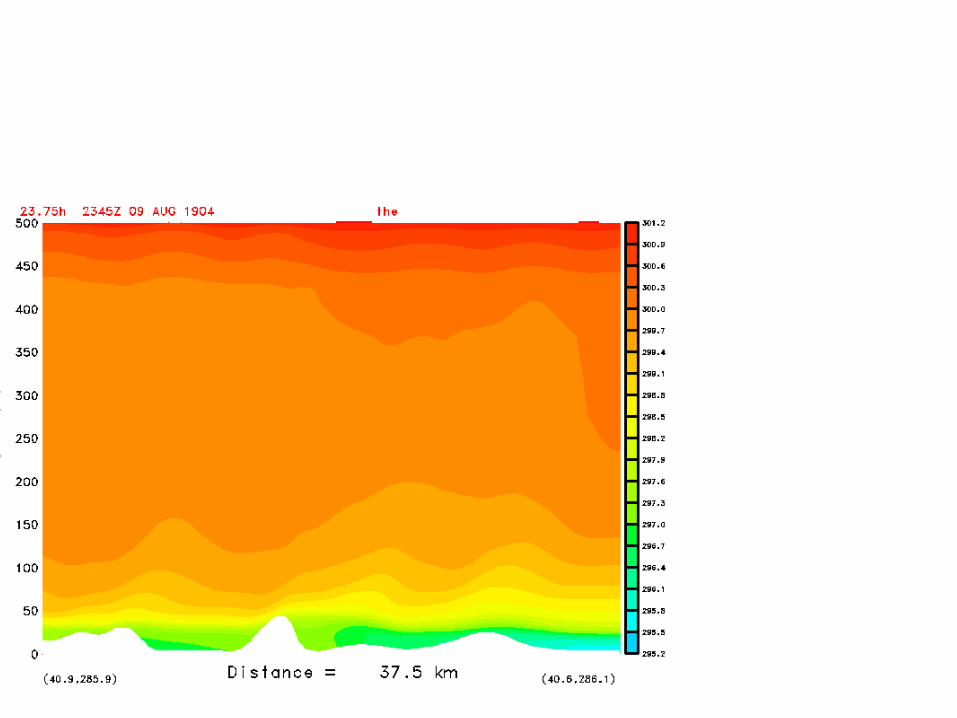
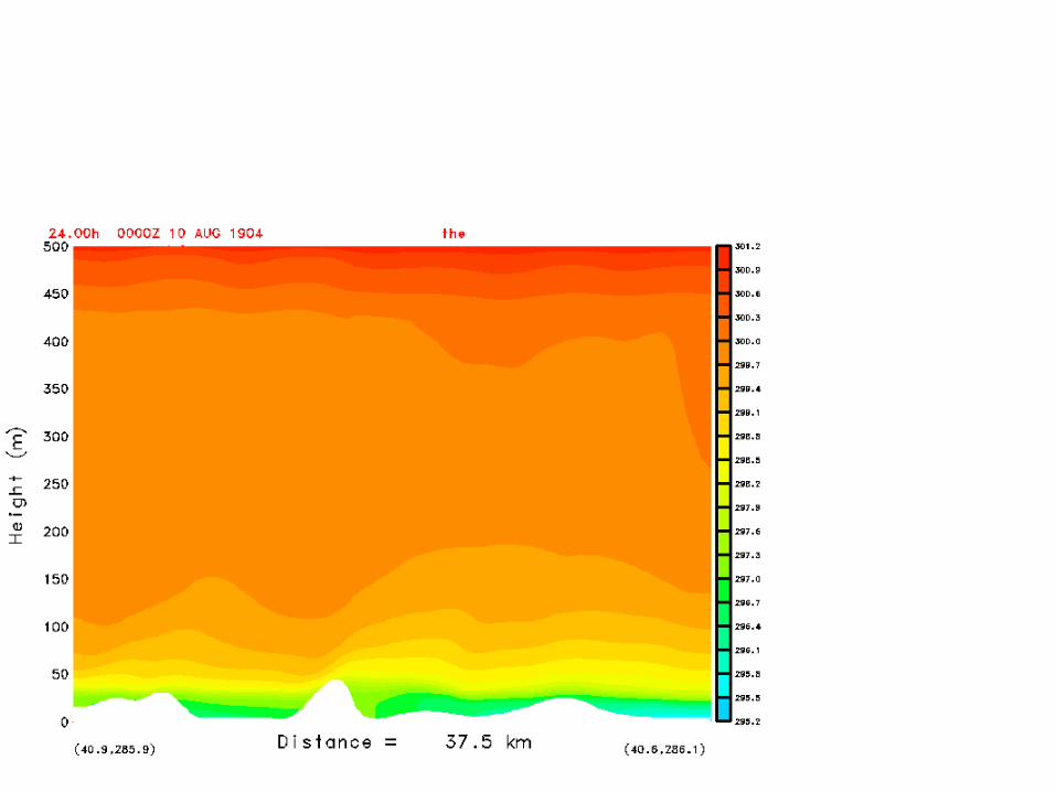
• Animated cross sections in the plane A-B from 1800 UTC to 0000 UTC 22 August 2004
• Frames every 15 min• A-B is 37.5 km from near the shore in Brooklyn,
across lower Manhattan, and into New Jersey• Potential temperature (K) is shown• Note the cool, shallow layer propagating along the
surface from B towards A (SE to NW)• Note also the density current head-like structure at
the leading edge at later hours
SEA BREEZE MAPS (FROM ANIMATION)(2 M WINDS (M/S) AND POTENTIAL TEMPERATURE (K))
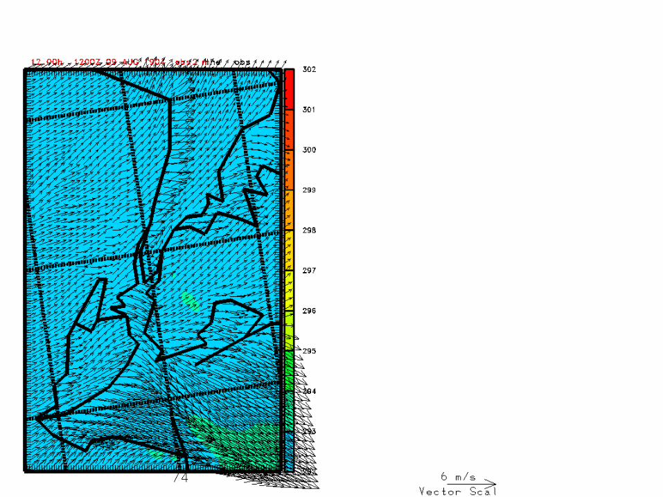
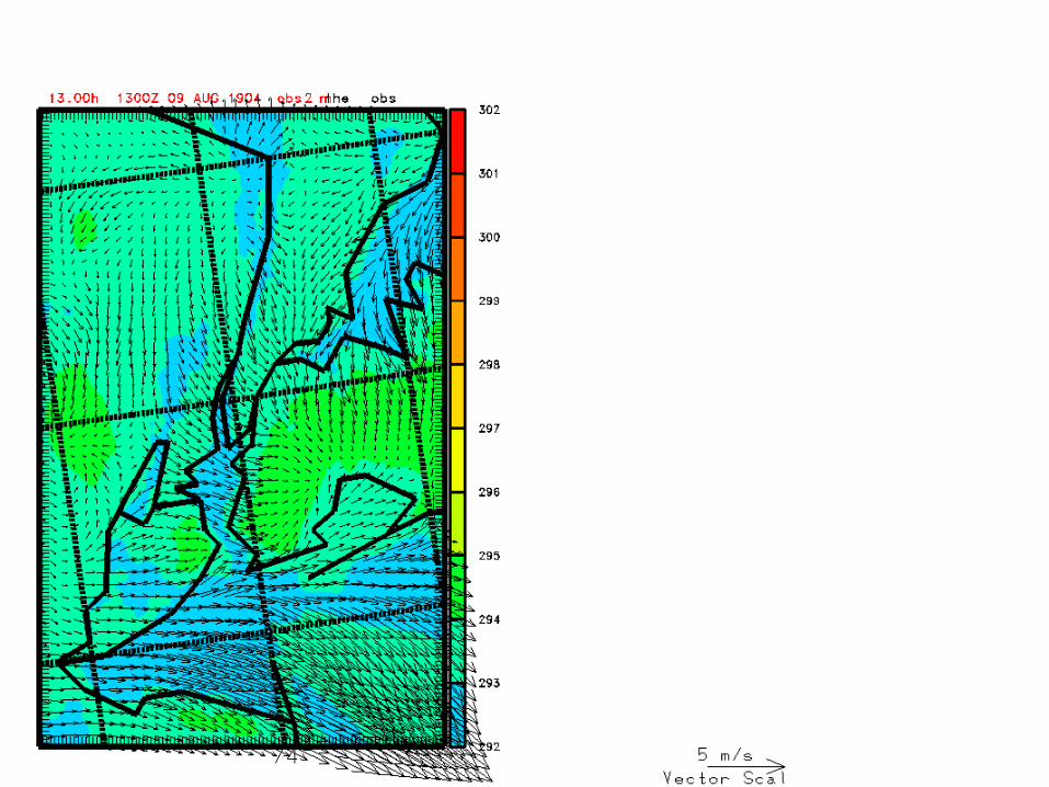
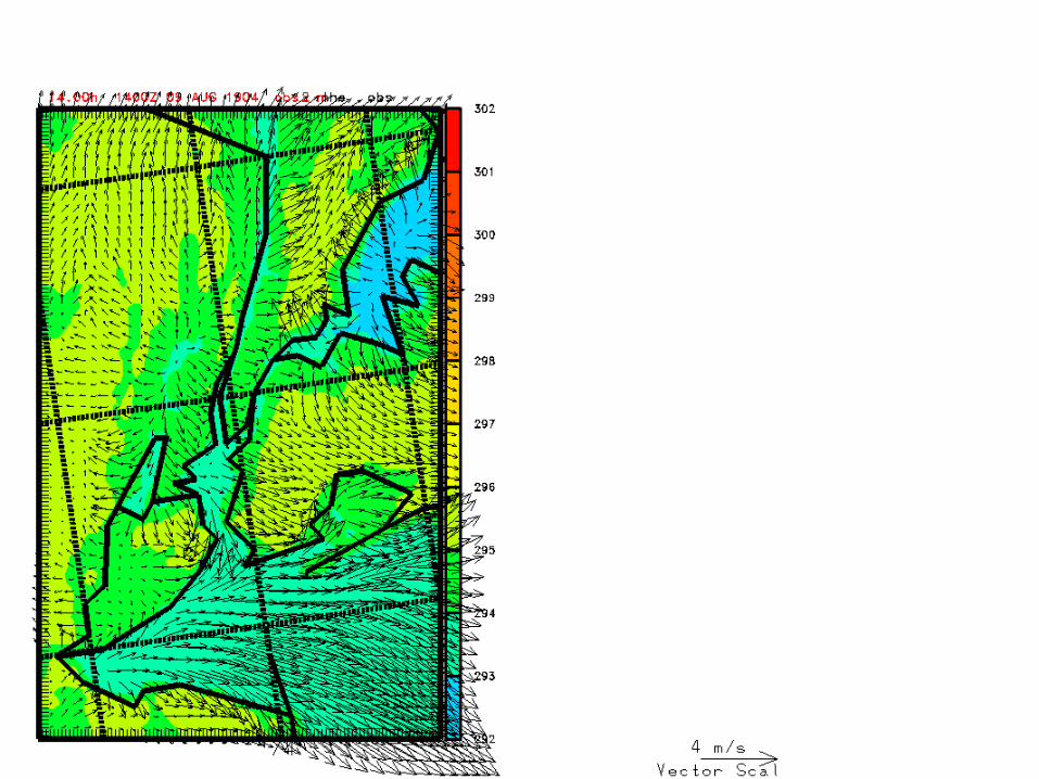
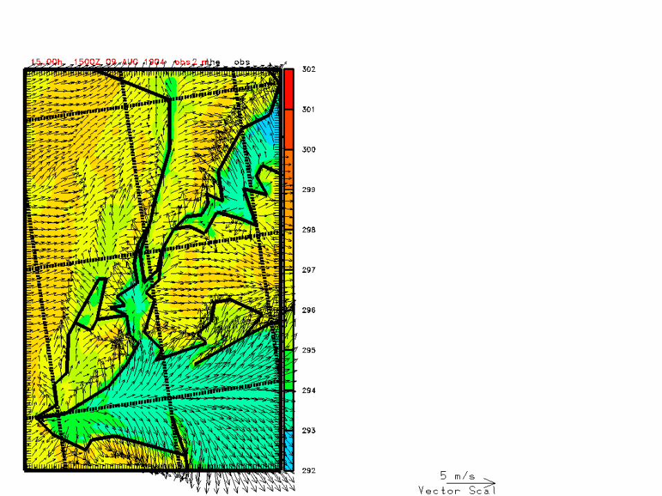
1HR INTERVAL
15 MIN INTERVAL


SEA BREEZE CROSS SECTIONS (FROM ANIMATION)(POTENTIAL TEMPERATURE (K))
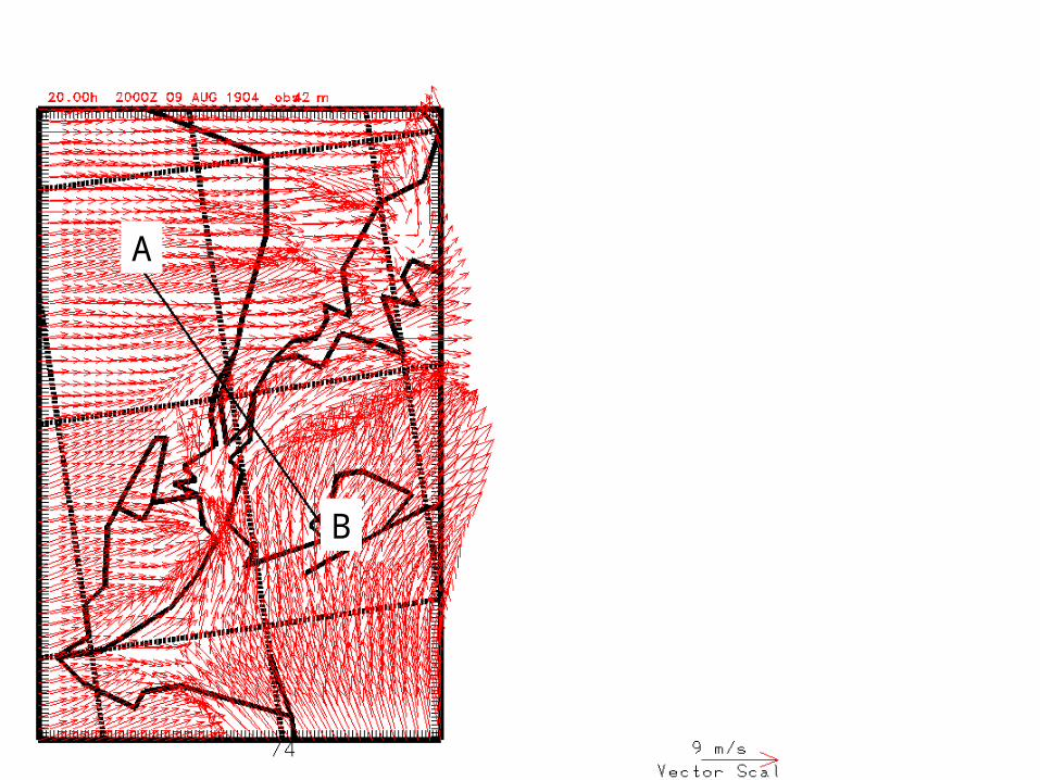
A
B
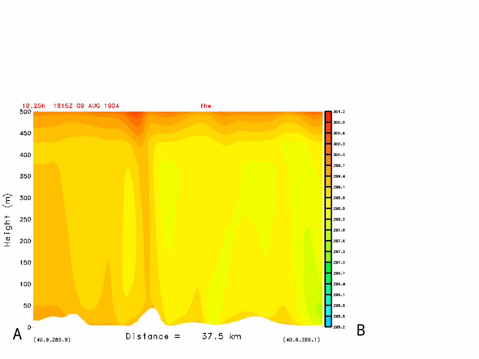
A B


Top Related