1. Stone Renewal relates to090/DM/18 [Turn over 5 9. Graticule-A network of lines representing...
30
090/DM/18 [Turn over 3 1. Stone Renewal relates to (A) Survey advance account (B) Permanent Advance Account (C) Taluk A Register (D) 10(1) Chitta PØPÒ ¦x¨¤zuÀ £o öuõhº£õÚ PnUS (A) {» AÍøÁ •ß£nU PnUS (B) {μ¢uμ •ß£nUPnUS (C) Ámh A. £v÷Ák (D) 10 (1) ]mhõ 2. In Cadastral Survey–measurement of A class stone are (A) 45 cm × 20 cm × 20 cm (B) 60 cm × 15 cm × 15 cm (C) 90 cm × 22.5 cm × 22.5 cm (D) 30 cm × 15 cm × 15 cm PhõìhÀ \º÷Á°À ""A'' PÀ¼ß AÍÄ –––––––––– BS® (A) 45 ö\.« × 20 ö\.« × 20 ö\.« (B) 60 ö\.« × 15 ö\.« × 15 ö\.« (C) 90 ö\.« × 22.5 ö\.« × 22.5 ö\.« (D) 30 ö\.« × 15 ö\.« × 15 ö\.« 3. Stone Renewal Notice will be issued to land holder under section (A) 15 (2) (B) 15 (1) (C) 13 (D) 9 (2) PØPÒ ¦x¨¤¨£uØPõÚ AÔ¨¦ –––––––––– ¤›Âß RÌ {» E›ø©¯õͺPÐUS ÁÇ[P¨£k® (A) 15 (2) (B) 15 (1) (C) 13 (D) 9 (2) 4. Notice to the registered holders after completing in the survey will be given on (A) Section 5 (B) Section 9 (2) (C) Section 10 (D) Section 13 (1) {» E›ø©¯õͺPÐUS {» AÍøÁ •i¢u ¤ß¦ ÁÇ[P¨£k® AÔ¨¦ –––––––––– BS® (A) ¤›Ä 5 (B) ¤›Ä 9 (2) (C) ¤›Ä 10 (D) ¤›Ä 13 (1)
Transcript of 1. Stone Renewal relates to090/DM/18 [Turn over 5 9. Graticule-A network of lines representing...
090/DM/18 [Turn over
3
1. Stone Renewal relates to
(A) Survey advance account (B) Permanent Advance Account
(C) Taluk A Register (D) 10(1) Chitta
PØPÒ ¦x¨¤zuÀ £o öuõhº£õÚ PnUS
(A) {» AÍøÁ •ß£nU PnUS (B) {μ¢uμ •ß£nUPnUS
(C) Ámh A. £v÷Ák (D) 10 (1) ]mhõ
2. In Cadastral Survey–measurement of A class stone are
(A) 45 cm × 20 cm × 20 cm (B) 60 cm × 15 cm × 15 cm
(C) 90 cm × 22.5 cm × 22.5 cm (D) 30 cm × 15 cm × 15 cm
PhõìhÀ \º÷Á°À ""A'' PÀ¼ß AÍÄ –––––––––– BS®
(A) 45 ö\.« × 20 ö\.« × 20 ö\.« (B) 60 ö\.« × 15 ö\.« × 15 ö\.«
(C) 90 ö\.« × 22.5 ö\.« × 22.5 ö\.« (D) 30 ö\.« × 15 ö\.« × 15 ö\.«
3. Stone Renewal Notice will be issued to land holder under section
(A) 15 (2) (B) 15 (1)
(C) 13 (D) 9 (2)
PØPÒ ¦x¨¤¨£uØPõÚ AÔ¨¦ –––––––––– ¤›Âß RÌ {» E›ø©¯õͺPÐUS ÁÇ[P¨£k®
(A) 15 (2) (B) 15 (1)
(C) 13 (D) 9 (2)
4. Notice to the registered holders after completing in the survey will be given on
(A) Section 5 (B) Section 9 (2)
(C) Section 10 (D) Section 13 (1)
{» E›ø©¯õͺPÐUS {» AÍøÁ •i¢u ¤ß¦ ÁÇ[P¨£k® AÔ¨¦ –––––––––– BS®
(A) ¤›Ä 5 (B) ¤›Ä 9 (2)
(C) ¤›Ä 10 (D) ¤›Ä 13 (1)
090/DM/18
4
5. CSM (A) Means
(A) Cost of Survey Marks (maintenance)
(B) Central Survey Marks
(C) Cost of Survey Marks (Scheme)
(D) Consolidated Stone Account
CSM (A) GÚU TÓ¨£kÁx
(A) {» AÍøÁ Aøh¯õÍ[PÎß ö\»Äz öuõøP (£μõ©›¨¦)
(B) ©zv¯ {» AÍøÁ Aøh¯õÍ®
(C) {» AÍøÁ Aøh¯õÍ[PÎß ö\»Äz öuõøP (vmh®)
(D) PØPÎß {» AÍøÁ PnUS öuõS¨¦
6. In Cadastral Survey – measurement of B class stone are
(A) 45 cm × 20 cm × 20 cm (B) 60 cm × 15 cm × 15 cm
(C) 90 cm × 22.5 cm × 22.5 cm (D) 30 cm × 15 cm × 15 cm
PhõìhÀ \º÷Á°À ""B'' PÀ¼ß AÍÄ ——————— BS®.
(A) 45 ö\.« × 20 ö\.« × 20 ö\.« (B) 60 ö\.« × 15 ö\.« × 15 ö\.«
(C) 90 ö\.« × 22.5 ö\.« × 22.5 ö\.« (D) 30 ö\.« × 15 ö\.« × 15 ö\.«
7. Measurement of Main Circuit field is
(A) 150 to 200 Sq. Km. (B) 200 to 250 Sq. Km.
(C) 250 to 300 Sq. Km. (D) 250 to 375 Sq. Km.
ö©°ß _ØÖ ¦»zvß £μ¨¦
(A) 150 •uÀ 200 \.Q.« (B) 200 •uÀ 250 \.Q.«
(C) 250 •uÀ 300 \.Q.« (D) 250 •uÀ 375 \.Q.«
8. The First GT Station of India located at St. Thomas Mount near
(A) Madurai (B) Chennai
(C) Delhi (D) Kashmir
•uÀ C¢v¯ GT {ø»¯® Aø©¢xÒÍ ö\°ßuõ©ì ©ø» –––––––––– À A¸QÀ EÒÍx
(A) ©xøμ (B) ö\ßøÚ
(C) öhÀ¼ (D) Põ諺
090/DM/18 [Turn over
5
9. Graticule-A network of lines representing paralles latitude and perpendicular of longitude forming a
(A) Map Projection (B) Road Projection
(C) River Projection (D) Land Projection
Am\÷μøP°ß Cøn÷PõkPЮ, wºUP ÷μøP°ß ö|k[÷PõkPЮ E¸ÁõUSÁx?
(A) ÷©¨ ¦μöáU\ß (B) ÷μõk ¦μöáU\ß
(C) ›Áº ¦μöáU\ß (D) ÷»sm ¦μöáU\ß
10. A Constant Azimuth (also called rhumb line or loxodrome) is a line that intersects each meridian at the
(A) Various angle (B) 360 angle
(C) Same angle (D) Bearing angle
{ø»¯õÚ vø\U÷Põn® JÆöÁõ¸ ö|k[÷Põmøh²® –––––––––– À öÁmkQÓx
(A) öÁÆ÷ÁÖ ÷Põn® (B) 360 ÷Põn®
(C) J÷μ ÷Põn® (D) ÷£›[ ÷Põn®
11. While processing the Land acquisition, stones which have been maintained should he eliminated from
(A) Village FMB (B) Village Map
(C) Stone sketch and Stone Register (D) FMB and Village Map
{» Gk¨¦ £o°ß ÷£õx £μõ©›¨¤À EÒÍ PØPøÍ –––––––––– C¸¢x }UP¨£kQÓx?
(A) Qμõ©¦»¨£h® (B) Qμõ© £h®
(C) PÀ£h® ©ØÖ® PÀ£v÷Ák (D) ¦»¨£h® ©ØÖ® Qμõ© £h®
12. When creating new sub-division in patta field, the signature of the parties should obtain in
(A) Field Measurement Book (B) A Register
(C) Sub Division Statement (D) 8(A) Register
J¸ £mhõ {»zvÀ ¦v¯ Em¤›Ä E¸ÁõUP¨£k® ÷£õx® E›ø©¯õÍ›h® –––––––––– J¨¦uÀ
ö£Ó ÷Ásk®
(A) ¦»¨£h® (B) A £v÷Ák
(C) Em¤›¦ £iÁ® (D) 8(A) £v÷Ák
090/DM/18
6
13. On the last day of the every quarter, a list of new field and subdivision with in the name of the Registered Holder should be forwarded to the
(A) District Collector (B) Revenue Divisional Officer
(C) District Revenue Officer (D) Sub Register
JÆöÁõ¸ Põ»õsk CÖv°¾® ¦v¯ Em¤›Ä £mi¯¾hß E›ø©¯õͺPÎß ö£¯º £mi¯ø»
–––––––––– US Aݨ£¨£k®
(A) ©õÁmh Bm]¯º (B) Á¸Áõ´ ÷Põmhõm]¯º
(C) ©õÁmh Á¸Áõ´ A¾Á»º (D) \õº £vÁõͺ
14. In case of error of area exceeds 5% of the old measurement approval must be obtained from
(A) District Collector (B) District Revenue Officer
(C) Assistant Director of survey (D) Tahsildar
AÍÄPÎÀ 5% US AvP©õP £μ¨¦ ¤øÇ C¸US® ÷£õx £øǯ £μ¨¦UPÎÀ C¸¢x ©õÖuÀ
ö\´¯ –––––––––– J¨¦uÀ ö£Ó ÷Ásk®
(A) ©õÁmh Bm]¯º (B) ©õÁmh Á¸Áõ´ A¾Á»º
(C) Eu C¯US|º {» AÍøÁ (D) uõ]Àuõº
15. When corrections made out in permanent A Register, a printed copy of all corrections in the settlement Register should be sent?
(A) The Collector
(B) The Joint Director
(C) The board of Revenue
(D) The Assistant Director of survey
{ø»¯õÚ ""A'' £v÷ÁmiÀ v¸zu[PÒ ÷©ØöPõÒͨ£k® ÷£õx Aa]h¨£mh {»Á›z vmh
£v÷ÁmiÀ v¸zu[PÒ ÷©ØöPõsk –––––––––– US Aݨ£¨£h ÷Ásk®
(A) ©õÁmh Bm]¯º
(B) Cøn C¯US|º
(C) Á¸Áõ´ Áõ›¯®
(D) Eu C¯US|º {» AÍøÁ
16. Length of metric chain commonly used in survey is
(A) 10 m (B) 15 m
(C) 20 m (D) 25 m
{» AÍøÁ°ß ÷£õx ö£õxÁõP £¯ß£kzu¨£k® \[Q¼°ß }Í®
(A) 10 « (B) 15 «
(C) 20 « (D) 25 «
090/DM/18 [Turn over
7
17. The set of Revenue maps to be maintained by the Town SIS
(A) In litho form (B) Mounted in cloth
(C) Bounded in volume (D) In tracing sheet
|Pμ \õº B´Áõͺ £μõ©›US® Á¸Áõ´ £h® –––––––––– Aø©¢v¸US®
(A) ¼z÷uõ £iÁ® (B) xo°ÚõÀ Jmi
(C) öuõS¨£õP (D) i÷μ][ uõÍõP
18. Set of Record of measurement with VAO, Town SIS and Chairman should
(A) be mounted
(B) not be mounted but edged with cloth
(C) should be bounded
(D) in litho form
Qμõ© A¾Á»º, |Pμ \õº B´Áõͺ ©ØÖ® |Pμ uø»Áº BQ÷¯õ›h® EÒÍ AÍÄPÐhß Ti¯
BÁn[PÒ
(A) Jmh¨£h ÷Ásk®
(B) KμzvÀ Jmh¨£mi¸UPõx
(C) öuõSv¯õP
(D) ¼z÷uõ £iÁzvÀ
19. In town survey, Record of measurement means
(A) Block Map (B) FMB
(C) Village Map (D) Revenue Map
|Pμ AÍøÁ°À AÍÄPÐhß Ti¯ BÁn® Gߣx
(A) ¤ÍõU÷©¨ (B) ¦»¨£h®
(C) Qμõ©£h® (D) Á¸Áõ´£h®
20. The service register of the Town sub inspector of survey, and his field assistant will be maintained at
(A) Municipal Office (B) Taluk Office
(C) Collector’s Office (D) District Survey Office
|Pμ \õº B´Áõͺ ©ØÖ® AÁμx ¦» Eu¯õͺPÎß £o¨£v÷ÁmiøÚ ––––––––––À
£μõ©›UP¨£k®
(A) •Û]£À A¾Á»P® (B) uõ¾Põ A¾Á»P®
(C) ©õÁmh Bm]¯º A¾Á»P® (D) ©õÁmh {»AÍøÁ A¾Á»P®
090/DM/18
8
21. All orders relating to the maintenance of survey, issued by Collector, Board of Revenue of Govt will be communicated to Town Sub Inspector of Survey, through
(A) Assistant Director of Survey
(B) District Collector
(C) Tahsildar
(D) Inspector of Survey
©õÁmh Bm]¯º ©ØÖ® Á¸Áõ´ Áõ›¯® AÀ»x Aμ\õÀ Aݨ£¨£k® EzuμÄPÒ |Pμ \õº
B´Áõ͸US –––––––––– ‰»©õP Aݨ£¨£k®
(A) Eu C¯US|º {»AÍøÁ
(B) ©õÁmh Bm]¯º
(C) uõ]Àuõº
(D) B´Áõͺ {»AÍøÁ
22. Whenever the Town SIS uses stones from any depot, the particulars should be entered in the registers which was maintained in
(A) Form No II (B) Form No III
(C) Form No IV (D) Form No V
|Pμ \õº B´Áõͺ öh¨÷£õ¼¸¢x PØPøÍ £¯ß£kzu Auß ÂÁμ[PøÍ £vÄ ö\´x®
£μõ©›US® £v÷Ák
(A) £iÁ® Gs II (B) £iÁ® Gs III
(C) £iÁ® Gs IV (D) £iÁ® Gs V
23. To enable the municipal overseer and sanitary inspector to detect encroachment training in use of maps should be given by
(A) Municipal Commissioner
(B) Town SIS
(C) Revenue Tahsildar
(D) VAO
•Û]£À KÁº]¯º ©ØÖ® x¨¦μÄ B´ÁõͺPÐUS BUQ쪨¦PøÍ PshÔ²® £°Ø]UPõÚ
Áøμ£hzvøÚ –––––––––– AΨ£õº
(A) |Pμõm] Bøn¯º
(B) |Pμ \õº B´Áõͺ
(C) Á¸Áõ´ Ámhõm]¯º
(D) Qμõ© {ºÁõP A¾Á»º
090/DM/18 [Turn over
9
24. DOP denotes
(A) Dilusion of precision (B) Direction of precision
(C) Dilusion of point (D) Direction of point
DOP Gߣx
(A) øh¼³\ß B¨ ¤›]¯ß (B) øhμU\ß B¨ ¤›]¯ß
(C) øh¼³\ß B¨ £õ°sm (D) øhμU\ß B¨ £õ°sm
25. District of collector approves the correction of an error of measurement of village body which
–––––––––– of the old measurement
(A) Exceeds 15% (B) Exceeds 10%
(C) Exceeds 5% (D) Exceeds 1%
Qμõ© GÀø»°À EÒÍ AÍÂÀ –––––––––– ÂÊUPõkUS ÷©À ¤øÇ C¸¢uõÀ ©õÁmh Bm]¯º
A[RP›¨£õº
(A) 15% ÷©À (B) 10% ÷©À
(C) 5% ÷©À (D) 1% ÷©À
26. In surveyed town, the Town survey fields which are open and besides the limit of town are
not maintained by Town SIS and it will be maintained by
(A) Revenue department
(B) Survey and land records department
(C) Municipality
(D) Municipal council
{» AÍøÁ ö\´¯¨£mk |Pμ \õº B´ÁõÍμõÀ £μõ©›UP£hõu |Pμ GÀø» Jmi²ÒÍ |Pμ
¦»[PÒ –––––––––– BÀ £μõ©›UP¨£k®
(A) Á¸Áõ´zxøÓ
(B) {»AÍøÁ xøÓ
(C) •ß]£õ¼mi
(D) •Û]£õ¼mi PÄß]À
090/DM/18
10
27. Field surveyor should inspect the survey equipments Maintenance after the commencement of fasli and should not be postponed beyond the end of
(A) January (B) May
(C) June (D) October
£μõ©›¨¤À \º÷Á E£Pμn[PøÍ B´Ä ö\´²® {» AÍÁº £\¼ Bsk öuõh[Q¯ ¤ßÚº
Á¸® –––––––––– ©õuzvØS ¤ß uÒÎ øÁUPUThõx
(A) áÚÁ› (B) ÷©
(C) áüß (D) AU÷hõ£º
28. Which Symbol denotes the Village boundary in field?
(A) + (B) –––––––––––––
(C) ..................... (D) ––.––.––.
¦»zvÀ Qμõ© GÀø»ø¯ Põmk® Aøh¯õÍU SÔ Gx?
(A) + (B) –––––––––––––
(C) ..................... (D) ––.––.––.
29. The following main Survey process will be done in field
(A) C&D and S&B (B) G&H and C&D
(C) A&B and E&F (D) S&B and I&J
¦»zvÀ ÷©ØöPõÒͨ£k® •ußø© {»AÍøÁ¨ £oPÒ
(A) C&D ©ØÖ® S&B (B) G&H ©ØÖ® C&D
(C) A&B ©ØÖ® E&F (D) S&B ©ØÖ® I&J
30. The topographical Survey operations will be done by
(A) Tamilnadu Survey Dept
(B) Survey of India
(C) Archaeology Dept
(D) Geological Survey of India
ìu»{» AÍøÁ¨ £oPÒ G¢u {ÖÁÚzuõÀ ÷©ØöPõÒͨ£k®
(A) uªÌ|õk {»AÍøÁz xøÓ
(B) C¢v¯ {»AÍøÁ {ÖÁÚ®
(C) öuõÀö£õ¸Î¯À xøÓ
(D) ¦Â°¯À {»AÍøÁ xøÓ
090/DM/18 [Turn over
11
31. GTS
(A) Great Trignometric Station
(B) Government Technical Survey
(C) Government Town Surveyor
(D) Government Triangulation Survey
GTS Gߣuß Â›ÁõUP®
(A) Great Trignometric Station
(B) Government Technical Survey
(C) Government Town Surveyor
(D) Government Triangulation Survey
32. Select the system presently followed for formation of Survey fields in Tamil Nadu
(A) Block map System
(B) Plantable System
(C) Simple Triangulation Method
(D) Diagonal and Triangulation Offset System
uªÌ|õmiÀ uØ\©¯® \º÷Á ¦»[PÒ Aø©UP¨£k® •øÓ
(A) ¤ÍõU ÷©¨ •øÓ
(B) ¤÷Íß÷h¤Ò •øÓ
(C) \õuõμn •U÷Põn •øÓ
(D) ‰ø»Âmh ©ØÖ® •U÷Põn SzuÍÄ •øÓ
33. In which Year Land Survey using Modern Equipments started
(A) 2003 (B) 2001
(C) 2005 (D) 2002
|ÃÚ öuõÈÀ~m£ P¸Â ‰»® {» AÍøÁ £o G¨÷£õx AÔ•P¨£kzu¨£mhx?
(A) 2003 (B) 2001 (C) 2005 (D) 2002
34. In which District Survey work Commenced
(A) Kovai (B) Salem
(C) Thiruvallur (D) South Arcot
•uß •u¼À {» AÍøÁ ÷©ØöPõÒͨ£mh ©õÁmh®
(A) ÷PõøÁ (B) ÷\»®
(C) v¸ÁÒѺ (D) öuß BØPõk
090/DM/18
12
35. In Seashore, from –––––––––– Meter Village boundary has been fixed
(A) 150 Meter (B) 250 Meter
(C) 100 Meter (D) 200 Meter
PhØPøμ £SvPÎÀ GÆÁÍÄ yμzv¼¸¢x Qμõ© GÀø» {ºn¯® ö\´¯¨£kQÓx?
(A) 150 «mhº (B) 250 «mhº
(C) 100 «mhº (D) 200 «mhº
36. Distance of earth from the sun
(A) 149.6 million KM (B) 140.8 million KM
(C) 159.8 million KM (D) 189.8 million KM
§ªUS® `›¯ÝUS® Cøh¨£mh yμ®
(A) 149.6 million KM (B) 140.8 million KM (C) 159.8 million KM (D) 189.8 million KM
37. Tenders inviting for the supply of the stones will be published in Form No.
(A) Form No 31 (B) Form No 21
(C) Form No 20 (D) Form No 14
{» AÍøÁ PØPÒ öPõÒ•uÀ ö\´ÁuØS J¨£¢u¦ÒÎ AøǨ¦ –––––––––– À öÁΰh
÷Ásk®
(A) £iÁ® 31 (B) £iÁ® 21
(C) £iÁ® 20 (D) £iÁ® 14
38. In district map the –––––––––– boundary should not be shown
(A) Taluk Boundary (B) Field Boundary
(C) State Boundary (D) District Boundary
©õÁmh Áøμ£hzvÀ –––––––––– GÀø»PÒ Põs¤UP¨£kÁvÀø»
(A) Ámh GÀø»PÒ (B) ¦» GÀø»PÒ
(C) ©õ{» GÀø»PÒ (D) ©õÁmh GÀø»PÒ
39. Survey is also known as triangulation of
(A) Cadastral Survey (B) Street Survey
(C) Geo Survey (D) Chain Survey
•U÷Põn •øÓ°À AÍÂk® {» AÍøÁUS –––––––––– GÚ¨ö£¯º
(A) PhõìiμÀ {»AÍøÁ (B) öu¸ {»AÍøÁ
(C) â÷¯õ {»AÍøÁ (D) \[Q¼ {»AÍøÁ
090/DM/18 [Turn over
13
40. The length of the chain should he tested
(A) Once in a week
(B) Once in a month
(C) Daily before measurement
(D) Daily after measurement
\[Q¼°ß }Ízøu –––––––––– \›£õºUP ÷Ásk®
(A) Áõμ® J¸ •øÓ
(B) ©õu® J¸ •øÓ
(C) vÚ\› AÍøÁUS •ß£õP
(D) vÚ\› AÍøÁUS ¤ß£õP
41. In survey field –––––––––– stone should be placed at the end of F-lines which do not coincide with field tri-junction or theodolite station
(A) A Stone (B) B Stone
(C) Field stone (D) Theodolite stone
‰ßÖ ¦»[PÎß \¢v¨¦ AÀ»x v÷¯õhø»m {ø»¯[PÒ Aø©¯õu PØ£øÚ ÷PõkPÒ \¢vUS®
(F-line) ¦»[PÎÀ –––––––––– PØPÒ |h ÷Ásk®
(A) A-PØPÒ (B) B-PØPÒ
(C) ¦» PØPÒ (D) v÷¯õhø»m PØPÒ
42. When the difference between actual area and the registered area differs more than 5 percent –––––––––– is permissible
(A) Temporary
(B) Permanent Adjustment
(C) Actual area should be adopted
(D) The registered area should be adopted
J¸ ¦»zvß £vÄ ö\´¯¨£mh £μ¨¦US® PoUP¨£mh £μ¨¦US® Cøh¨£mh Âzv¯õ\® 5%
US ÷©À GÛÀ –––––––––– £μ¨¦ AÝ©vUP»õ®
(A) uØPõ¼P £μ¨¦
(B) {μ¢uμ©õÚ £μ¨¦
(C) Pozu £μ¨¦
(D) £vÄ ö\´¯¨£mh £μ¨¦
090/DM/18
14
43. The reputed areas should be rateably adjusted if
(A) Entire field area and subdivision area are more than 5%
(B) Entire field area difference and component sub division are does not difference
(C) Entire field area and component sub division are does not difference
(D) Entire field area does not differs more then 5% and subdivision area differes more than 5%
©Ö PnURk £μ¨¦ –––––––––– GÛÀ \›Pmh¨£kQÓx
(A) •Ê¨¦»® ©ØÖ® Em¤›Ä £μ¨£ÍÄ ÷ÁÖ£õk 5% US ÷©À C¸¢uõÀ
(B) •Ê¦»® £μ¨£ÍÄ Âzv¯õ\® ©ØÖ® Em¤›ÄPÎß £μ¨£ÍÄ Âzv¯õ\® CÀ»õ©À
C¸¢uõÀ
(C) •Ê¦»® ©ØÖ® Em¤›ÄPÎß £μ¨£ÍÄ Âzv¯õ\® CÀ»õ©À C¸¢uõÀ
(D) •Ê¦»¨£μ¨£ÍÂß Âzv¯õ\® 5% US ÷©À CÀ»õ©À Em¤›ÄPÎß £μ¨£ÍÄ
Âzv¯õ\® 5% US ÷©À C¸¢uõÀ
44. On scrutiny when the sub division sketch is prepared and not signed by MFS, then the sub division records may be
(A) Sent to Tahsildar
(B) Sent to Deputy Inspector of Survey
(C) Returned to the M.F.S
(D) Village Administrative Officer
Em¤›Ä Áøμ£h® u¯õ›zx øPö¯Êzvhõ©À £μõ©›¨¦ SÖÁmh AÍÁº Tμõ´ÄUS
Aݨ¤ÚõÀ A¢u Em¤›Ä Áøμ£h BÁn® –––––––––– US Aݨ£¨£k®
(A) Ámhõm]¯º
(B) Ámh \õºB´Áõͺ
(C) £μõ©›¨¦ SÖÁmh AÍÁº
(D) Qμõ© {ºÁõP A¾Á»º
45. –––––––––– are used to find the foot of the perpendicular of the Object on survey line or to set a perpendicular from a point on a survey line
(A) Tape (B) Cross staffs
(C) Theodolite (D) Chain
{» AÍøÁ°À –––––––––– öPõsk SzuÍÄ •øÓ PnUQh¨£kQßÓÚ
(A) ÷h¨ (B) ÷|º÷Põn Pmøh
(C) v÷¯õhø»m (D) \[Q¼
090/DM/18 [Turn over
15
46. The full responsibility of the scrutiny of sub-division records are
(A) The Assistant Director (B) The Inspector of Survey
(C) Deputy inspector of Survey (D) Tahsildar
Em¤›Ä BÁn[PøÍ –––––––––– Tμõ´Ä (Scrutiny) ö\´ÁuØS •Ê¨ö£õÖ¨÷£ØQÓõº
(A) Eu C¯US|º (B) {»AÍøÁ B´Áõͺ
(C) {» AÍøÁ xøn B´Áõͺ (D) Ámhõm]¯º
47. All the new subdivisions sanctioned by the Tahsildar should entered in
(A) 6 (1) Register (B) IR Register
(C) 8 A Register (D) 5 Register
Ámhõm]¯μõÀ A[RP›UP¨£k® AøÚzx Em¤›ÄPøͲ® –––––––––– À £v¯¨£kQÓx
(A) 6 (1) £v÷Ák (B) IR £v÷Ák
(C) 8 A £v÷Ák (D) £v÷Ák 5
48. The first stage in all land acquisition process is
(A) The post award passing
(B) Draft decleration
(C) Draft notification under section 4(1) of the Act
(D) Draft notification under section 6 of the Act
–––––––––– Gߣx {» Gk¨¦ £o°ß •ußø©¯õÚuõS®
(A) £o {¯©Ú®
(B) ÁøμÄ öÁΰkuÀ
(C) ÁøμÄ AÔUøP ¤›Ä 4 (1) Âv £i öÁΰkuÀ
(D) ÁøμÄ AÔUøP ¤›Ä 6 Âv £i öÁΰkuÀ
49. The subdivision work in LA should commence only after the publication of
(A) Notification under section 5 (B) Notification under section 6(1)
(C) Notification under section 8(1) (D) Notification under section 9(1)
–––––––––– öÁΰmh ¤ß Em¤›Ä £oPÒ {» Gk¨¤À |øh•øÓUS Á¸QßÓÚ
(A) ¤›Ä 5 ß £i ÂÍ®£μ® (B) ¤›Ä 6 (1) ß £i ÂÍ®£μ®
(C) ¤›Ä 8 (1) ß £i ÂÍ®£μ® (D) ¤›Ä 9 (1) ß £i ÂÍ®£μ®
090/DM/18
16
50. In Land Acquisition incorporation of changes in village and taluk records should be done
only after the inspection of
(A) Deputy Inspector of survey
(B) Inspector of survey
(C) Tahsildar
(D) Assistant Director
{» Gk¨¦ Qμõ©® ©ØÖ® Ámh BÁn[PÒ BQ¯ÁØÔÀ ©õ|Pμ {» Gk¨¤ß ––––––––––
B´ÄUS¨ ¤ß ©õÖuÀ ö\´¯¨£kQÓx
(A) xøn {»AÍøÁ B´Áõͺ
(B) {»AÍøÁ B´Áõͺ
(C) Ámhõm]¯º
(D) Eu C¯US|º
51. From Taluk Office the indent of instrument and stationary should be sent to
(A) The collector (B) The District Revenue Officer
(C) The Assistant Director (D) The Revenue Division Officer
Ámhõm]¯º A¾Á»Pzv¼¸¢x –––––––––– US E£Pμn[PÒ ©ØÖ® GÊx ö£õ¸mPÒ £mi¯À
Aݨ£¨£kQÓx
(A) ©õÁmh Bm]¯º (B) ©õÁmh Á¸Áõ´ A¾Á»º
(C) Eu C¯US|º (D) Á¸Áõ´ ÷Põmh A¾Á»º
52. Equipment register should maintained by –––––––––– inspect the instrument issued to
V.A.O
(A) Deputy Inspector of Survey (B) Maintenance Firka Surveyor
(C) Inspector of Survey (D) L.R.D
–––––––––– BÀ E£Pμn[PÒ £v÷Ák £μõ©›UP¨£mk Qμõ© {ºÁõP A¾Á»¸US
ÁÇ[P¨£kQÓx
(A) {» AÍøÁ xøn B´Áõͺ (B) £μõ©›¨¦ SÖÁmh AÍÁº
(C) {» AÍøÁ B´Áõͺ (D) Ámh BÁn ÁøμÁõͺ
090/DM/18 [Turn over
17
53. –––––––––– sub division fee should he collected with the subdivision application
(A) After measurement of subdivision
(B) Before measurement
(C) In advance
(D) After issuing patta
Em¤›Ä Âsn¨£zxhß –––––––––– Em¤›Ä Pmhn® Á`¼UP¨£kQÓx
(A) Em¤›ÄUS¨ ¤ß
(B) AÍøÁUS •ß
(C) •ßöuõøP
(D) £mhõ ÁÇ[Q¯ ¤ß
54. No subdivision fees need be collected from Govt. of India for
(A) Poramboke Subdivision (B) Land assignment
(C) Land acquisition (D) Changes in land rights
C¢v¯ Aμ]hª¸¢x –––––––––– US Em¤›Ä Pmhn® Á`¼¨£vÀø»
(A) ¦Ó®÷£õUS {»zvÀ Em¤›Ä ö\´¯
(B) {» J¨£øh ö\´¯
(C) {»® øP¯P¨£kzxuÀ ö\´¯
(D) {» E›ø© ©õØÓ® ö\´¯
55. The amount of sub division fees collected should be credited to –––––––––– head of account
(A) 8085 LR (B) 2029 LR
(C) 0085 LR (D) 0029 LR
Em¤›Ä Pmhn® –––––––––– À PnUS uø»¨¤À ÁμÄ øÁUP¨£kQÓx
(A) 8085 LR (B) 2029 LR
(C) 0085 LR (D) 0029 LR
56. The Inspector of survey should submit their diary once in a
(A) Month (B) Fort Night
(C) Bimonth (D) Week
{» AÍøÁ B´Áõͺ –––––––––– u©x |õmSÔ¨ø£ \©º¤UP ÷Ásk®
(A) ©õu® (B) •Ø£Sv
(C) ©õu® C¸•øÓ (D) Áõμ®
090/DM/18
18
57. Hearing of original land complaint is the main duty of
(A) Tahsildar (B) Inspector of survey
(C) Taluk Sub Inspector (D) Maintance Firka Surveyor
Esø©¯õÚ {»uõÁõUPøÍ wº¨£x –––––––––– ß •uÀ £o¯õS®
(A) Ámhõm]¯º (B) {»AÍøÁ B´Áõͺ
(C) Ámh \õº B´Áõͺ (D) SÖÁmh {»AÍÁº
58. Length of commonly used metric chains are
(A) 10 M (B) 20 M
(C) 30 M (D) 40 M
ö£õxÁõP ö©m›U \[Q¼°ß }Í®
(A) 10 « (B) 20 «
(C) 30 « (D) 40 «
59. In a closed traverse of N sides the sum of internal angles should be
(A) 2n × 90 degree (B) 42n 90 degree
(C) 42n 90 degree (D) 90n degree
‰i¯ iμõÁºêß £UP[PÒ N GÛÀ Em÷Põn[PÎß TkuÀ ——————— BS®.
(A) 2n × 90 iQ› (B) 42n 90 iQ›
(C) 42n 90 iQ› (D) 90n iQ›
60. Before starting survey –––––––––– is prepared and marked
(A) Index map (B) Location sketch
(C) Town Map (D) Topographical map
{»AÍøÁ ö\´ÁuØS •ß£õP –––––––––– u¯õ›zx SÔ°h ÷Ásk®
(A) SÔ±mk Áøμ£h® (B) Ch® Põq® Áøμ£h®
(C) |Pμ Áøμ£h® (D) ÷hõ÷£õQμõ¤PÀ Áøμ£h®
090/DM/18 [Turn over
19
61. In compass surveying direction of survey lines are measured with
(A) Beam compass (B) Magnetic compass
(C) Prismatic compass (D) Plotting Compass
Põ®£ì {»AÍøÁ°À {»AÍøÁ ÷PõkPÎß vø\PÒ –––––––––– BÀ AÍÂh¨£kQÓx
(A) ¥® Põ®£ì (B) ÷©UÚiU Põ®£ì
(C) ¤μì÷©iU Põ®£ì (D) ¤Íõi[ Põ®£ì
62. The difference in the two ends of the magnetic needle should be
(A) 0 degree (B) 90 degree
(C) 180 degree (D) 360 degree
Cμsk Põ¢u •øÚPÐUS® Cøh¨£mh Âzv¯õ\® –––––––––– BS®
(A) 0 iQ› (B) 90 iQ›
(C) 180 iQ› (D) 360 iQ›
63. Under which G.O. the Natham Settlement work has commenced
(A) G.O.NO. 1177 (B) G.O.NO. 1178
(C) G.O.NO.7711 (D) G.O.NO.1717
|zu® {»Á›z vmh® G¢u Bøn°ß £i ÷©ØöPõÒͨ£mhx
(A) G.O.NO. 1177 (B) G.O.NO. 1178
(C) G.O.NO.7711 (D) G.O.NO.1717
64. In Traverse Calculation if n = 7, what is the total angle value
(A) 90 (B) 960
(C) 9000 (D) 900
iμõÁºì PnURmiÀ n = 7 GÛÀ ö©õzu ÷Põn AÍÄ GßÚ?
(A) 90 (B) 960
(C) 9000 (D) 900
090/DM/18
20
65. Parallax + Refraction reflects to
(A) 180 (B) 360
(C) 270 (D) 90
Parallax + Refraction ö©õzu ©v¨¦
(A) 180 (B) 360
(C) 270 (D) 90
66. The process of adjusting the position of point on plane table exactly over its position on
ground is called as
(A) Levelling (B) Orientation
(C) Centring (D) Traversing
¤÷Íß ÷h¤Ò £o°ÛÀ ¦Ò롧 Chzøu \›ö\´x {ø»¯zøu Aø©zuø» –––––––––– GÚ
AøÇUQ÷Óõ®
(A) ö»Á¼[ (B) \›ö\´uÀ
(C) {ø»£kzuÀ (D) iμõÁºì
67. Convenient Theodolite points are selected between our traverse and the –––––––––– which
is usually on a high hill
(A) Binjunction
(B) Village khandam
(C) GIS Station
(D) GT Station
E¯º¢u ©ø»£SvPÎÀ iμõÁºêß v÷¯õhø»m ¦ÒÎPÒ –––––––––– BP Aø©UP¨£kQßÓÚ
(A) Cμsk ¦» \¢v¨¦
(B) Qμõ© Psh®
(C) GIS {ø»¯®
(D) GT {ø»¯®
090/DM/18 [Turn over
21
68. WGS 84 Spherical Co-ordinates (Lat, long) of all the Primary, Secondary Control Points
(GCPs) in the State should be got from SOI or recorded through GPS and checked with
(A) Total stations
(B) IGS Stations
(C) GIS Stations
(D) Primary Stations
AøÚzx WGS-84 ìö£›UPÀ ÷Põ–Bºi÷ÚmPÎß (Am\, wºUP) •ußø©, Cμshõ®
¦ÒÎPøͲ® |©x uªÇPzvÀ SOI AÀ»x GPS ‰»® £vÄPÒ ö£Ó¨£mk –––––––––– À
\›£õºUP¨£kQÓx
(A) ÷hõmhÀ ì÷h\ß
(B) IGS ì÷h\ß
(C) GIS ì÷h\ß
(D) •ußø© ì÷h\ß
69. The methods used in modern survey –––––––––– system and in the manual survey earlier.
Everest Ellipsoid, are basically different
(A) WGS-56 (B) WGS-64
(C) WGS-68 (D) WGS-84
–––––––––– ‰»® {»AÍøÁ ö\´Áx £øǯ {»AÍøÁ, GÁöμìm G¼¨\õ´k BQ¯
AÍøÁ°¼¸¢x •ØÔ¾® ©õÖ£mkÒÍx
(A) WGS-56 (B) WGS-64
(C) WGS-68 (D) WGS-84
70. In the following which is not prepared for Street survey field
(A) Off -Set (B) F-line
(C) Area (D) G -line
öu¸ GÀø» ¦»[PÐUS –––––––––– Po¨£vÀø»
(A) B¨ö\m (B) F–ø»ß
(C) £μ¨¦ (D) G–ø»ß
090/DM/18
22
71. Creation of new sub-divisions using collabland and Tamil Nilam software interface in
(A) Survey and settlement office
(B) Collector office
(C) Taluk Office
(D) Municipal office
–––––––––– À öPõ»õ¨÷»sm ©ØÖ® uªÌ{»® ©ØÖ® ö©ßö£õ¸Ò E£÷¯õQzx ¦v¯
Em¤›ÄPÒ £v¯¨£kQßÓÚ
(A) {» AÍøÁ ©ØÖ® {»Á›zvmh A¾Á»P®
(B) ©õÁmh Bm]¯º A¾Á»P®
(C) Ámhõm]¯º A¾Á»P®
(D) |Pμõm] A¾Á»P®
72. The collabland and Tamil Nilam Software have login features for various user levels such as Draftsman, Deputy Inspector of Survey and
(A) Sub-Inspector of Survey (B) Revenue inspector
(C) Deputy Collector (D) Tahsildar
ÁøμÁõͺ {»AÍøÁ Ámhzxøn B´Áõͺ ©ØÖ® –––––––––– BQ÷¯õº öPõ»õ¨÷»sm
©ØÖ® uªÌ{»® ö©ßö£õ¸mPøÍ £¯ß£kzv £o ö\´QßÓÚº
(A) Ámh \õº B´Áõͺ (B) Á¸Áõ´ B´Áõͺ
(C) ©õÁmh xøn Bm]¯º (D) Ámhõm]¯º
73. This department is developing web-based software applications for the online maintenance of land records through the
(A) State National Informatics Centre
(B) Central Government
(C) Corporation
(D) Survey of India
{»AÍøÁ BÁn[PøÍ –––––––––– Eu¯õÀ Ai¨£øh¯õÚ ö©ßö£õ¸Ò öPõsk
Bßø»ß ‰»® |©x xøÓ {ºÁõQUQÓx
(A) ©õ{» ÷u]¯ uPÁÀ ø©¯® (NIC)
(B) ©zv¯ Aμ_
(C) |Pμõm]
(D) \º÷Á B¨ C¢v¯õ
090/DM/18 [Turn over
23
74. LCC Denotes
(A) Lambert Conical Conformal Projection
(B) Land Candid Carto Projection
(C) Lambert Conformal Conical Projection
(D) Lambert Costing Concive Projection
LCC Gߣx
(A) ÷»®£ºm ÷PõÛUPÀ Pߣõº©À ¦öμõöáUåß
(B) ÷»sm ÷Psim Põºm÷hõ ¦öμõöáUåß
(C) ÷»®£ºm Pߣõº©À ÷PõÛUPÀ ¦öμõöáUåß
(D) ÷»®£ºm Põìi[ PßæÆ ¦öμõöáUåß
75. WGS-84 use the Universal Transverse Mercator Projection for –––––––––– projection
(A) Traverse (B) Conical
(C) Map (D) Continuous
²ÛÁº\À iμõÁºì ö©º÷Phº ¦öμõáUåß WGS-84 E£÷¯õQzx –––––––––– ¦öμõáUåß
ö£Ó¨£kQÓx
(A) iμõÁºì (B) ÷PõÛUPÀ
(C) Áøμ£h® (D) öuõhºa]¯õP
76. In Madras Presidency Cadastral Survey, measurement of area is made in British Acres and cents and in metric system –––––––––– (after 1964)
(A) Conic and feet
(B) Ground and Manai
(C) Maa and Kulzhi
(D) Hectares and Ares
ö\ßøÚ ©õPõnzvÀ PhõìiμõÀ {»AÍøÁ°À ¤›miè •øÓ°À HUPº ©ØÖ® ö\sm GßÖ®
(1964 US ¤ß) ö©m›U •øÓ°À –––––––––– GßÖ® AÍÂh¨£kQÓx
(A) Põo ©ØÖ® Ai
(B) QμÄsm ©ØÖ® ©øÚ
(C) ©õ ©ØÖ® SÈ
(D) öíU÷hº ©ØÖ® Hº
090/DM/18
24
77. AS in the replacement of the Paimaish system by the modern manual survey in the –––––––
century, correlated records and historical legacy records have to be maintained meticulously
(A) Late 12th (B) Late 15th
(C) Late 16th (D) Late 19th
–––––––––– ¡ØÓõsiÀ ø£©õì •øÓ°¼¸¢x |ÃÚ •øÓUS öuõhº¦ ÂÍUP¨£mi¯À ©ØÖ®
Áμ»õØÖ BÁn[PÒ \› ö\´¯¨£mk {ºÁQUP öPõsk Á쨣mhx
(A) 12 ® ¡ØÓõsk (B) 15 ® ¡ØÓõsk
(C) 16 ® ¡ØÓõsk (D) 19 ® ¡ØÓõsk
78. Check the positions of old traverse stones and refix, if necessary using the ––––––––––
facility of Total Stations
(A) Shifting (B) Stake out
(C) Measuring (D) Scanning
£øǯ iμõÁºì PØPøÍ B´Ä ©ØÖ® ©õØÖuÀ BQ¯Ú ÷hõmhÀ ì÷h\ß ‰»©õP –––––––––À
Aø©UP¨£kQßÓÚ
(A) ©õØÖuÀ (B) öÁÎ÷¯ØÖuÀ
(C) AÍÄPÍõÀ (D) £vzuÀ
79. Observe and record the WGS-84 Co-ordinates with –––––––––– for all the traverse points
and GT Stations (Major, Minor and MTS).
(A) ETS (B) GPS
(C) GCPS (D) Traverse
AøÚzx iμõÁºì ¦ÒÎPÒ ©ØÖ® ÷u]¯ •U÷Põn® {ø»¯[PÒ (÷©áº ©ØÖ® ø©Úº
G®.i.Gì) –––––––––– xøn öPõsk WGS-84 ÷Põ Bºi÷ÚmkPÒ AÍÂmk
BÁn¨£kzu¨£kQßÓÚ
(A) ETS (B) GPS
(C) GCPS (D) iμõÁºì
090/DM/18 [Turn over
25
80. By feeding the –––––––––– With Local False Origin Co-ordinates, surveying should be done
for measuring the boundaries of individual land parcels
(A) GPS (B) Theodolite
(C) Total Stations (D) Tacto-Meter
EÒк öuõhUP uÁÓõÚ ÷Põ–Bºi÷ÚmPøÍ –––––––––– À EÒÏk ö\´x ¤ß uÛ¨£mh
{»zvß GÀø»PÒ AÍÂh¨£kQßÓÚ
(A) GPS (B) v÷¯õhø»m
(C) ÷hõmhÀ ì÷h\ß (D) ÷hU÷hõ «mhº
81. Area measurements should be recorded in Hectares, Ares and Square Metres in rural areas.
For –––––––––– and Nathams, area should be recorded in decimal of Square Metre (i.e.
Hectares, Ares, Square Metres and decimal of Sq. Mt)
(A) Cadestral Survey (B) Town Survey
(C) Municipal Survey (D) Corporation survey
Qμõ© {»AÍøÁ°À £μ¨£ÍÄ öíU÷hºì, Hºì ©ØÖ® \.«mhºPÎÀ £v¯¨£kQÓx. ––––––––
©ØÖ® |zu® {» AÍøÁ°À xÀ¼¯©õÚ \.«À u\©ìuõÚzxhß £μ¨£ÍÄ £v¯¨£kQÓx (E.®.
öíU÷hºì, Hºì, \xμ «mhº u\©ìuõÚ AÍÄPÐhß \xμ «mh›À)
(A) PhõìiμÀ \º÷Á (B) |Pμ AÍøÁ
(C) •ß]£À AÍøÁ (D) ©õ|Pμ AÍøÁ
82. EGM denotes
(A) Earth Gravity model
(B) Eastern Gravity model
(C) Earth Gap method
(D) East and West Goal method
EGM Gߣx
(A) Gºz Q÷μÂmi ©õhÀ
(B) Dìmμß Q÷μÂmi ©õhÀ
(C) Gºz ÷P¨ ö©zöuk
(D) Dìm ©ØÖ® öÁìm ÷PõÀ ö©zöuk
090/DM/18
26
83. NIMA means
(A) National Imagery and Mapping Agency
(B) National Irrigation and Modern Agency
(C) Navigation Image and Model Aid
(D) Natural Imagination and Method Apply
NIMA Gߣx
(A) ÷|åÚÀ Cö©â› Aßm ÷©¨¤[ Höáßê
(B) ÷|åÚÀ C›÷Påß Aßm ÷©õh® Höáßê
(C) ÷|Â÷Påß C÷©ä Aßm ©õhÀ G´m
(D) ÷|a_μÀ Cö©â÷Úåß Aßm ö©zöuk A¨øÍ
84. Aerial survey is a method of collecting information by using aerial
(A) Survey (B) Photography
(C) Method (D) Line
ÁõßÁÈ {» AÍøÁ°À –––––––––– ß ‰»® ö£Ó¨£mh ÂÁμ[PÒ £¯ß£kzu¨£kQßÓÚ
(A) AÍøÁ (B) ÷£õm÷hõQμõ¤
(C) •øÓ (D) ÷Põk
85. LIDAR defines
(A) Light Detection and Ranging
(B) Loose detective and ragging
(C) Light delight and road
(D) Loose deled and routine
LIDAR Gߣx
(A) ø»m iöhUåß Aßm ÷μ[Q[
(B) ¿ì iöhUiÆ Aßm ÷μUQ[
(C) ø»m iø»m Aßm ÷μõk
(D) ¿ì jÀk Aßm öμõmjß
090/DM/18 [Turn over
27
86. When did Lands Department begin the digitization of FMB and land information using Everest Ellipsoid technologies?
(A) 1991 (B) 2002
(C) 2005 (D) 2010
GÁöμìm G¼¨\õ´k öPõsk ¦»¨£h® ©ØÖ® {»® \õº¢u uPÁÀPøÍ G¢u Bsk •uÀ
Poo©¯©õUP¨£mhx
(A) 1991 (B) 2002
(C) 2005 (D) 2010
87. In land Surveying, what does GIS stand for?
(A) Geological investigation system
(B) Geographic infrastructure service
(C) Geographic information system
(D) Geodetic information system
{»AÍøÁ°À, GIS G¢u •øÓ°À £¯ÚõQÓx?
(A) â÷¯õ»õâUPÀ CßöÁìi÷Påß ]ìh®
(B) â÷¯õQμõ¤U CߣμõìhU\º \ºÃì
(C) â÷¯õQμõ¤U Cߣº÷©åß ]ìh®
(D) â÷¯õöhiU Cߣº÷©åß ]ìh®
88. 20 Meter Chain = –––––––––– Feet
(A) 66 Feet (B) 66.5 Feet
(C) 65 Feet (D) 65.5 Feet
20 «mhº \[Q¼ = –––––––––– Ai
(A) 66 Ai (B) 66.5 Ai
(C) 65 Ai (D) 65.5 Ai
89. Which scale is used to calculate area of Village Map
(A) Plotting Scale (B) Diagonal Scale
(C) Verniar Scale (D) Bit Scale
Qμõ© Áøμ£hzvÀ £μ¨¦ PoUP EuÄ® AÍÄ÷PõÀ Gx?
(A) ÁøμÄ AÍÄ÷PõÀ (B) ‰ø»Âmh AÍÄ÷PõÀ
(C) öÁºÛ¯º AÍÄ÷PõÀ (D) xsk AÍÄ÷PõÀ
090/DM/18
28
90. Which record is called Account No 10 (1)?
(A) FMB (B) Adangal
(C) A Register (D) Chitta
PnUS Gs 10 (1) GßÓ £v÷Ák Gx?
(A) ¦» Áøμ£h® (B) Ah[PÀ
(C) A £v÷Ák (D) ]mhõ
91. In street survey, The combined sketch contains all the streets called
(A) Survey Field Atlas (B) Street FMB
(C) Composit Map (D) Index Map
öu¸ {» AÍøÁ°À, öu¸ ¦»[PøÍ EÒÍhUQ u¯õº ö\´¯¨£k® Tmk Áøμ£hzvß ö£¯º
(A) Survey Field Atlas (B) Street FMB
(C) Composit Map (D) Index Map
92. 24 Hours = –––––––––– seconds
(A) 86400 (B) 84600
(C) 84800 (D) 88400
24 ©o ÷|μ® Gߣx GzuøÚ ÂÚõiPøÍ EÒÍhUQ¯x?
(A) 86400 (B) 84600
(C) 84800 (D) 88400
93. Which Sub process denotes Traverse Calculation?
(A) SP 31 (B) SP 32
(C) SP 35 (D) SP 30
RÌPshÁØÔÀ G¢u E££o iμõÁºì PnURmk¨ £oø¯ SÔUQÓx?
(A) E££o 31 (B) E££o 32
(C) E££o 35 (D) E££o 30
090/DM/18 [Turn over
29
94. ETS Means
(A) Electronic Total Station
(B) Electromagnetic Total Station
(C) Electrical Total Station
(D) Eqilateral Total Station
ETS Gߣuß Â›ÁõUP®
(A) Electronic Total Station
(B) Electromagnetic Total Station
(C) Electrical Total Station
(D) Eqilateral Total Station
95. NLRMP means
(A) National Land records moderation programm
(B) National Land records manual programm
(C) National Land records model project
(D) National Land records measurement project
NLRMP- ß Â›ÁõUP® GßÚ?
(A) ÷u]¯ {»AÍøÁ BÁn[PÒ |ÃÚ©õUSuÀ vmh®
(B) ÷u]¯ {»AÍøÁ BÁn[PÒ Áøμ•øÓ vmh®
(C) ÷u]¯ {»AÍøÁ BÁn[PÒ •ß ©õv› vmh®
(D) ÷u]¯ {»AÍøÁ BÁn[PÒ AÍÄPÒ vmh®
96. 1 Feet = –––––––––– meter
(A) 0.350 Meter (B) 0.305 Meter
(C) 0.375 Meter (D) 0.315 Meter
1 Ai = ––––––––––«mhº
(A) 0.350 «mhº (B) 0.305 «mhº
(C) 0.375 «mhº (D) 0.315 «mhº
090/DM/18
30
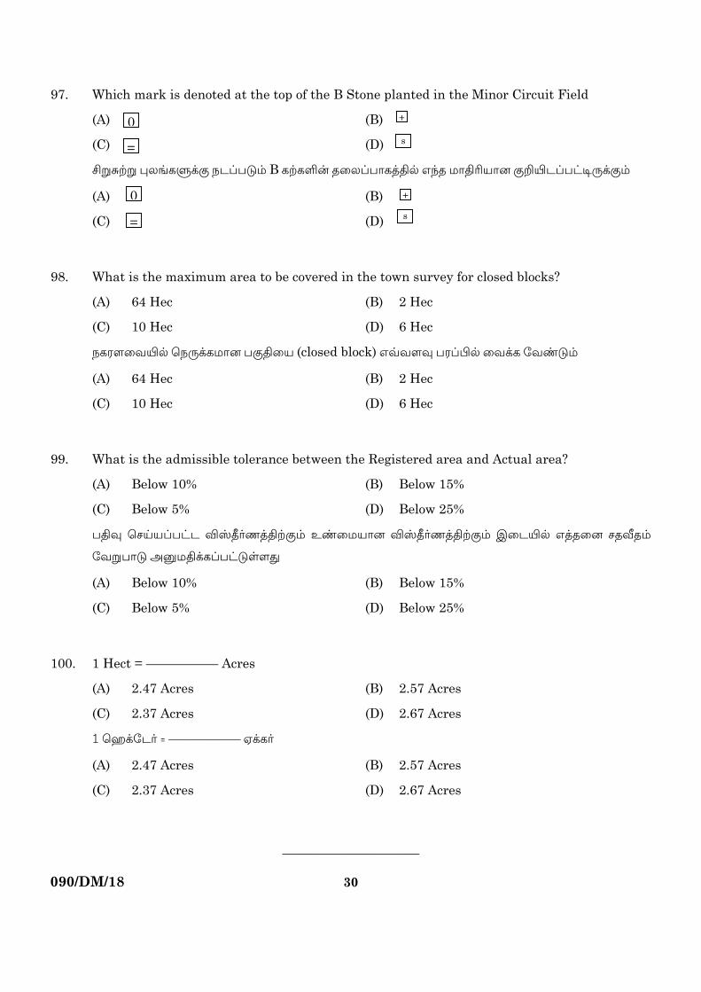
97. Which mark is denoted at the top of the B Stone planted in the Minor Circuit Field
(A) (B)
(C) (D)
]Ö_ØÖ ¦»[PÐUS |h¨£k® B PØPÎß uø»¨£õPzvÀ G¢u ©õv›¯õÚ SÔ°h¨£mi¸US®
(A) (B)
(C) (D)
98. What is the maximum area to be covered in the town survey for closed blocks?
(A) 64 Hec (B) 2 Hec
(C) 10 Hec (D) 6 Hec
|PμÍøÁ°À ö|¸UP©õÚ £Svø¯ (closed block) GÆÁÍÄ £μ¨¤À øÁUP ÷Ásk®
(A) 64 Hec (B) 2 Hec
(C) 10 Hec (D) 6 Hec
99. What is the admissible tolerance between the Registered area and Actual area?
(A) Below 10% (B) Below 15%
(C) Below 5% (D) Below 25%
£vÄ ö\´¯¨£mh ÂìwºnzvØS® Esø©¯õÚ ÂìwºnzvØS® Cøh°À GzuøÚ \uÃu®
÷ÁÖ£õk AÝ©vUP¨£mkÒÍx
(A) Below 10% (B) Below 15%
(C) Below 5% (D) Below 25%
100. 1 Hect = –––––––––– Acres
(A) 2.47 Acres (B) 2.57 Acres
(C) 2.37 Acres (D) 2.67 Acres
1 öíU÷hº = –––––––––– HUPº
(A) 2.47 Acres (B) 2.57 Acres
(C) 2.37 Acres (D) 2.67 Acres
–––––––––––––––––––
+
+
s
0
=
=
0 s

090/DM/18 [Turn over
31
ROUGH WORK

090/DM/18
32
ROUGH WORK


![N arXiv:1608.03265v2 [math.PR] 26 Apr 2017 · 2017. 4. 28. · for a length-Npolymer with extremely sparse disorder satisfying (1.3), see [25]. PINNING OF A RENEWAL ON A QUENCHED](https://static.fdocument.org/doc/165x107/5ffcc40bb34f7e5f726931dc/n-arxiv160803265v2-mathpr-26-apr-2017-2017-4-28-for-a-length-npolymer.jpg)