


γλώσσες
Σελίδες
Νομικός

1
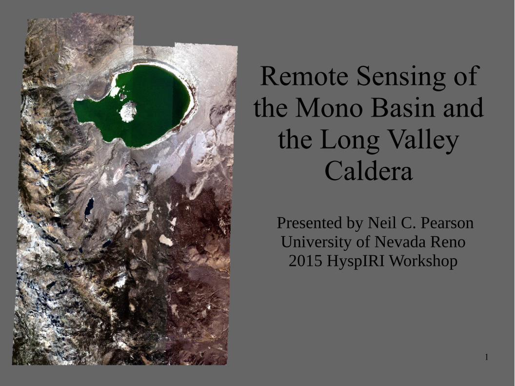
Remote Sensing of the Mono Basin and
the Long Valley Caldera
Presented by Neil C. PearsonUniversity of Nevada Reno 2015 HyspIRI Workshop
2
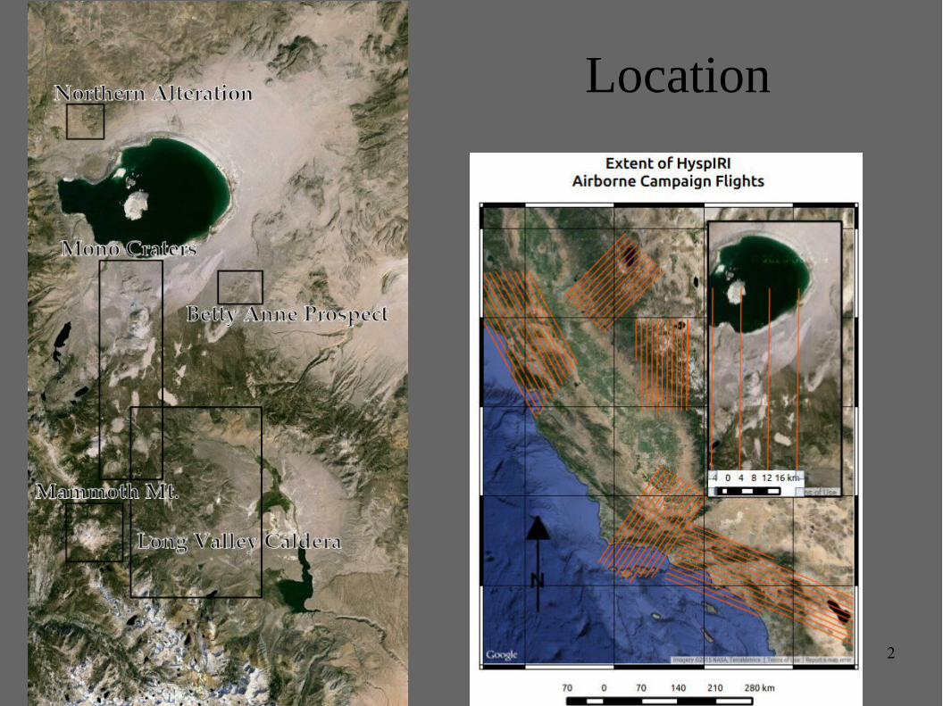
Location
3
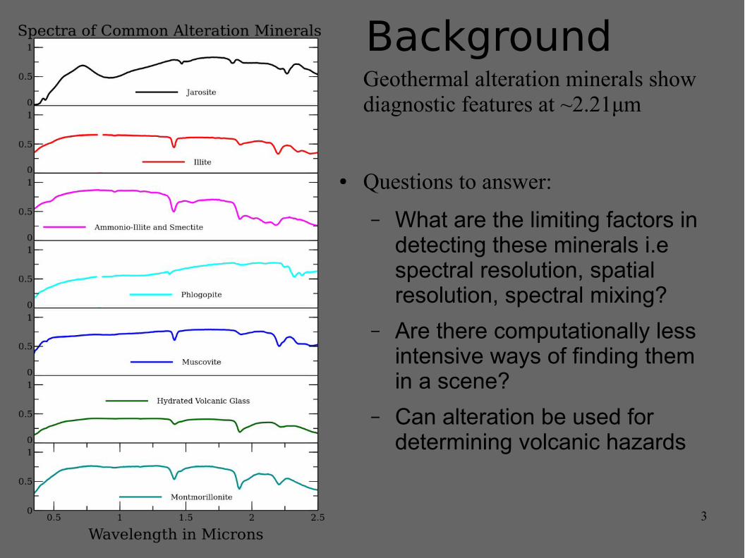
BackgroundGeothermal alteration minerals show diagnostic features at ~2.21μm
● Questions to answer:
– What are the limiting factors in detecting these minerals i.e spectral resolution, spatial resolution, spectral mixing?
– Are there computationally less intensive ways of finding them in a scene?
– Can alteration be used for determining volcanic hazards
4
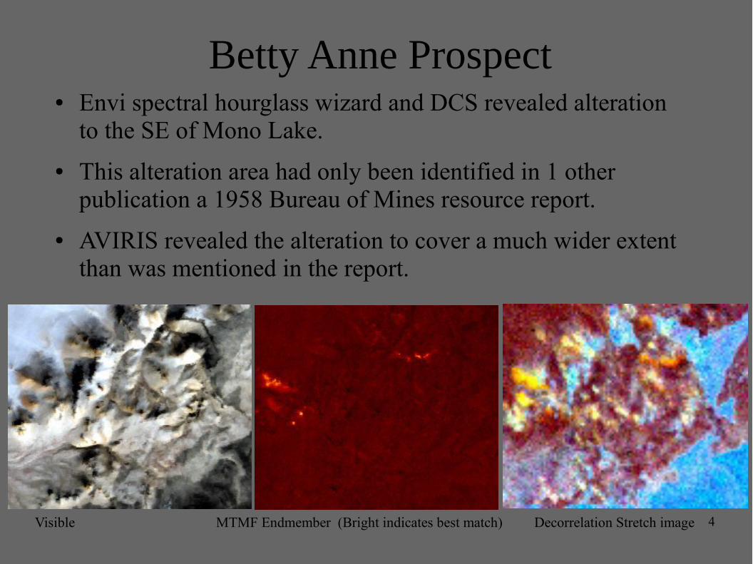
Betty Anne Prospect● Envi spectral hourglass wizard and DCS revealed alteration
to the SE of Mono Lake.
● This alteration area had only been identified in 1 other publication a 1958 Bureau of Mines resource report.
● AVIRIS revealed the alteration to cover a much wider extent than was mentioned in the report.
Visible MTMF Endmember (Bright indicates best match) Decorrelation Stretch image
5
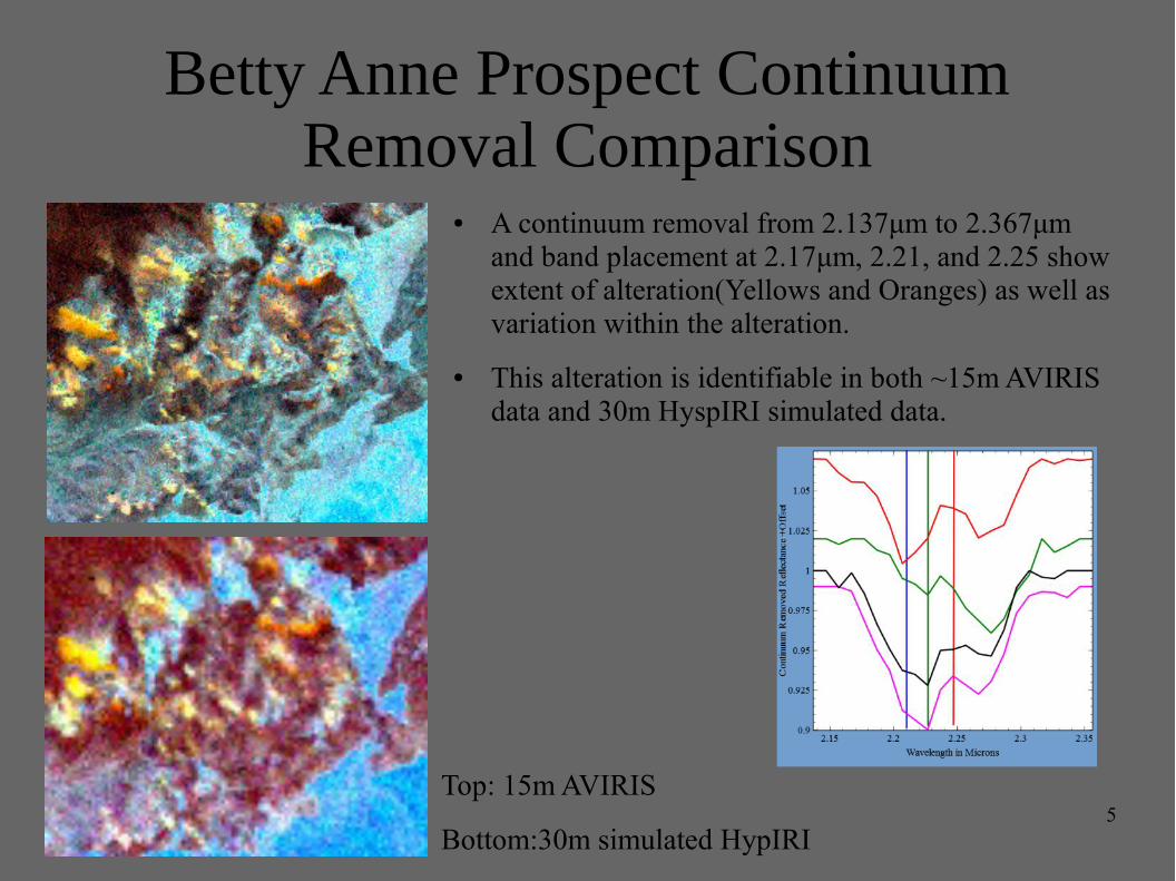
Betty Anne Prospect Continuum Removal Comparison
Top: 15m AVIRIS
Bottom:30m simulated HypIRI
● A continuum removal from 2.137μm to 2.367μm and band placement at 2.17μm, 2.21, and 2.25 show extent of alteration(Yellows and Oranges) as well as variation within the alteration.
● This alteration is identifiable in both ~15m AVIRIS data and 30m HyspIRI simulated data.
6
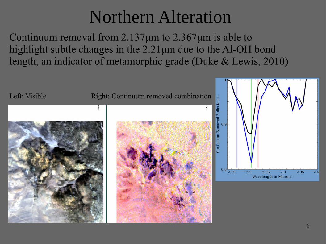
Northern AlterationContinuum removal from 2.137μm to 2.367μm is able to highlight subtle changes in the 2.21μm due to the Al-OH bond length, an indicator of metamorphic grade (Duke & Lewis, 2010)
Left: Visible Right: Continuum removed combination
7
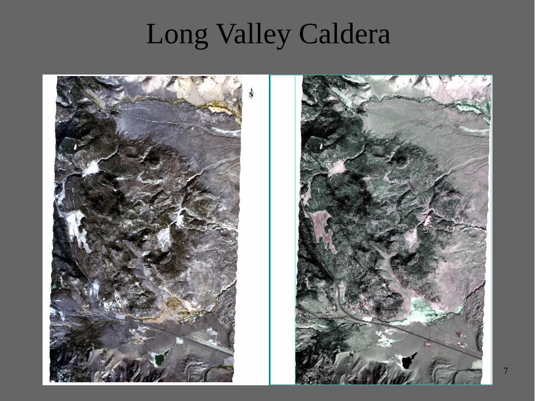
Long Valley Caldera
8
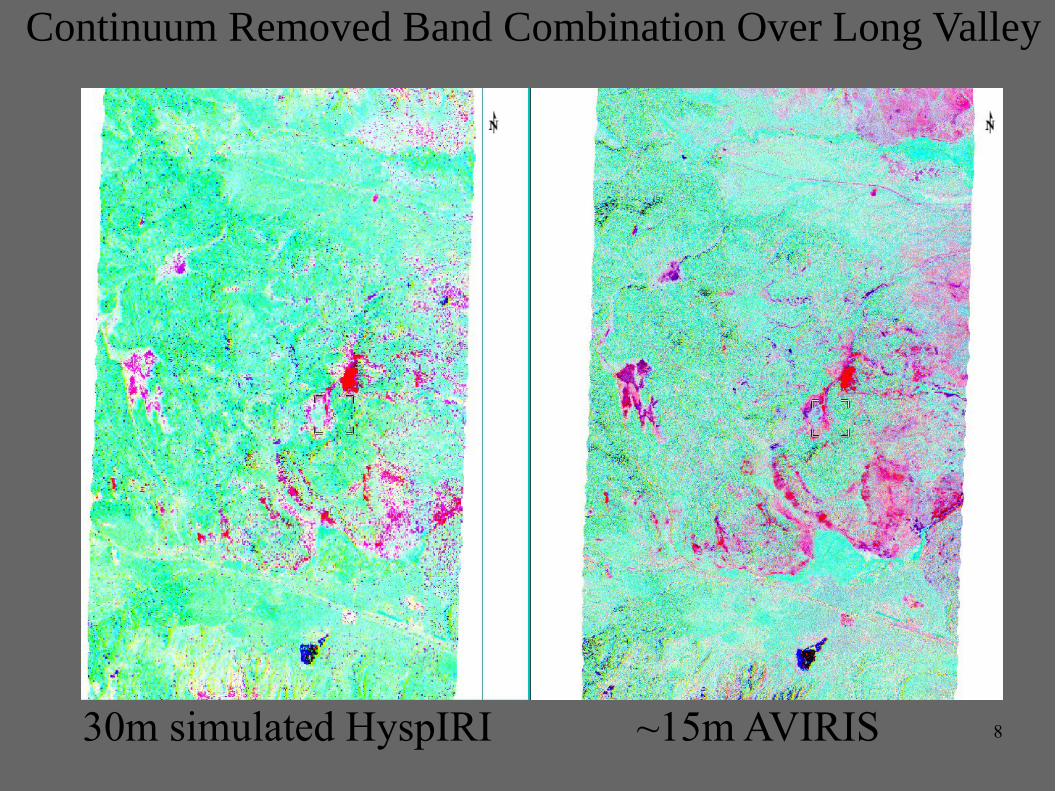
Continuum Removed Band Combination Over Long Valley
30m simulated HyspIRI ~15m AVIRIS
9
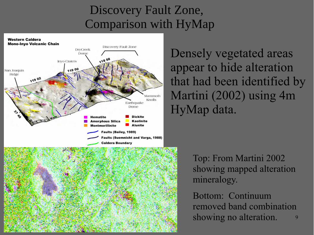
Discovery Fault Zone, Comparison with HyMap
Densely vegetated areas appear to hide alteration that had been identified by Martini (2002) using 4m HyMap data.
Top: From Martini 2002 showing mapped alteration mineralogy.
Bottom: Continuum removed band combination showing no alteration.
10
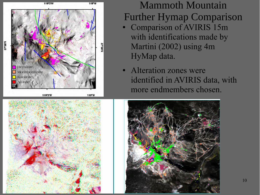
Mammoth MountainFurther Hymap Comparison
● Comparison of AVIRIS 15m with identifications made by Martini (2002) using 4m HyMap data.
● Alteration zones were identified in AVIRIS data, with more endmembers chosen.
11
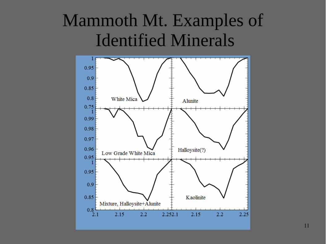
Mammoth Mt. Examples of Identified Minerals
12
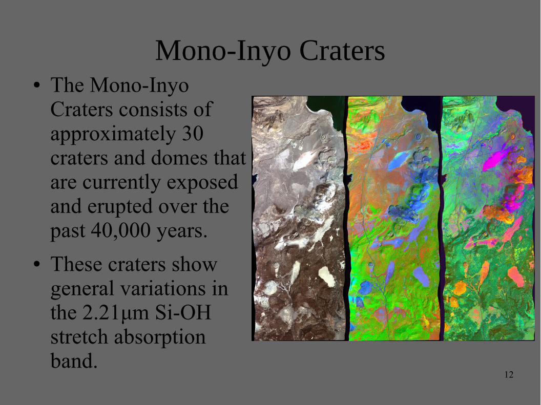
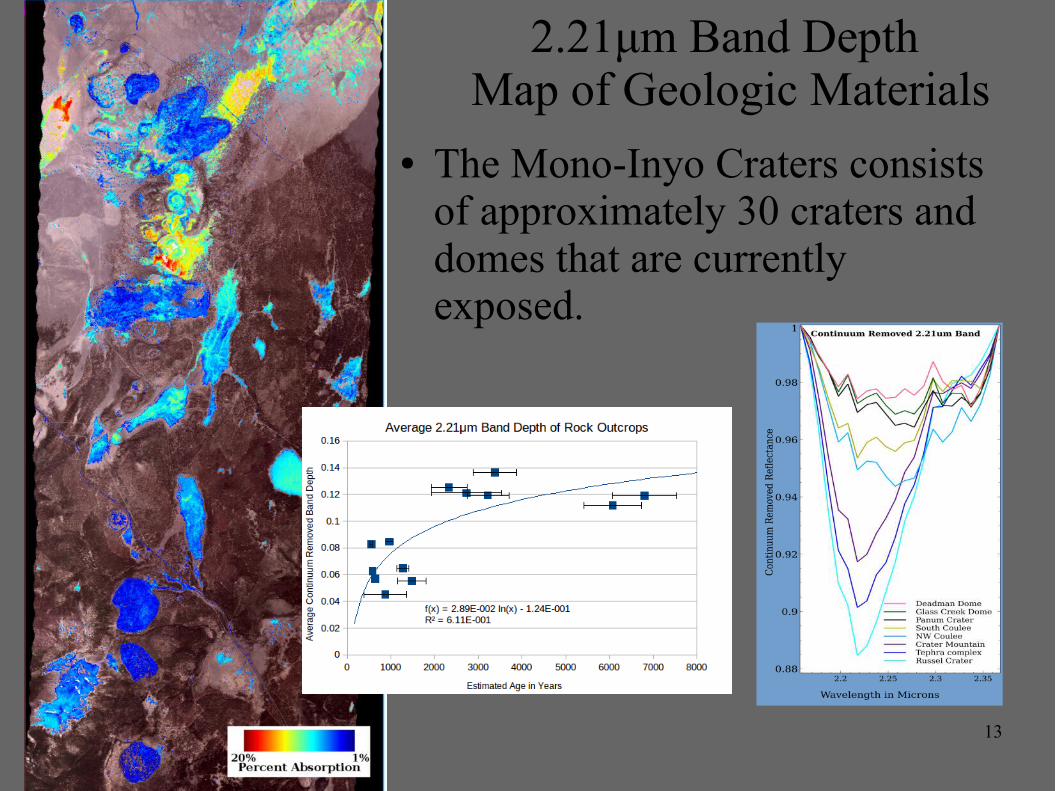
Mono-Inyo Craters● The Mono-Inyo
Craters consists of approximately 30 craters and domes that are currently exposed and erupted over the past 40,000 years.
● These craters show general variations in the 2.21μm Si-OH stretch absorption band.
13
2.21μm Band Depth Map of Geologic Materials
● The Mono-Inyo Craters consists of approximately 30 craters and domes that are currently exposed.
14
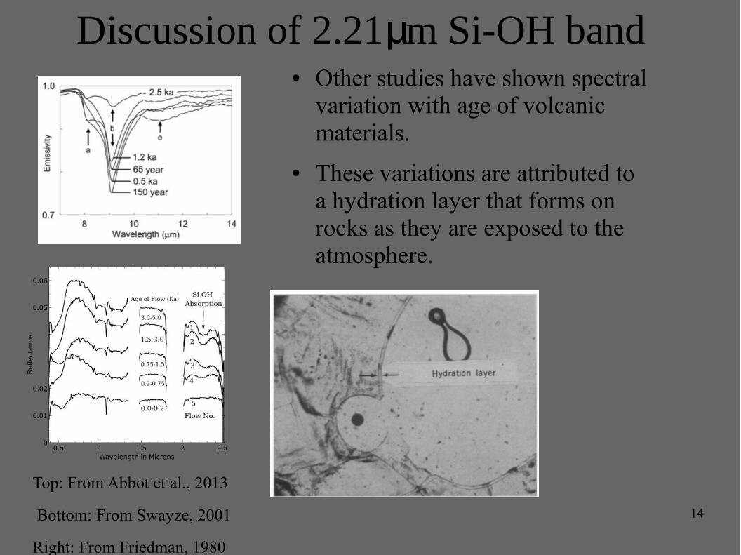
Discussion of 2.21 m Si-OH bandμ
Top: From Abbot et al., 2013
Bottom: From Swayze, 2001
Right: From Friedman, 1980
● Other studies have shown spectral variation with age of volcanic materials.
● These variations are attributed to a hydration layer that forms on rocks as they are exposed to the atmosphere.
15
Conclusions
● Multiple alteration mineral types, including argillic and QSP that cover small areas are identifiable using ~15m AVIRIS spectra and to a slightly lesser extent in 30m.
● A Continuum Removal from 2.137μm to 2.357μm with proper channel placement highlight alteration minerals in 15m data and to a lesser extent 30m data, and can show subtleties mineral transitions.
● Volcanic materials in the area show an increase in band depth in the 2.21μm Si-OH stretch, as age increases similar changes were shown by Abbot et al. (2013) and Swayze (2001). This could be used as a way to date young volcanic occurrences in remote areas such as the Aleutian Islands or Kamchatka Region.
Top Related