Thrace - gha.liveon.tech
52
www.visitgreece.gr Thrace GREEK NATIONAL TOURISM ORGANISATION
Transcript of Thrace - gha.liveon.tech

www.visitgreece.grThrace
GREEK NATIONAL TOURISM ORGANISATION THRA
CE
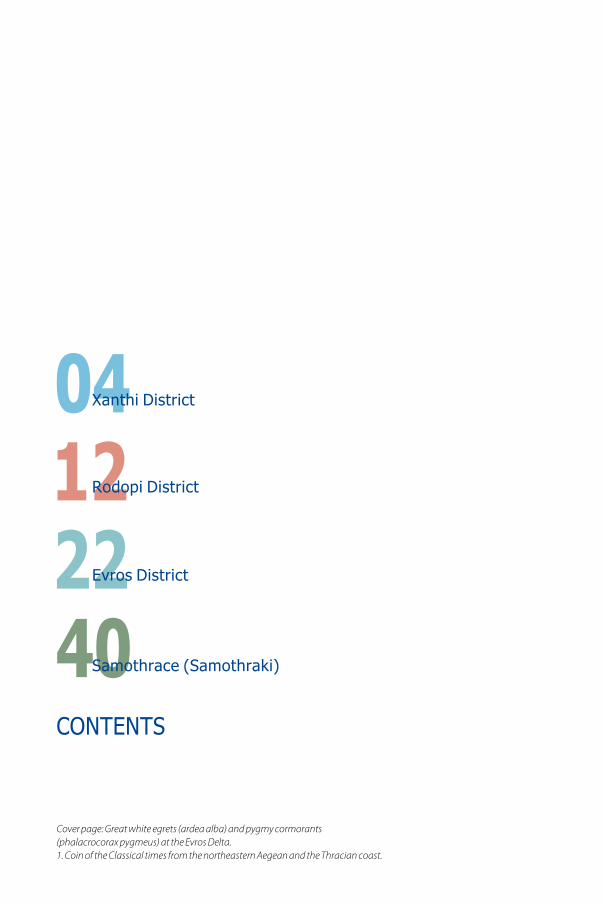
CONTENTS
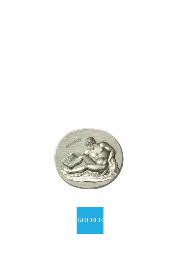
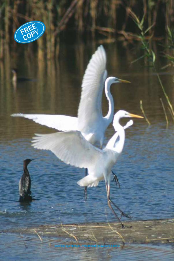
Cover page: Great white egrets (ardea alba) and pygmy cormorants (phalacrocorax pygmeus) at the Evros Delta.1. Coin of the Classical times from the northeastern Aegean and the Thracian coast.
04122240
Xanthi District
Rodopi District
Evros District
Samothrace (Samothraki)
Thrace
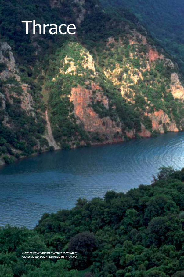
2. Nestos River and its riverside forestland, one of the most beautiful forests in Greece.
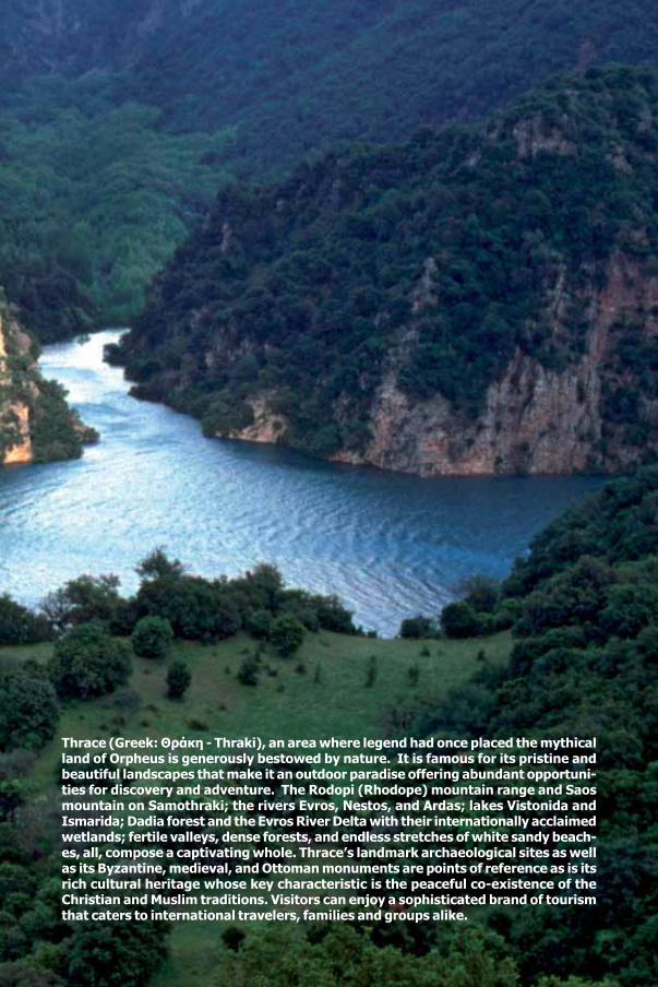
Thrace (Greek: Θράκη - Thraki), an area where legend had once placed the mythical land of Orpheus is generously bestowed by nature. It is famous for its pristine and beautiful landscapes that make it an outdoor paradise offering abundant opportuni-ties for discovery and adventure. The Rodopi (Rhodope) mountain range and Saos mountain on Samothraki; the rivers Evros, Nestos, and Ardas; lakes Vistonida and Ismarida; Dadia forest and the Evros River Delta with their internationally acclaimed wetlands; fertile valleys, dense forests, and endless stretches of white sandy beach-es, all, compose a captivating whole. Thrace’s landmark archaeological sites as well as its Byzantine, medieval, and Ottoman monuments are points of reference as is its rich cultural heritage whose key characteristic is the peaceful co-existence of the Christian and Muslim traditions. Visitors can enjoy a sophisticated brand of tourism that caters to international travelers, families and groups alike.
XANTHI District
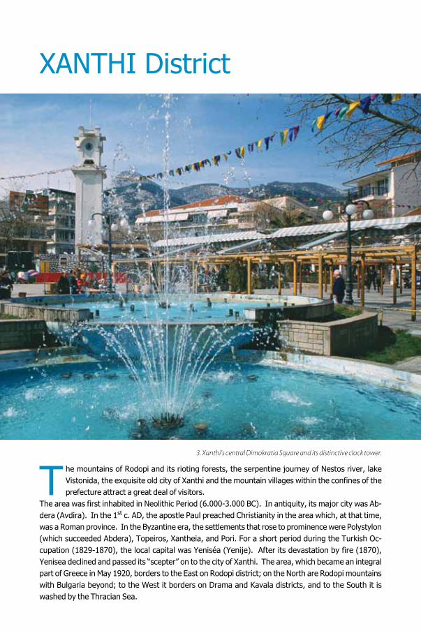
he mountains of Rodopi and its rioting forests, the serpentine journey of Nestos river, lake Vistonida, the exquisite old city of Xanthi and the mountain villages within the confines of the prefecture attract a great deal of visitors.
The area was first inhabited in Neolithic Period (6.000-3.000 BC). In antiquity, its major city was Ab-dera (Avdira). In the 1st c. AD, the apostle Paul preached Christianity in the area which, at that time, was a Roman province. In the Byzantine era, the settlements that rose to prominence were Polystylon (which succeeded Abdera), Topeiros, Xantheia, and Pori. For a short period during the Turkish Oc-cupation (1829-1870), the local capital was Yeniséa (Yenije). After its devastation by fire (1870), Yenisea declined and passed its “scepter” on to the city of Xanthi. The area, which became an integral part of Greece in May 1920, borders to the East on Rodopi district; on the North are Rodopi mountains with Bulgaria beyond; to the West it borders on Drama and Kavala districts, and to the South it is washed by the Thracian Sea.
3. Xanthi’s central Dimokratia Square and its distinctive clock tower.
T

XAN
THI
5Xanthi 1
The “Noblewoman of Thrace”, as Xanthi is called, is built on the slopes of western Rodopi and captivates visitors with its old town: Re-searchers believe that it occupies the site of an-cient Xantheia, a city founded by the Thracian tribe of Kikones and mentioned for the first time by Strabo. During Byzantine times (13th-14th cent. AD), Xanthi was the most important urban centre in the district. Under Turkish rule it was called Iskeje and emerged as a major commer-cial centre where tobacco was produced, proc-essed and traded. By the 18th century Xanthi and Yenisea had made a name for themselves internationally as two significant centres of tobacco trade until 1829 when a devastating earthquake levelled the former. Nevertheless, the opening of the Thessaloniki-Constantinople railroad in 1891 and, later on, the foundation of the Democritus University of Thrace (after 1974) contributed to the city’s economic revival. Dis-tance northeast from Athens: 738 km. Dis-tance northeast from Thessaloniki: 225 km.
City promenade• The old town of Xanthi. It was rebuilt am-phitheatrically at the end of the 19th century, and stands out for its picturesque cobblestoned alleys, its restored mansions, its neoclassical buildings as well as the ones built by Western Macedonia and Epirus craftsmen in the region’s traditional architectural style which combines local trends with Balkan influences. One of the first buildings visitors notice in the old town is Demarcheion (Town Hall), commissioned in 1830 by Moses, a Jewish tobacco merchant. On Orfeos Street, a traditional establishment of the old town houses the Municipal Art Gallery. The Folk Art Museum maintained by the Friends of Progress Association of Xanthi (FEX) is located nearby in the elegant mansions that had once belonged to the tobacco mer-chants Athanasios and Pantelis Kou-gioumtzoglou.The walls and ceilings
of the two mansions are decorated by murals painted by German artists. Metropolis Square is quite close to the Folk Art Museum. The cathe-dral dedicated to Saint John the Baptist (Ayios Ioannis Prodromos) was erected in 1839 and is a three-aisled basilica. Its three-storey belfry was constructed in 1924. The Metropolitan Hall, a two-storey building that includes semi-base-ment premises dates back to 1897. Moreover, the buildings of the A’ Elementary School and the Stalios Infant School are worth visiting.• The Byzantine fortress, atop the hill, whose purpose was to «monitor» the pass accessing the interior. • Xanthi’s central square, dominated by the old clock tower (1859). • The Municipal Gardens and the children’s playground park. • The riverside part of Kosynthos River (anc. Kossinites) which the locals have dubbed «The Beach». Numerous cafés, restaurants and bars function in the area. • The Xanthi marketplace with its motley vibrancy and its Middle Eastern ambience. It takes place every Saturday in the area of the Fire Department.• The Ecclesiastical Museum, housed in the Monastery of Panagia Archangeliotissa (near the city’s old Samakov District).
4. The Holy Metropolitan Church of Xanthi and its belfry.
• The Museum of Natural History, within the local forest authorities’ premises, where embalmed birds, animals, and reptiles, all indigenous fauna species, are on display. • The magnificent Kaloudis Mansion, built in 1877. • Xanthi’s tobacco storage area and espe-cially the well-known Odos Kapnergaton (Tobacco Workers Street) whose name derived from the «P» (Π) shape the 1890 warehouses form. The Foun-dation for Thracian Art and Tradition is housed in a former tobacco storeroom on Dodeka Apostolon and Androutsou Streets. • Palia Chryssa, a beautiful suburb of grand man-sions west of the city.
Monasteries• Monastery of Archangels Michael and Gabriel (Pamnegistoi Taxiarches), where the
Xanthi Ecclesiastical School (Seminary) functions.• Panagia Archangeliotissa or Samovariani (19th c). Archaeological finds have been discov-ered in the vicinity of the church. • Panagia Kalamous (north of the city), a fort-like edifice built in an area with a breathtaking view.
Nearby trips• Diomedeia, 6 km S; on Tepé hill a significant Late Neolithic settlement was excavated.• Yeniséa, 10 km SE, a pleasant small town; the 15th-16th cent. mosque recently renovated is a must-see attraction. • Toxotes, 15 km SE. A Nestos riverside village where most of the alternative tourism outfits maintain their bases. The ruins of Topeiros lie be-tween Toxotes and Paradeisos. Topeiros, “the first (among the cities of) the coast of Thrace” (Procopius), was founded in the 1st c. AD and was
PORTO LAGOS
SAMOTHRAKI
!
!
!
!P
!
!
!P
!P
!
!
!
!
!
!
!
!
!
!
!P
!
!P
!
!P
!
!
!
"T
!
!P
!
!
!
!
!
!
!
!
!
!
!
!
!
!P
!P
!
!
!
!
!
!P
!P
!
!
!
!
!
!
!
!
!P
XANTHI Kimmeria
Yenisea
Selero
Avato
Neo Erasmio
Avdira
Miki
Ehinos
Kentavros
Glafki
Pahni
Iliokentima
Thalassia
Satres
Melivia
Ano Thermes
Medousa
Kotani
Simantra
Pigadia
Porto Lagos
Sounio
Polisitos
Koutso Nea Kessani
Toxotes
Dimario
Mandra
Vafeika
Lefkopetra
Magiko
Olvio
Melissa
Feloni Paleos Zigos
Paleo Katrami
Petinos
Neos Zigos
Evlalo Mirodato
Maggana
Sminthi
Diomidia
Efmiro
Petrohori
Kremasti
Kirnos Dekarho
Oreo
Dafnonas
Komnina
Stavroupoli
Kato Karιofito
Ioniko
Neohori
Livaditis
Filia
Kotili
Porto Lagos
Mirodatou
Neo Erasmio
Maggana
Avdira (Agios Ioannis)
Mandra
Porto Molo
0 7.5 153.75
N[
Galani
LEGEND
AirportArchaeological sitePoliceHospitalCampingCastle - FortressCasinoPortMarinaMuseumBeachBus stationRegion capital"T
!P Village >1000 per.! Hamlet
Main road networkRural road networkMinor road networkFerry route
RODOPI
BULGARIA
MACEDONIA
km
a diocese seat between the 5th and 8th c. AD. • Pomakochoria (villages of Pomaks). It is a cluster of approximately 40 villages north of Xanthi interspersed along the valley of Echinos on both sides of the river, on the way to the Greek-Bulgarian border (road leading to Smin-thi and Echinos). They are known for their cul-tural and architectural uniqueness as well as for the faithful preservation of their ancient tradi-tions by their Muslim inhabitants (Pomaks), who speak a Slavic dialect containing many ancient Greek words. In the heart of each and every one of the Pomakochoria, a mosque with a tall minaret holds a prominent position. The dis-trict’s main village is Echinos whose entrance is flanked by tobacco drying sheds. Other Poma-kochoria such as Oraio, Satres, Medousa, and Kotani are very picturesque as well.
Events• Xanthi’s popular carnival, during which the city is inundated by visitors for at least three days.• “Thracian Folklore Celebrations”: during the last week of Carnival.• “Old Town Celebration”, festivities that, among
others, include concerts, theatrical performanc-es, and art exhibitions: beginning of September.• “Youth Celebration”: every May and June.
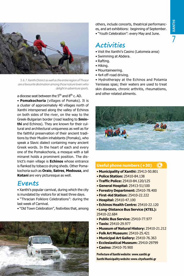
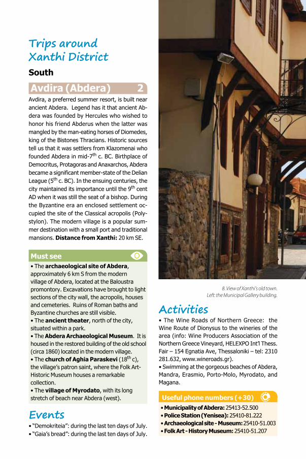
Activities• Visit the Xanthi’s Casino (Latomeia area)• Swimming at Abdera. • Rafting. • Hiking. • Mountaineering. • 4x4 off-road driving. • Hydrotherapy at the Echinos and Potamia Yeniseas spas; their waters are used to treat skin diseases, chronic arthritis, rheumatisms, and other related ailments.
Useful phone numbers (+30)• Municipality of Xanthi: 25413-50.801• Police Station: 25410-84.138• Traffic Police: 25410-84.120/125• General Hospital: 25413-51/100• Forestry Department: 25410-78.400• First-Aid Station: 25410-22.222• Hospital: 25410-47.100• Echinos Health Centre: 25410-22.120• Long-Distance Bus Service (KTEL):25410-22.684• Public Bus Service: 25410-77.977• Taxis: 25410-29.977• Museum of Natural History: 25410-21.212• Folk Art Museum: 25410-25.421• Municipal Art Gallery: 25410-76.363• Ecclesiastical Museum: 25410-29799• Casino: 25410-70.900
Prefecture of Xanthi website: www.xanthi.grXanthi Municipality website: www.cityofxanthi.gr
XAN
THI
7
5. 6. 7. Xanthi District as well as the entire region of Thrace are a favourite destination among those nature lovers who
delight in adventure sports.
Trips aroundXanthi DistrictSouth
Avdira (Abdera) 2Avdira, a preferred summer resort, is built near ancient Abdera. Legend has it that ancient Ab-dera was founded by Hercules who wished to honor his friend Abderus when the latter was mangled by the man-eating horses of Diomedes, king of the Bistones Thracians. Historic sources tell us that it was settlers from Klazomenai who founded Abdera in mid-7th c. BC. Birthplace of Democritus, Protagoras and Anaxarchos, Abdera became a significant member-state of the Delian League (5th c. BC). In the ensuing centuries, the city maintained its importance until the 9th cent AD when it was still the seat of a bishop. During the Byzantine era an enclosed settlement oc-cupied the site of the Classical acropolis (Poly-stylon). The modern village is a popular sum-mer destination with a small port and traditional mansions. Distance from Xanthi: 20 km SE.
Must see• The archaeological site of Abdera, approximately 6 km S from the modern village of Abdera, located at the Baloustra promontory. Excavations have brought to light sections of the city wall, the acropolis, houses and cemeteries. Ruins of Roman baths and Byzantine churches are still visible. • The ancient theater, north of the city, situated within a park. • The Abdera Archaeological Museum. It is housed in the restored building of the old school (circa 1860) located in the modern village. • The church of Aghia Paraskevi (18th c), the village’s patron saint, where the Folk Art-Historic Museum houses a remarkable collection.• The village of Myrodato, with its long stretch of beach near Abdera (west).
Events• “Demokriteia”: during the last ten days of July.• “Gaia’s bread”: during the last ten days of July.
Activities• The Wine Roads of Northern Greece: the Wine Route of Dionysus to the wineries of the area (info: Wine Producers Association of the Northern Greece Vineyard, HELEXPO Int’l Thess. Fair – 154 Egnatia Ave, Thessaloniki – tel: 2310 281.632, www.wineroads.gr). • Swimming at the gorgeous beaches of Abdera, Mandra, Erasmio, Porto-Molo, Myrodato, and Magana.
Useful phone numbers (+30)• Municipality of Abdera: 25413-52.500• Police Station (Yenisea): 25410-81.222• Archaeological site - Museum: 25410-51.003• Folk Art - History Museum: 25410-51.207
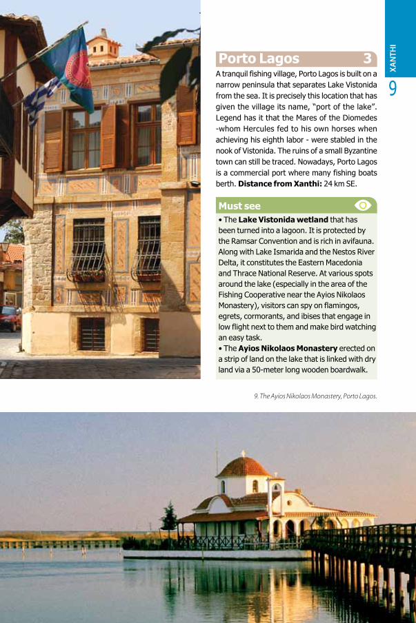
8. View of Xanthi’s old town. Left: the Municipal Gallery building.
XAN
THI
9
• Folk Art – History Museum: 25410-51.207
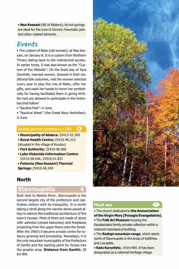
Porto Lagos 3A tranquil fishing village, Porto Lagos is built on a narrow peninsula that separates Lake Vistonida from the sea. It is precisely this location that has given the village its name, “port of the lake”. Legend has it that the Mares of the Diomedes -whom Hercules fed to his own horses when achieving his eighth labor - were stabled in the nook of Vistonida. The ruins of a small Byzantine town can still be traced. Nowadays, Porto Lagos is a commercial port where many fishing boats berth. Distance from Xanthi: 24 km SE.
Must see• The Lake Vistonida wetland that has been turned into a lagoon. It is protected by the Ramsar Convention and is rich in avifauna. Along with Lake Ismarida and the Nestos River Delta, it constitutes the Eastern Macedonia and Thrace National Reserve. At various spots around the lake (especially in the area of the Fishing Cooperative near the Ayios Nikolaos Monastery), visitors can spy on flamingos, egrets, cormorants, and ibises that engage in low flight next to them and make bird watching an easy task. • The Ayios Nikolaos Monastery erected on a strip of land on the lake that is linked with dry land via a 50-meter long wooden boardwalk.
9. The Ayios Nikolaos Monastery, Porto Lagos.
• Nea Kessani (NE of Abdera); its hot springs are ideal for the cure of chronic rheumatic pain and other related ailments.
Events • The custom of Babo (old woman), at Nea Kes-sani, on January 8. It is a custom from Northern Thrace dating back to the matriarchal society. In earlier times, it was also known as the “Cus-tom of the Midwife”: On the feast day of Ayia Dominiki, married women, dressed in their tra-ditional folk costumes, visit the woman selected every year to play the role of Babo, offer her gifts, and wash her hands to honor her symboli-cally for having facilitated them in giving birth. No men are allowed to participate in the festivi-ties that follow!• “Sardine Fest”: in June.• “Nautical Week” (the Greek Navy festivities): in June.
Useful phone numbers (+30)• Municipality of Abdera: 25413-52.500• Rural Health Centre: 25410-96.315 (situated in the village of Koutso)• Port Authority: 25410-96.666• Lake Vistonida Information Centre: 25410-96.646, 25910-51.831• Potamia (Nea Kessani) Thermal Springs: 25410-96.349
North
Stavroupolis 4Built next to Nestos River, Stavroupolis is the second largest city of the prefecture and cap-tivates visitors with its tranquility. It is worth taking a stroll along the narrow stone-paved al-leys to admire the traditional architecture of the town’s houses. Most of them are made of stone with sahnisia (closed balconies) and fireplaces projecting from the upper floors onto the street. After the 1960’s it became a trade centre for to-bacco growing and processing. Nowadays, it is the only mountain municipality of the Prefecture of Xanthi and the starting point for forays into the greater area. Distance from Xanthi: 28 km NW.
Must see• The church dedicated to the Annunciation of the Virgin Mary (Panagia Evangelistria).• The Folk Art Museum housing the Karabatzakis family private collection within a restored neoclassical building. • The Rodopi mountain range, which starts north of Stavroupolis in the areas of Kallithea and Leivaditis.• Kato Karyofyto, 14 km NW. It has been designated as a national heritage village
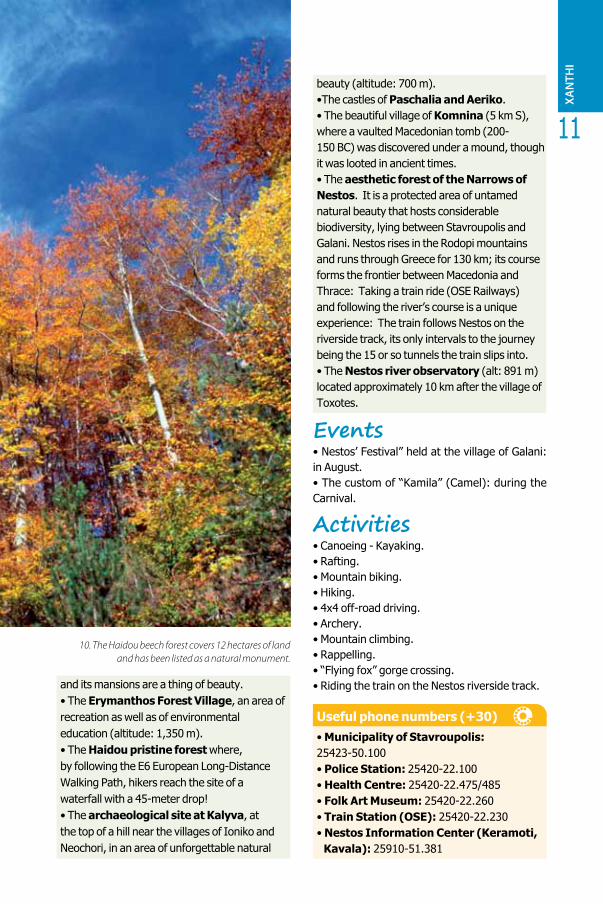
10. The Haidou beech forest covers 12 hectares of landand has been listed as a natural monument.
XAN
THI
11
and its mansions are a thing of beauty.• The Erymanthos Forest Village, an area of recreation as well as of environmental education (altitude: 1,350 m). • The Haidou pristine forest where, by following the E6 European Long-Distance Walking Path, hikers reach the site of a waterfall with a 45-meter drop! • The archaeological site at Kalyva, at the top of a hill near the villages of Ioniko and Neochori, in an area of unforgettable natural
beauty (altitude: 700 m). •The castles of Paschalia and Aeriko.• The beautiful village of Komnina (5 km S), where a vaulted Macedonian tomb (200-150 BC) was discovered under a mound, though it was looted in ancient times.• The aesthetic forest of the Narrows of Nestos. It is a protected area of untamed natural beauty that hosts considerable biodiversity, lying between Stavroupolis and Galani. Nestos rises in the Rodopi mountains and runs through Greece for 130 km; its course forms the frontier between Macedonia and Thrace: Taking a train ride (OSE Railways) and following the river’s course is a unique experience: The train follows Nestos on the riverside track, its only intervals to the journey being the 15 or so tunnels the train slips into.• The Nestos river observatory (alt: 891 m) located approximately 10 km after the village of Toxotes.
Events• Nestos’ Festival” held at the village of Galani: in August.• The custom of “Kamila” (Camel): during the Carnival.
Activities • Canoeing - Kayaking.• Rafting. • Mountain biking.• Hiking. • 4x4 off-road driving. • Archery. • Mountain climbing. • Rappelling. • “Flying fox” gorge crossing. • Riding the train on the Nestos riverside track.
Useful phone numbers (+30)• Municipality of Stavroupolis:25423-50.100• Police Station: 25420-22.100• Health Centre: 25420-22.475/485• Folk Art Museum: 25420-22.260• Train Station (OSE): 25420-22.230• Nestos Information Center (Keramoti, Kavala): 25910-51.381
10. The Haidou beech forest covers 12 hectares of landand has been listed as a natural monument.
RODOPI District
odopi is a region of particular interest legendary for its scenery, its scope of activities and attractions and its hospitality. It has many beautiful vistas (Lakes Vistonida and Ismarida), rich flora and fauna found on the mountainous part on the east of the
prefecture, archaeological sites, and traditional small villages. Its capital is Komotini, a city with a long historic course throughout which the Christian and Muslim populations have co-existed peacefully. On the basis of archaeological finds, the district was first inhabited in prehistoric period. During historic times, its most significant city was Maroneia, which was founded by Chian settlers in the mid-seventh cent. BC. In the Byzantine era, cities such as Maroneia, Mosyno(u)polis, Anastassioupolis, and Gratianoupolis played a key role in this region. From the 10th to the 14th c. AD, Papikion mountain became a preeminent monastic centre. The area was taken by the Turks in 1361. During the years of Turkish rule, Komotini became a major urban centre in the area until it was finally incorporated into the Greek state in 1920. Presently, the Democritus University of Thrace, the new industrial plants in the area as well as the construction of Egnatia highway have significantly contributed to the region’s growth. On the North the district of Rodopi is separated from Bulgaria by the Rodopi Mountains; on the West it borders on the district of Xanthi and on the East on the district of Evros; to the South it is washed by the Thracian Sea.
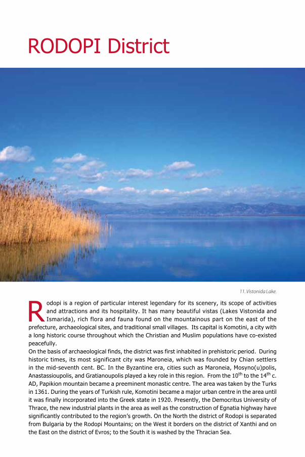
11. Vistonida Lake.
R
ROD
OPI
13 Komotini 1Built on the north part of the Komotini plain, Ko-motini is the capital as well as the administrative, financial, and cultural hub of the prefecture. It is also the seat of the Regional Authority of Eastern Macedonia and Thrace and a major traffic junction. In the heart of Komotini stands the rectangular for-tress, the nucleus of the modern city, built during the reign of Theodosius I (379-395). At that time, Komotini was merely a small fortified settlement, a station, on the Via Egnatia. In the 14th c. «Ko-motena» or «Komotini» (Gregoras) or «Koumout-zina» (Cantacuzenus) grew into a significant city. Its population increased due to the installation of refugees from the devastated city of Mosynoupo-lis. The Ottoman Turks captured the town in 1361. During the Turkish Occupation, the city, then named Gümülcine, rose to prominence. During the second half of the 19th c. it reached its peak as a major centre of agricultural and livestock breed-ing activities for the greater area. It was liberated in 1913 but did not become a part of Greece until May 1920, after the Treaty of Sèvres, receiving a large influx of refugees in 1922-1923. Nowadays in Komotini, the Western European element and the Middle Eastern one merge harmoniously both in terms of culture as well as in terms of everyday habits. Distance from Athens: 795 km NE. Dis-tance northeast from Thessaloniki: 281 km
City promenade• Downtown you can see the remains of the Byzantine wall circuit dated to the 4th cent. AD• The Komotini fortress encloses the cathe-dral dedicated to the Assumption of the Virgin (Koimisis tis Theotokou -1800) that occupies the site of an earlier Byzantine church: Its historic re-ligious paintings and the wood-carved iconostasis impress. • The colourful old town (Muslim quarter), with its maze of alleys and low traditional houses with their tiled roofs.• The old marketplace teeming with small shops, thrift stores, traditional family businesses, smithies, and tinker shops. An outdoor fresh pro-duce market functions there every Saturday.• The impressive New Mosque (Yeni Jāmi),
quite close to the central square where visitors may also see the clock tower.• The 14th century Poorhouse (Imaret), west of Filikis Etaireias street, founded by Gazi Evrenos Bey, a Christian renegade. • The Tsanakleios School, on Dimokritou Street. It was founded in 1904 with a donation by Komotini’s benefactor Nestor Tsanaklis, a wealthy Greek industrialist that lived in Egypt. • The magnificent neoclassical mansions built in 19th-20th cent.• The Armenian Marketplace and the Teneke neighbourhood. • The Aghia Paraskevi Municipal Park and its zoo: At its entrance to the west, visitors may view the city’s main Iroon (War Memorial). Made of marble and standing 14 m high the memorial also comprises the likeness of a sword in metal
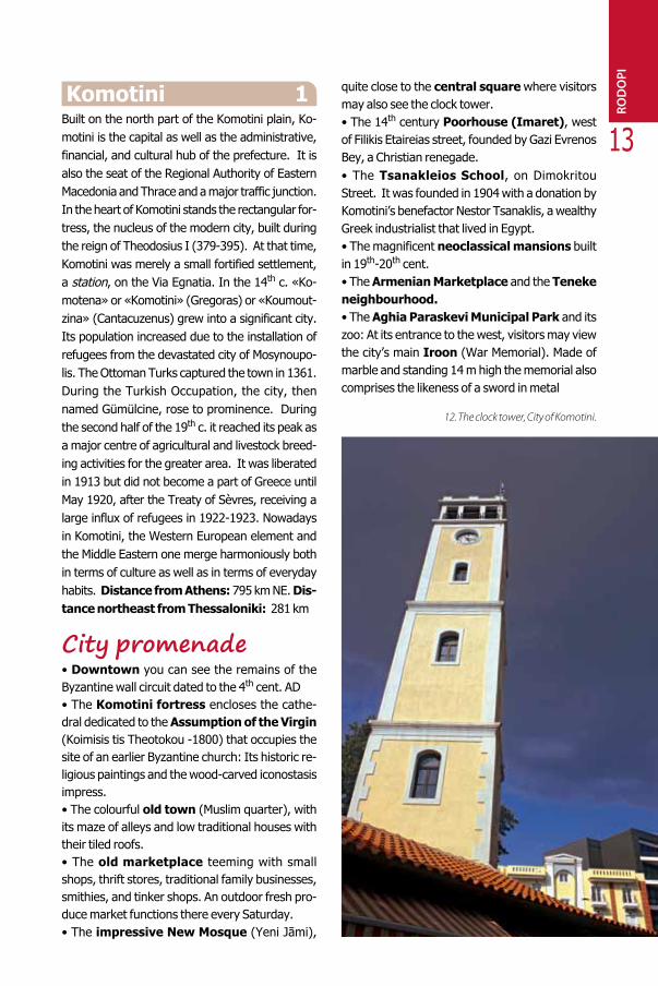
12. The clock tower, City of Komotini.
Museums• Archaeological Museum. It contains important archaeological finds from the whole of Thrace (that range from Paleolithic period to the Byzantine era). • Ecclesiastical Museum. Its collection spread over the 14th cent. Imaret comprises impressive portable icons (16th-19th cent.). • Folk Art Museum: Housed in a 19th-century mansion, the bulk of the collection is made up of traditional domestic and agricultural items• The N. Papanikolaou Foundation–Byzan-tine Museum. Ecclesiastical heirlooms and re-ligious items dated to the Byzantine era are on display. There is also a remarkable library with a good selection of 16th, 17th, and 18th century man-uscripts. • Roma Basketry Museum. It is located at the village of Thrylorio and features a varied collection
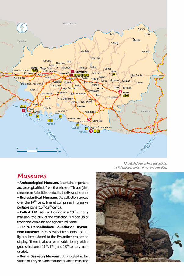
13. Detailed view of Anastassioupolis: The Paleologos Family monograms are visible.
BU LGA RIA
ALEXANDROUPOLI
SAMOTH
RAKI
PORTO LAGOS
SAMOTHRAKI
EVROS
XANTHI
!
!
!
!
!
!
!
!
!
!
!
!
!
!
!
!
!P
!P
!
!
!
!P
!
!P
!P
!
!
!
!!P
!!
!
!
!!
!
!
!
!
!
!
!
!
!P
!
!
!
!
!P!P
! !P
!P
!
!
!
!
!
!
!
!
!
"T
!
!
!
!
!
!!
!
!P
!
KOMOTINI
AratosArisvi
Arriana
Sapes
Filira
Likio
IfaistosAmaxades
Aegiros
Xilagani
DokosIasmos
Nimfaia
Mesi
Imeros
Kosmio
Fanari
Dialampi
KopteroAno Amaxades Linos
Mistakas
Profitis Ilias
GratiniKalhas
Hloi
Kerasia
Mirtiski
Virsini
Mishos
Lampro
Kimi
Paterma
Sostis
Organi
Mega Pisto Asomati
Thamna Dimi
Proskinites
Thrilorio
LofariAmaranta
Maronia
Nea Santa
Isalo
Vragia
Evrinos
Poliantho
Amfia
ArsakioVenna
Nea PetraErgani
Agios Charalampos
Kikidio Passos
Alkiona
RoditisMeleti
Pagouria
Porpi
Paradimi
GlifadaArogi
Mega Doukato
Amvrosia
Neo Sidirohori
Agioi TheodoriSalpi
Nea Kallisti
Kerasia
Kaggeles
Molivoti
Mesi
Arogi
Fanari
Imeros
Alkiona
0 10 205
N[
Neda
km
15
of artifacts created by the Roma (gypsies) basket weavers. • Thracian Museum of Education. It has a unique selection of earlier types of school materials that are of historical importance.
Nearby trips• Papikion Mountain. A major Byzantine mo-nastic centre between the 11th and the 14th centu-ries, organized in compliance with the Mount Athos typicon. It lies in the western part of the prefecture and access to it is ensured through the village of Sostis or Mega Pisto. Ruins of old monasteries have been found in the area.• Mischos (5 km W). Remnants of fortifications as well as the foundations of a Byzantine church have been excavated. The church had once been part of the city of Maximianoupolis; its name de-rived from the Roman emperor Maximian (286-305, 307-310) and it flourished during the Early Christian period. In the 9th cent. AD the city then named Mosyno(u)polis re-emerged as a significant urban centre. Large sections of the city wall as well as numerous houses have been unearthed bearing witness to its importance.•The Monastery of Panagia Faneromeni Vathyriaka or Fatiriaka (dedicated to the As-sumption of the Virgin - 12 km NW); it has an inter-
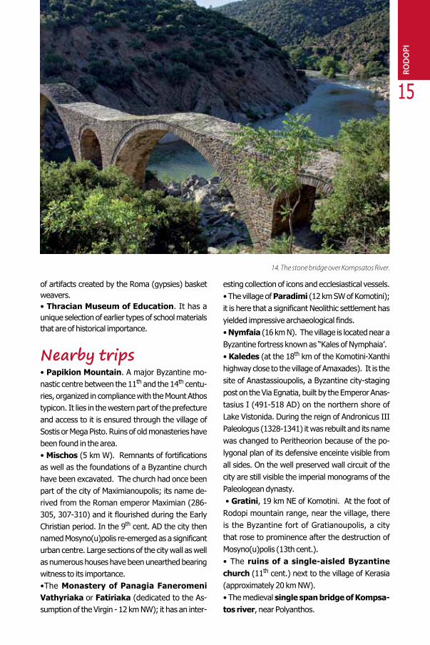
esting collection of icons and ecclesiastical vessels.• The village of Paradimi (12 km SW of Komotini); it is here that a significant Neolithic settlement has yielded impressive archaeological finds. • Nymfaia (16 km N). The village is located near a Byzantine fortress known as “Kales of Nymphaia’.• Kaledes (at the 18th km of the Komotini-Xanthi highway close to the village of Amaxades). It is the site of Anastassioupolis, a Byzantine city-staging post on the Via Egnatia, built by the Emperor Anas-tasius I (491-518 AD) on the northern shore of Lake Vistonida. During the reign of Andronicus III Paleologus (1328-1341) it was rebuilt and its name was changed to Peritheorion because of the po-lygonal plan of its defensive enceinte visible from all sides. On the well preserved wall circuit of the city are still visible the imperial monograms of the Paleologean dynasty. • Gratini, 19 km NE of Komotini. At the foot of Rodopi mountain range, near the village, there is the Byzantine fort of Gratianoupolis, a city that rose to prominence after the destruction of Mosyno(u)polis (13th cent.).• The ruins of a single-aisled Byzantine church (11th cent.) next to the village of Kerasia (approximately 20 km NW).• The medieval single span bridge of Kompsa-tos river, near Polyanthos.
ROD
OPI
14. The stone bridge over Kompsatos River.
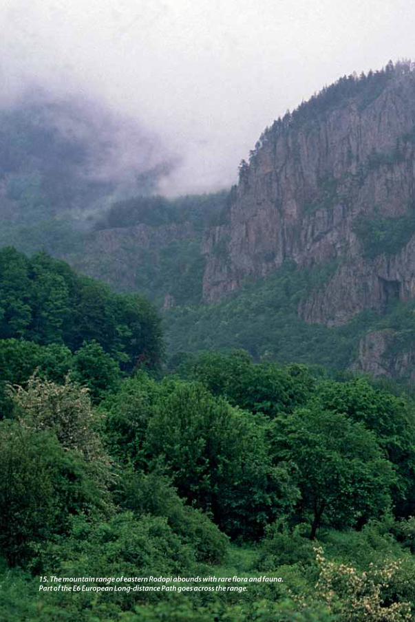
15. The mountain range of eastern Rodopi abounds with rare flora and fauna. Part of the E6 European Long-distance Path goes across the range.

ROD
OPI
17
• The three-arched medieval bridge within the forest near the village of Paterma. In the same area, there is also a single-aisled Byzantine church dated to 11th-12th c. AD.
Events•“Eleftheria”, festivities held in May, in com-memoration of the city’s liberation from the Turks.• “Thrace”, a Panhellenic commercial exhibition held at Komotini’s exhibition hall every May.
Activities• The cultural tour (starting at the Eirini Central Square) on a small train and a uniform fare which visits the 24 most important sights and museums of the city.• Hiking through a magnificent natural setting on the E6 European Long-Distance Walking Path that crosses the mountainous part of Rodopi District.• Climbing in Eastern Rodopi at “Ipsoma 1,050”. The “Charalambos Dimou” Komotini Alpine Club (EOS) maintains a fully equipped mountain shel-ter there.• Mountaineering. • 4x4 off-road driving.
Useful phone numbers (+30)
• Municipality of Komotini: 25313-52.400-10• Police Station: 25310-22.100• Traffic Police: 25310-83.215• General Hospital: 25310-22.222• Long-Distance Bus Service (KTEL): 25310-22.912Museums• Archaeological Museum: 25310-22.411• Ecclesiastical Museum: 25310-22.642• Folk Art Museum: 25310-25.975•The N. Papanikolaou Foundation: 25310-22.112• Museum of Roma Basketry: mobile 6977-585.844• Thracian Museum of Education: 25310-36.739
Municipality of Komotini website: www.komotini.gr
Trips aroundRodopi DistrictEast
Sapes 2A picturesque small town and the area’s commer-cial centre, Sapes is well known for its large market. It is built in a beautiful location on the Komotini-Alexandroupolis highway. Distance from Ko-motini: 21 km E.
Must see• The ruins of Roman baths and a cemetery, at the village of Arriana (6 km N).• The relief of Thracian Horseman prominently standing on the hill at the village of Neda.
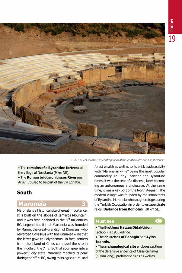
16. The ancient theatre (Hellenistic period) at the location of “Cabana”, Maroneia.
19
• The remains of a Byzantine fortress at the village of Nea Santa (9 km NE).• The Roman bridge on Lissos River near Arisvi: It used to be part of the Via Egnatia.
South
Maroneia 3Maroneia is a historical site of great importance. It is built on the slopes of Ismaros Mountain, and it was first inhabited in the 3rd millennium BC. Legend has it that Maroneia was founded by Maron, the great-grandson of Dionysus, who rewarded Odysseus with fine unmixed wine that the latter gave to Polyphemus. In fact, settlers from the island of Chios colonized the site in the middle of the 7th c. BC that soon grew into a powerful city-state. Maroneia reached its peak during the 4th c. BC, owing to its agricultural and
forest wealth as well as to its brisk trade activity with “Maroneian wine” being the most popular commodity. In Early Christian and Byzantine times, it was the seat of a diocese, later becom-ing an autonomous archdiocese. At the same time, it was a key port of the North Aegean. The modern village was founded by the inhabitants of Byzantine Maroneia who sought refuge during the Turkish Occupation in order to escape pirate raids. Distance from Komotini: 30 km SE.
Must see• The Brothers Hatzea Didaktirion (school), a 1908 edifice.• The churches of Panagia and Ayios Ioannis.• The archaeological site encloses sections of the defensive enceinte of Classical times (10 km long), prehistoric ruins as well as
16. The ancient theatre (Hellenistic period) at the location of “Cabana”, Maroneia.
ROD
OPI
monuments which date back to the Byzantine period (Hellenistic mansion, Roman propylon, ruins of Early-Christian churches and a monastery). Also worth visiting are the ancient theater (sitting capacity: 3,000 at the location of “Kambana”); the 4th c. BC sanctuary (dedicated possibly to Dionysus).• The Ayios Georgios acropolis, on an inaccessible peak of Ismaros mountain: Its walls were 1,330 m in overall length whereas the monumental gateway and the wine presses still stand in situ. The acropolis is identified with the Kikonian city of Ismara.• The magnificent “Cyclops’ Cave” (not visitable), situated between the villages of Maroneia and Proskynites. It is rich in stalactites and stalagmites and also the site of prehistoric finds. • The ruins of a Byzantine monastic complex (9th-13th cent. AD) at Synaxi (10 km E)
• The ancient quarries located near the beach of Marmaritsa.• The Folk Art Museum, in the village of Xylagani (12 km NW) housed in a restored watermill. • The ruins of ancient Ergani (15 km NW), a fortified acropolis dated to the Late Bronze and Early Iron Age (1200-900 BC). • The Lake Ismarida wetland and its rich avifauna that is protected by the Rasmar Convention.
Events• The folk custom of “Babo”, that is reenacted at the villages of Xylagani, Nea Petra, Proskynites, and Imeros on January 8: It is the day when men stay home and do all the women’s chores whereas women have a good time in taverns and cafés.
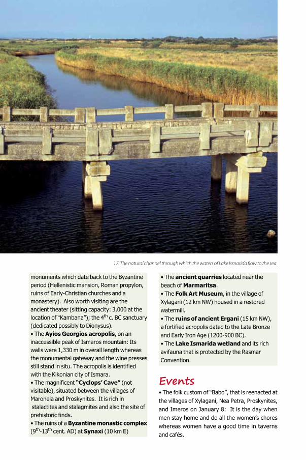
17. The natural channel through which the waters of Lake Ismarida flow to the sea.
ROD
OPI
21
Activities• The Wine Roads of Northern Greece: the Wine Route of Dionysus to the wineries of the area (info: Wine Producers Association of the Northern Greece Vineyard, HELEXPO Int’l Thess. Fair – 154 Egnatia Ave, Thessaloniki – tel: 2310 281.632, www.wineroads.gr). • Swimming at Platanitis, Imeros, Marmaritsa, Petrota, Alkyona, Profitis Elias, and Proskynites.
Useful phone numbers (+30)• Maroneia Municipality: 25330-22.210• Xylagani Police Station: 25330-22.203• Rural Health Centre (Xylagani): 25330-22.207• Folk Art Museum: 25330-22.388
Fanari 4It is a well-known fishing village that has turned into a seaside resort with solid tourism infrastruc-ture. Distance from Komotini: 31 km SW.
Must see• The ruins of ancient Dikaia located after the intersection of the Komotini-Xanthi highway. It was possibly a Samian colony and took its name from Dikaios, son of Poseidon. (Visit by prior arrangement with the 19th Ephorate of Prehistoric and Classical Antiquities, tel. 25310-22411)• Ancient Stryme, on the Molyvoti Peninsula. It was founded in the mid-seventh cent. BC by Thassian settlers that aimed to engage in the exploitation of the fertile inland plain. The aqueduct tunnels on the beach are significant examples of ancient Greek technology and engineering with gutters, wells and shafts for the water supply of the city. They are a miniature of the Eupalineion Tunnel at Samos. (Visit by prior arrangement with the 19th Ephorate of Prehistoric and Classical Antiquities, tel. 25310-22411)• The picturesque Pomak village of Arogi, 3 km E.• The Lake Vistonida wetland that hosts considerable biodiversity and endemism.
The area is protected by the Ramsar Convention. Nearby are located the smaller lakes Elos, Alyki, Karatza and Xirolimni.
Activities• Swimming at the village’s sandy stretch of beach at Arogi, Mesi, and Glyfada.
Useful phone numbers (+30)• Municipality of Komotini: 25313-52.400
Ayios Charalambos 5
It is a small coastal village, near modern Maron-eia. In the summer, it receives a steady flow of tourists. Worth visiting are the Hellenistic house with the impressive mosaic and the Roman pro-pylon that are part of Maroneia’s archaeological site. Distance from Komotini: 35 km SE.
Useful phone numbers (+30)• Maroneia Municipality: 25330-22210•Rural Health Centre (at Maroneia): 25330-41259
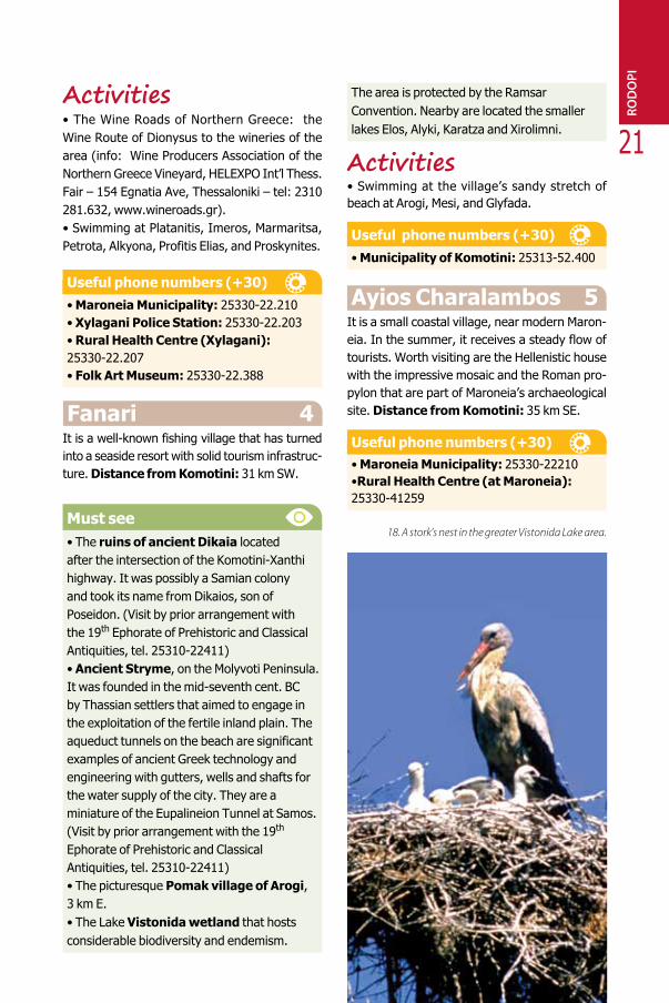
18. A stork’s nest in the greater Vistonida Lake area.
EVROS District
andscapes where nature has excelled itself in beauty such as the Evros River Delta and the Dadia Forest, sites of great archaeological significance, Byzantine monuments and churches, a remarkable tourism infrastructure, and a rich cultural heritage, compose a captivating picture of
Greece’s northeastern part. The district of Evros borders on Bulgaria to the N-NW; on the E it is divided from Turkey by Evros River; on the W it borders on the district of Rodopi; to the S the district of Evros bounds the Thracian Sea. Archaeological finds in the district bear witness to the fact that it was first inhabited in prehistoric times. Evros region rose to prominence during Classical and Hellenistic times. The Romans built urban centres and modernised its road network. Due to its proximity to Constantinople the area reached its peak during Byzantine era which explains the presence of a plethora of monuments. During the Turk-ish occupation, noteworthy buildings were also erected. Cities within the confines of the district, such as Soufli and Didimotiho, flourished from the 18th cent. onwards.
19. Lush vegetation along the Evros riverside.
L
EVRO
S
23
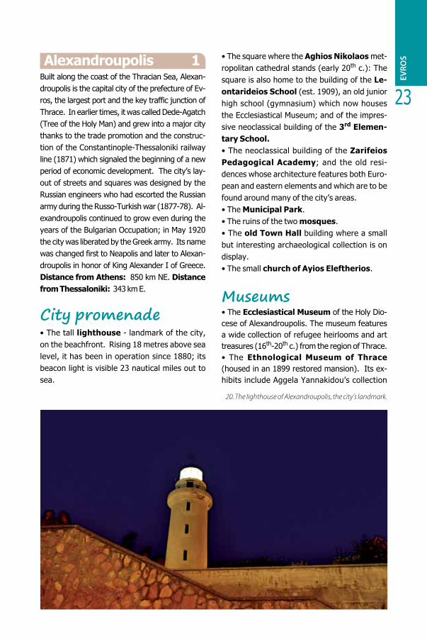
Alexandroupolis 1Built along the coast of the Thracian Sea, Alexan-droupolis is the capital city of the prefecture of Ev-ros, the largest port and the key traffic junction of Thrace. In earlier times, it was called Dede-Agatch (Tree of the Holy Man) and grew into a major city thanks to the trade promotion and the construc-tion of the Constantinople-Thessaloniki railway line (1871) which signaled the beginning of a new period of economic development. The city’s lay-out of streets and squares was designed by the Russian engineers who had escorted the Russian army during the Russo-Turkish war (1877-78). Al-exandroupolis continued to grow even during the years of the Bulgarian Occupation; in May 1920 the city was liberated by the Greek army. Its name was changed first to Neapolis and later to Alexan-droupolis in honor of King Alexander I of Greece. Distance from Athens: 850 km NE. Distance from Thessaloniki: 343 km E. City promenade• The tall lighthouse - landmark of the city, on the beachfront. Rising 18 metres above sea level, it has been in operation since 1880; its beacon light is visible 23 nautical miles out to sea.
• The square where the Aghios Nikolaos met-ropolitan cathedral stands (early 20th c.): The square is also home to the building of the Le-ontarideios School (est. 1909), an old junior high school (gymnasium) which now houses the Ecclesiastical Museum; and of the impres-sive neoclassical building of the 3rd Elemen-tary School.• The neoclassical building of the Zarifeios Pedagogical Academy; and the old resi-dences whose architecture features both Euro-pean and eastern elements and which are to be found around many of the city’s areas.• The Municipal Park.• The ruins of the two mosques.• The old Town Hall building where a small but interesting archaeological collection is on display.• The small church of Ayios Eleftherios.
Museums• The Ecclesiastical Museum of the Holy Dio-cese of Alexandroupolis. The museum features a wide collection of refugee heirlooms and art treasures (16th-20th c.) from the region of Thrace. • The Ethnological Museum of Thrace (housed in an 1899 restored mansion). Its ex-hibits include Aggela Yannakidou’s collection
20. The lighthouse of Alexandroupolis, the city’s landmark.
made up of fascinating artifacts that range from the 17th to the 20th cent. • The Historic-Folklore Museum. It was founded by the Society of the Friends of Archae-ology and it hosts art and photography exhibi-tions. • The Flora and Fauna Museum, housed at the “Georgios Vizyinos” Art and Culture Centre. All its exhibits come from the Evros River Delta. • The Alexandroupolis Museum of Natural History (area: Platanotopos) where, in 4 halls the museum presents the prefecture’s eco-sys-
tems and human activities in the area’s urban and rural settings.
Nearby trips• Avantas, 11 km N. A village of remarkable natu-ral beauty, Avantas is built in an area covered by dense forests. Worth visiting is the Ayios Athana-sios church that lies close to the village as well as the medieval castle (2 km SW).• Kirki, 14 km NW. Atop of the hill of this mountain village, a prehistoric, open-air shrine of the ancient Thracians has been discovered.
BULG A RIA
TURKEY
ALEXANDROUPOLIS
SAMOTH
RAKI
ROD OPI
!
!
!
!
!
!
!
!P
!
!P
!
!
!
!
!
!
!
!
!
!
!P
!
!
!
!
!
!
!
!
!P
!
!
!
!
!
!
"T
!!
!P
!
!
!
! !
!
!P
!
!
! !P
!P
!P!
!
!
!
!P
!
!
!P
!
!P
! !
!P
!
!!P
!
!
!
!
!
"T!
!
!
ALEXANDROUPOLIS
ORESTIADA
Soufli
Lavara
Didimotiho
Lagos
Kastanies
Kiprinos
Rizia Nea Vissa
Neohori
FeresLoutros
Peplos
Tihero
Kavili
Dadia
Ampelakia
Aristino
Filakto
Anthia
Avas
Lefkimmi
Provatonas
Lagina
Kipi
Goniko
Doriskos
KavisosArdani
Makri
Kirki
Petrades
Agriani
Nei Psathades
Sofiko
Mesembria
Likofos
Kornofolea
Protokklisi
Metaxades
PaliouriAsproneri
Elafohori
Kiani
Mani
Amorio
Karoti
Koufovouno
Ellinohori
Thourio
Asimenio
IsaakioPithio
Nipsa
Mega Derio
RoussaSidiro
Neos PirgosLepti
Mikri Doxipara
Doxa
Neo Himonio
Filaki
PimenikoSitohori
Petrota
Pentalofos
Ormenio
PteleaDikaia
Spileo
Komara EleaPlati
SternaValtos
Megali Doxipara
Ag. Paraske
vi
Ai Giorgi
Delfini
Dikello
n
Kiani A
kti
Mesembria
Skorpios
N. Hili
0 10 205
N[
km

25
Events• “Eleftheria”, festivities celebrating the city’s libera-tion from the Turks: every May.
Activities• 4x4 off-road driving along a scenic riverside byway that leads from Avantas to Kirki (17 km) through dense forests.• Swimming at the organized G.N.T.O. (EOT) beach and at the beaches along the coastline to Makri. • Fishing. • Water sports.
Useful phone numbers (+30)
• Municipality of Alexandroupolis: 25510-64.100• Police Station: 25510-66.108• Tourist Police: 25510-66.200• Traffic Police: 25510-66.395• General Hospital: 25510-74.000• Port Authority: 25510-26.468• “Democritos” Airport: 25510-89.300• Long-Distance Bus Service (KTEL): 25510-26.479
• OSE Train Station: 2510-26.395• Taxis: 25510-22.000• Ecclesiastical Museum of theAlexandroupolis Holy Diocese: 25510-82.282• Ethnological Museum of Thrace: 25510-36.663• History-Folklore Museum: 25510-28.926• Flora and Fauna Museum: 25510-26.200 • Alexandroupolis Museum of Natural History: 25510-80.204
Prefecture of Evros website: www.visitevros.gr Municipality of Alexandroupolis website: www.alexpolis.gr
22. Traditional Thracian silver-wrought piece of jewellery.
EVRO
S
21. The small harbour of Alexandroupolis.
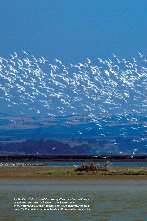
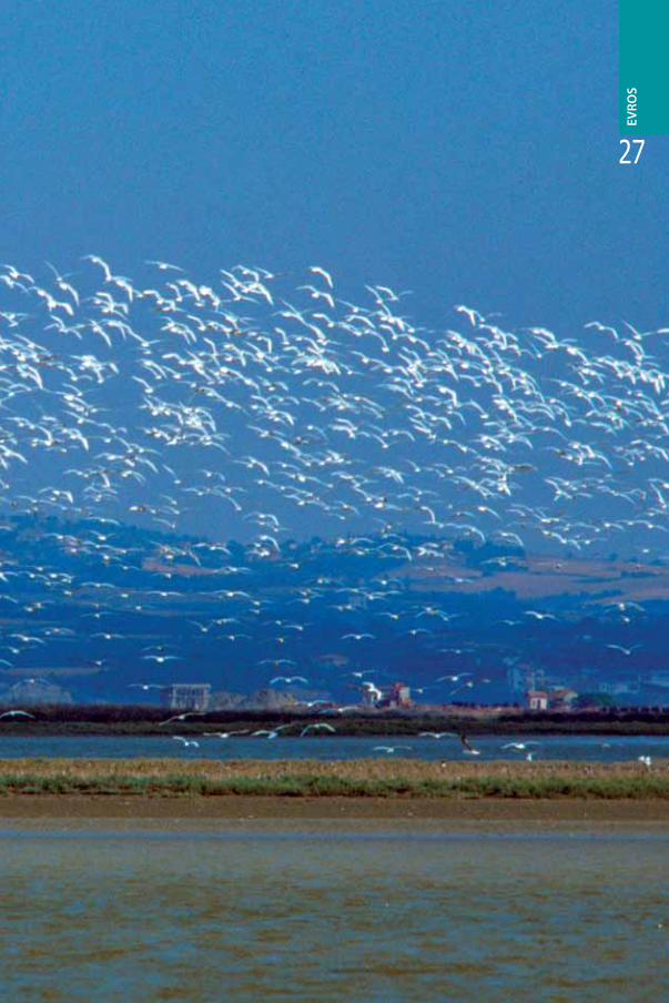
23. The Evros Delta is one of the most significant wetlands of Europe, covering an area of 9,500 hectares. It has been included in the Natura 2000 Network and has been listed as a protected areaunder the Ramsar International Treaty, as the habitat of rare species.
EVRO
S
27
Trips aroundEvros District South
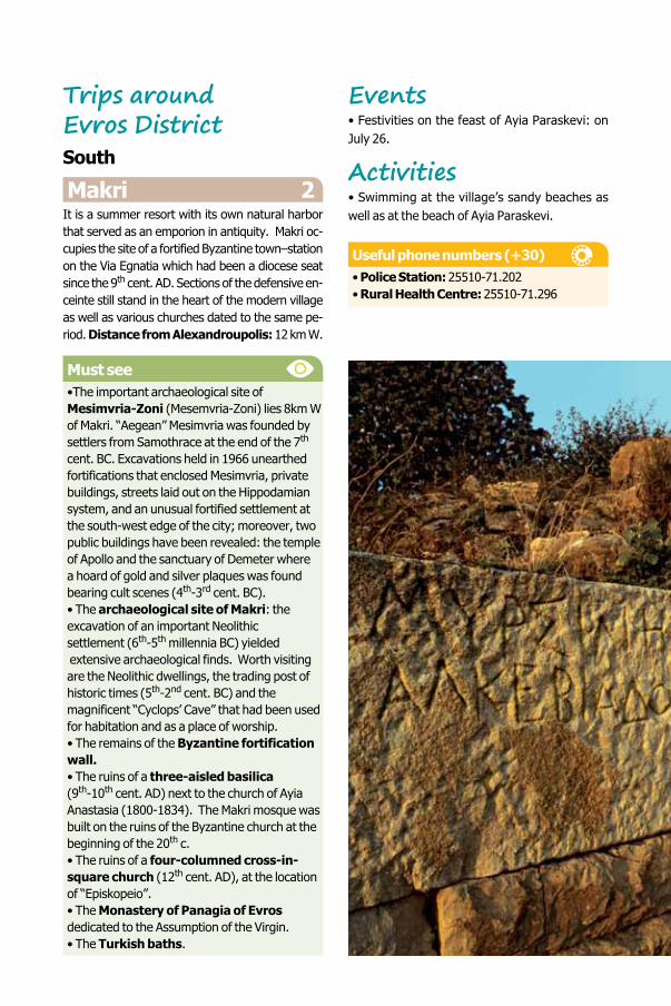
Makri 2It is a summer resort with its own natural harbor that served as an emporion in antiquity. Makri oc-cupies the site of a fortified Byzantine town–station on the Via Egnatia which had been a diocese seat since the 9th cent. AD. Sections of the defensive en-ceinte still stand in the heart of the modern village as well as various churches dated to the same pe-riod. Distance from Alexandroupolis: 12 km W. Must see•The important archaeological site of Mesimvria-Zoni (Mesemvria-Zoni) lies 8km W of Makri. “Aegean” Mesimvria was founded by settlers from Samothrace at the end of the 7th cent. BC. Excavations held in 1966 unearthed fortifications that enclosed Mesimvria, private buildings, streets laid out on the Hippodamian system, and an unusual fortified settlement at the south-west edge of the city; moreover, two public buildings have been revealed: the temple of Apollo and the sanctuary of Demeter where a hoard of gold and silver plaques was found bearing cult scenes (4th-3rd cent. BC).• The archaeological site of Makri: the excavation of an important Neolithic settlement (6th-5th millennia BC) yielded extensive archaeological finds. Worth visiting are the Neolithic dwellings, the trading post of historic times (5th-2nd cent. BC) and themagnificent “Cyclops’ Cave” that had been used for habitation and as a place of worship. • The remains of the Byzantine fortification wall.• The ruins of a three-aisled basilica (9th-10th cent. AD) next to the church of Ayia Anastasia (1800-1834). The Makri mosque was built on the ruins of the Byzantine church at the beginning of the 20th c.• The ruins of a four-columned cross-in-square church (12th cent. AD), at the location of “Episkopeio”.• The Monastery of Panagia of Evros dedicated to the Assumption of the Virgin.• The Turkish baths.
Events• Festivities on the feast of Ayia Paraskevi: on July 26.
Activities• Swimming at the village’s sandy beaches as well as at the beach of Ayia Paraskevi.
Useful phone numbers (+30)• Police Station: 25510-71.202• Rural Health Centre: 25510-71.296
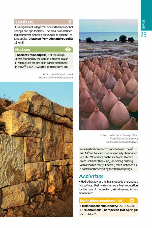
24. Section of the western wall, Mesimvria-Zoni archeological site.
29
Loutros 3It is a significant village that boasts therapeutic hot springs and spa facilities. The area is of archaeo-logical interest since it is quite close to ancient Tra-ianoupolis. Distance from Alexandroupolis: 15 km E.
Must see• Ancient Traianoupolis, E of the village. It was founded by the Roman Emperor Trajan (Traianus) on the site of an earlier settlement in the 2nd c. AD. It was the administrative and
ecclesiastical centre of Thrace between the 4th and 14th centuries but was eventually abandoned in 1347. What is left on the site from Ottoman times is “Hana” (han=inn), an oblong building with a vaulted roof (14th cent.) that functioned as a hostel for those visiting the thermal springs.
Activities• Hydrotherapy at the Traianoupolis therapeutic hot springs; their waters enjoy a high reputation for the cure of rheumatism, skin diseases, kidney ailments etc.
Useful phone numbers (+30)• Traianoupolis Municipality: 25513-50.900• Traianoupolis Therapeutic Hot Springs: 25510-61.225
24. Section of the western wall, Mesimvria-Zoni archeological site.
EVRO
S
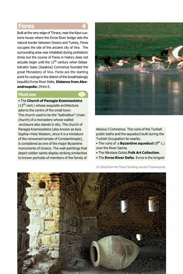
25. Mesimvria-Zoni archeological site. House floor insulation using
amphorae placed upside down.
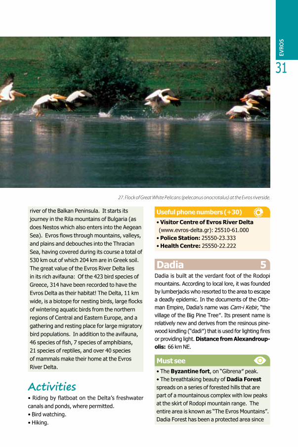
Feres 4Built at the very edge of Thrace, near the Kipoi cus-toms house where the Evros River bridge sets the natural border between Greece and Turkey, Feres occupies the site of the ancient city of Vira. The surrounding area was inhabited during prehistoric times but the course of Feres in history does not actually begin until the 12th century when Sebas-tokrator Isaac (Isaakios) Comnenus founded the great Monastery of Vira. Feres are the starting point for outings in the district of the breathtakingly beautiful Evros River Delta. Distance from Alex-androupolis: 29 km E. Must see• The Church of Panagia Kosmosoteira (12th cent.) whose exquisite architecture adorns the centre of the small town. The church used to be the “katholikon” (main church) of a monastery whose walled enclosure also stands in situ. The church of Panagia Kosmosoteira (also known as Ayia Sophia=Holy Wisdom, since it is a miniature of the renowned temple of Constantinople), is considered as one of the major Byzantine monuments of Greece. The wall-paintings that depict soldier saints display striking similarities to known portraits of members of the family of
Alexius I Comnenus. The ruins of the Turkish public baths and the aqueduct built during the Turkish Occupation lie nearby.• The ruins of a Byzantine aqueduct (8th c.) over the River Samia.• The Nikolaos Gotsis Folk Art Collection.• The Evros River Delta. Evros is the longest
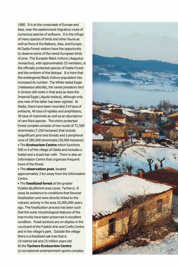
27. Flock of Great White Pelicans (pelecanus onocrotalus) at the Evros riverside.
26. Detail from the “Hana” building, ancient Traianoupolis.
31
river of the Balkan Peninsula. It starts its journey in the Rila mountains of Bulgaria (as does Nestos which also enters into the Aegean Sea). Evros flows through mountains, valleys, and plains and debouches into the Thracian Sea, having covered during its course a total of 530 km out of which 204 km are in Greek soil. The great value of the Evros River Delta lies in its rich avifauna: Of the 423 bird species of Greece, 314 have been recorded to have the Evros Delta as their habitat! The Delta, 11 km wide, is a biotope for nesting birds, large flocks of wintering aquatic birds from the northern regions of Central and Eastern Europe, and a gathering and resting place for large migratory bird populations. In addition to the avifauna, 46 species of fish, 7 species of amphibians,21 species of reptiles, and over 40 species of mammals make their home at the Evros River Delta.
Activities• Riding by flatboat on the Delta’s freshwater canals and ponds, where permitted.• Bird watching. • Hiking.
Useful phone numbers (+30)• Visitor Centre of Evros River Delta (www.evros-delta.gr): 25510-61.000• Police Station: 25550-23.333• Health Centre: 25550-22.222
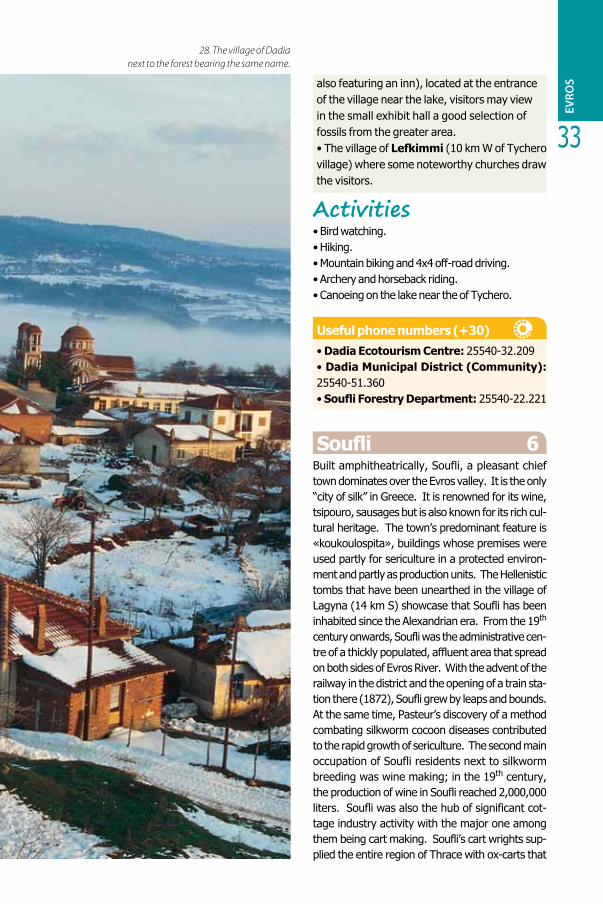
Dadia 5Dadia is built at the verdant foot of the Rodopi mountains. According to local lore, it was founded by lumberjacks who resorted to the area to escape a deadly epidemic. In the documents of the Otto-man Empire, Dadia’s name was Cam-i Kebir, “the village of the Big Pine Treeʺ. Its present name is relatively new and derives from the resinous pine-wood kindling (“dadiʺ) that is used for lighting fires or providing light. Distance from Alexandroup-olis: 66 km NE.
Must see• The Byzantine fort, on “Gibrenaʺ peak.• The breathtaking beauty of Dadia Forest spreads on a series of forested hills that are part of a mountainous complex with low peaks at the skirt of Rodopi mountain range. The entire area is known as “The Evros Mountains”. Dadia Forest has been a protected area since
27. Flock of Great White Pelicans (pelecanus onocrotalus) at the Evros riverside.
EVRO
S
1980. It is at the crossroads of Europe and Asia, near the easternmost migratory route of numerous species of avifauna. It is the refuge of many species of birds and other fauna as well as flora of the Balkans, Asia, and Europe. At Dadia Forest visitors have the opportunity to observe some of the rarest European birds of prey. The Eurasian Black Vulture (Aegypius monachus), with approximately 25 members, is the officially protected species of Dadia Forest and the emblem of the biotope. It is here that the endangered Black Vulture population has increased its number. The White-tailed Eagle (Haliaeetus albicilla), the rarest predatory bird in Greece still nests in that area as does the Imperial Eagle (Aquila heliaca), although only one nest of the latter has been sighted. At Dadia, there have been recorded 219 taxa of avifauna, 40 taxa of reptiles and amphibians, 36 taxa of mammals as well as an abundance of rare flora species. The entire protected forest complex consists of two nuclei of 72,500 stremmata (7,250 hectares) that include magnificent pine tree forests and a peripheral zone of 280,000 stremmata (28,000 hectares) • The Ecotourism Centre which functions 500 m S of the village of Dadia and includes a hostel and a snack bar-café. There is also an Information Centre that organizes frequent tours of the forest. • The observation post, located approximately 3 km away from the Information Centre.• The fossilized forest at the greater Fylakto &Lefkimmi area (area: Tychero). It owes its existence to conditions that favored fossilization and were directly linked to the volcanic activity in the area 25,000,000 years ago. The fossilization process has been such that the outer morphological features of the tree trunks have been preserved in excellent condition. Fossil sections are on display in the courtyard of the Fylakto Arts and Crafts Centre and in the village’s park. Outside the village there is a fossilized oak tree that is19 metres tall and 25 million years old. At the Tychero Ecotourism Centre(a recreational-entertainment-sports complex
EVRO
S
33
also featuring an inn), located at the entrance of the village near the lake, visitors may view in the small exhibit hall a good selection of fossils from the greater area.• The village of Lefkimmi (10 km W of Tychero village) where some noteworthy churches draw the visitors.
Activities• Bird watching. • Hiking. • Mountain biking and 4x4 off-road driving. • Archery and horseback riding.• Canoeing on the lake near the of Tychero.
Useful phone numbers (+30)• Dadia Ecotourism Centre: 25540-32.209• Dadia Municipal District (Community): 25540-51.360• Soufli Forestry Department: 25540-22.221
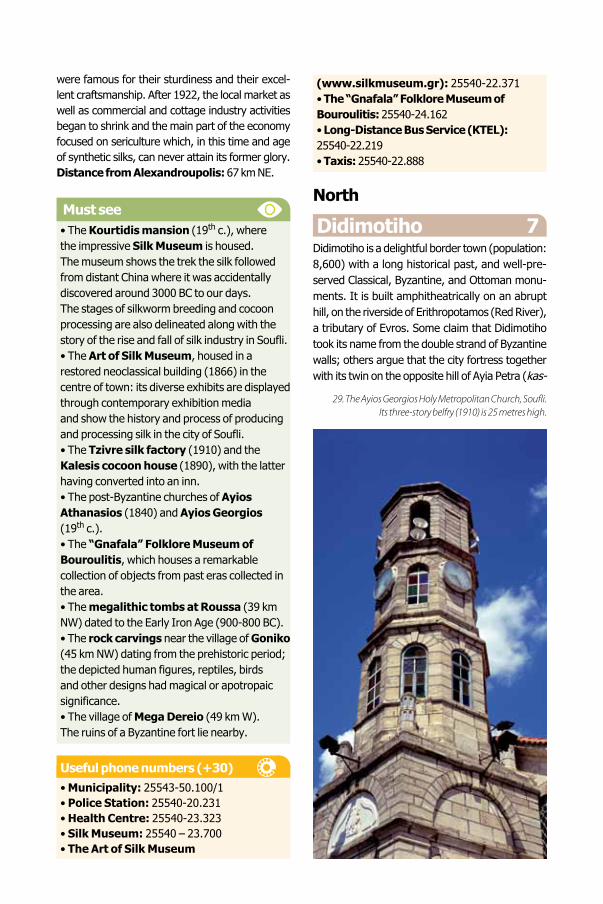
Soufli 6Built amphitheatrically, Soufli, a pleasant chief town dominates over the Evros valley. It is the only “city of silk” in Greece. It is renowned for its wine, tsipouro, sausages but is also known for its rich cul-tural heritage. The town’s predominant feature is «koukoulospita», buildings whose premises were used partly for sericulture in a protected environ-ment and partly as production units. The Hellenistic tombs that have been unearthed in the village of Lagyna (14 km S) showcase that Soufli has been inhabited since the Alexandrian era. From the 19th century onwards, Soufli was the administrative cen-tre of a thickly populated, affluent area that spread on both sides of Evros River. With the advent of the railway in the district and the opening of a train sta-tion there (1872), Soufli grew by leaps and bounds. At the same time, Pasteur’s discovery of a method combating silkworm cocoon diseases contributed to the rapid growth of sericulture. The second main occupation of Soufli residents next to silkworm breeding was wine making; in the 19th century, the production of wine in Soufli reached 2,000,000 liters. Soufli was also the hub of significant cot-tage industry activity with the major one among them being cart making. Soufli’s cart wrights sup-plied the entire region of Thrace with ox-carts that
28. The village of Dadia next to the forest bearing the same name.
were famous for their sturdiness and their excel-lent craftsmanship. After 1922, the local market as well as commercial and cottage industry activities began to shrink and the main part of the economy focused on sericulture which, in this time and age of synthetic silks, can never attain its former glory. Distance from Alexandroupolis: 67 km NE.
Must see• The Kourtidis mansion (19th c.), where the impressive Silk Museum is housed.The museum shows the trek the silk followed from distant China where it was accidentally discovered around 3000 BC to our days.The stages of silkworm breeding and cocoon processing are also delineated along with the story of the rise and fall of silk industry in Soufli.• The Art of Silk Museum, housed in a restored neoclassical building (1866) in the centre of town: its diverse exhibits are displayed through contemporary exhibition mediaand show the history and process of producing and processing silk in the city of Soufli.• The Tzivre silk factory (1910) and the Kalesis cocoon house (1890), with the latter having converted into an inn.• The post-Byzantine churches of Ayios Athanasios (1840) and Ayios Georgios(19th c.). • The “Gnafala” Folklore Museum of Bouroulitis, which houses a remarkable collection of objects from past eras collected in the area.• The megalithic tombs at Roussa (39 km NW) dated to the Early Iron Age (900-800 BC).• The rock carvings near the village of Goniko (45 km NW) dating from the prehistoric period; the depicted human figures, reptiles, birds and other designs had magical or apotropaic significance.• The village of Mega Dereio (49 km W).The ruins of a Byzantine fort lie nearby.
Useful phone numbers (+30)• Municipality: 25543-50.100/1• Police Station: 25540-20.231• Health Centre: 25540-23.323• Silk Museum: 25540 – 23.700• The Art of Silk Museum
(www.silkmuseum.gr): 25540-22.371• The “Gnafala” Folklore Museum ofBouroulitis: 25540-24.162• Long-Distance Bus Service (KTEL): 25540-22.219• Taxis: 25540-22.888
North
Didimotiho 7 Didimotiho is a delightful border town (population: 8,600) with a long historical past, and well-pre-served Classical, Byzantine, and Ottoman monu-ments. It is built amphitheatrically on an abrupt hill, on the riverside of Erithropotamos (Red River), a tributary of Evros. Some claim that Didimotiho took its name from the double strand of Byzantine walls; others argue that the city fortress together with its twin on the opposite hill of Ayia Petra (kas-
29. The Ayios Georgios Holy Metropolitan Church, Soufli. Its three-story belfry (1910) is 25 metres high.

35
tro didymariko) gave their name to Didimotiho. In Byzantine times, the town then named De-motika became the seat of the empire in 1325 during the reign of Emperor Andronicus III Paleologus. After Thrace was captured by the Ottoman Turks, it became the Turkish capital for a short time. It was then that its churches (more than 100 in the area) were turned into mosques. During the years of Turkish rule, the organized guilds founded by craftsmen engaged in vari-ous trades contributed to the city’s prosperity. Didimotiho was also occupied by the Russians during the Russo-Turkish War and later by the Bulgarians. It was liberated in 1920 according to the Treaty of Neuilly after five and a half cen-turies of Turkish occupation. Distance from Alexandroupolis: 98 km NE.
Must see• The walls that surround “Pano Poli”(Upper City).• The fort (“Kales”) and the Byzantine monuments located in the archaeological site. Other interesting sights are the ruins of buildings and their basements that were carved into the rock, the church of Ayia Ekaterini and its tombs,
30. The listed building of the railway station at Tychero.
31. The impressive Brika Mansion (1890), at Soufli,which has been converted into a Folk Art and History Museum.
EVRO
S
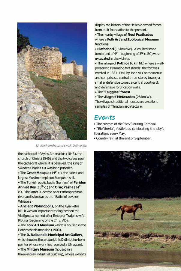
the cathedral of Ayios Athanasios (1843), the church of Christ (1846) and the two caves near the cathedral where, it is believed, the king of Sweden Charles XII was held prisoner.• The Great Mosque (14th c.), the oldest and largest Muslim temple on European soil.• The Turkish public baths (hamam) of Feridun Ahmet Bey (16th c.) and Oruç Pasha (14th c.). The latter is located near Erithropotamos river and is known as the “Baths of Love or Whispers». • Ancient Plotinopolis, on the Ayia Petra hill. It was an important trading post on the Via Egnatia named after Emperor Trajan’s wife Plotina (beginning of the 2nd c. AD). • The Folk Art Museum which is housed in the Hatzirbasanis mansion (1900). • The D. Nalbandis Municipal Art Gallery, which houses the artwork this Didimotiho-born painter whose work has received a UN award. • The Military Museum (housed in athree-storey industrial building), whose exhibits
display the history of the Hellenic armed forces from their foundation to the present. • The nearby village of Neoi Psathades where a Folk Art and Zoological Museum functions.• Elafochori (16 km NW). A vaulted stone tomb (end of 4th - beginning of 3rd c. BC) was excavated in the vicinity.• The village of Pythio (16 km NE) where a well-preserved Byzantine fort stands: the fort was erected in 1331-1341 by John VI Cantacuzenus and comprises a central three-storey tower; a smaller defensive tower; a central courtyard; and defensive fortification walls. • The “Tsigglas” forest.• The village of Metaxades (28 km W).The village’s traditional houses are excellent samples of Thracian architecture.
Events• The custom of the “Bey”, during Carnival.• “Eleftheria”, festivities celebrating the city’s liberation: every May.• Country fair, at the end of September.
33. Erithropotamos riverside.32. View from the castle’s walls, Didimotiho.

37
Useful phone numbers (+30)• Municipality of Didimotiho: 25533-50.602• Police Station: 25530-22.238• Hospital: 25533-50.100• Taxis: 25530-23.000• Long-Distance Bus Service (KTEL): 25530-22.366• OSE Train Station: 25530-22.263• Folk Art Museum: 25530-22.316• N. Nalbandis Municipal Art Gallery: 25530-23.658• Military Museum: 25530-26.518
Orestiada 8It is the second largest city of Evros district (15,500) after Alexandroupolis. Orestiada is also the cultural, administrative, and commercial centre of Northern Evros district. It was founded in 1923 by refugees from Adrianople and Karaagac after the Treaty of Lausanne was implemented. Distance from Al-exandroupolis: 115 km NE.
33. Erithropotamos riverside.
34. Didimotiho. The Grand Mosque (1420). Part of the city is visible in the background.
EVRO
S
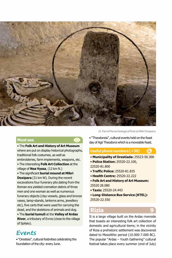
Must see• The Folk Art and History of Art Museum where are put on display historical photographs, traditional folk costumes, as well as embroideries, farm implements, weapons, etc.• The interesting Folk Art Collection at the village of Nea Vyssa, (12 km N.)• The significant burial mound at Mikri Doxipara (31 km W). During the recent excavations four funerary pits dating from the Roman era yielded cremation debris of three men and one woman as well as numerous funerary objects (clay vessels, glass and bronze vases, lamp-stands, lanterns arms, jewellery etc), five carts that were used for carrying the dead, and the skeletons of animals and dog.• The burial tumuli at the Valley of Ardas River, a tributary of Evros (close to the village of Spilaio).
Events• “Oresteia”, cultural festivities celebrating the foundation of the city: every June.
• “Theodoreia”, cultural events held on the feast day of Agii Theodoroi which is a moveable feast.
Useful phone numbers (+30)
• Municipality of Orestiada: 25523-50.300• Police Station: 25520-22.100, 22520-81.800• Traffic Police: 25520-81.835• Health Centre: 25520-22.222• Folk Art and History of Art Museum: 25520 28.080• Taxis: 25520-24.443• Long-Distance Bus Service (KTEL): 25520-22.550
Rizia 9It is a large village built on the Ardas riverside that boasts an interesting folk art collection of domestic and agricultural items; in the vicinity of Rizia a prehistoric settlement was discovered dated to Mesolithic period (10.000-7.000 BC). The popular “Ardas – Youth Gathering” cultural festival takes place every summer (end of July)
35. Part of the archeological finds at Mikri Doxipara.
39
in the village of Kastanies which is situated at the confluence of Evros and Ardas (www.ardas.gr). Distance from Alexandroupolis: 140 km NE.
Dikaia 10The commercial hub of the area, Dikaia is built on the border of Greece with Bulgaria. It is the starting point for outings to the villages of Or-menio, Pentalofo, and Petrota in the area known as “the Evros Triangle”: Houses, cisterns, and water wells in all three villages are masterpieces of stone masonry. Distance from Alexan-droupolis: 162 km NE.
Must see• The village’s railway station.• The ruins of the Byzantine fort near the
village of Komara.• The mill at Petrota (14 km W) built in 1933; presently, after it has been renovated, the building complex of the mill houses the Museum of Prewar Agricultural Technology and is also used as a conference hall.• The Folk Art Collection at Pentalofo (24 km SW).
Events• The winemakers’ celebration on February 1st, on the feast day of Ayios Tryfon.
Useful phone numbers (+30)• Municipality of Orestiada: 25523-50.300• Police Station: 25560-31.222• Rural Health Centre: 25560-31.611
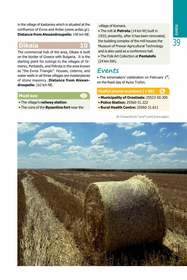
36. Characteristic “rural” scene, Evros region.
EVRO
S
SAMOTHRACE (SAMOTHRAKI)
n antiquity, Samothrace was called “the island of the Great Gods”. Renowned for the rituals that took place in honor of the Great Gods as well as for the famous statue of the goddess Nike, this northeastern island of the Aegean Sea does not simply awe with its forbidding aspect; it is also the
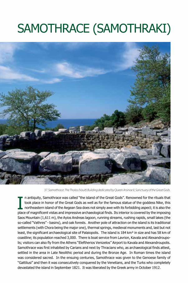
place of magnificent vistas and impressive archaeological finds. Its interior is covered by the imposing Saos Mountain (1,611 m), the Ayios Andreas lagoon, running streams, rushing rapids, small lakes (the so-called “Vathres” - basins), and oak forests. Another pole of attraction on the island is its traditional settlements (with Chora being the major one), thermal springs, medieval monuments and, last but not least, the significant archaeological site of Palaiopolis. The island is 184 km² in size and has 58 km of coastline; its population reached 3,000. There is boat service from Lavrion, Kavala and Alexandroupo-lis; visitors can also fly from the Athens “Eleftherios Venizelos” Airport to Kavala and Alexandroupolis. Samothrace was first inhabited by Carians and next by Thracians who, as archaeological finds attest, settled in the area in Late Neolithic period and during the Bronze Age. In Roman times the island was considered sacred. In the ensuing centuries, Samothrace was given to the Genoese family of “Gattilusi” and then it was consecutively conquered by the Venetians, and the Turks who completely devastated the island in September 1821. It was liberated by the Greek army in October 1912.
37. Samothrace: The Tholos (Vault) Building dedicated by Queen Arsinoe II, Sanctuary of the Great Gods.
I
SAM
OTH
RACE
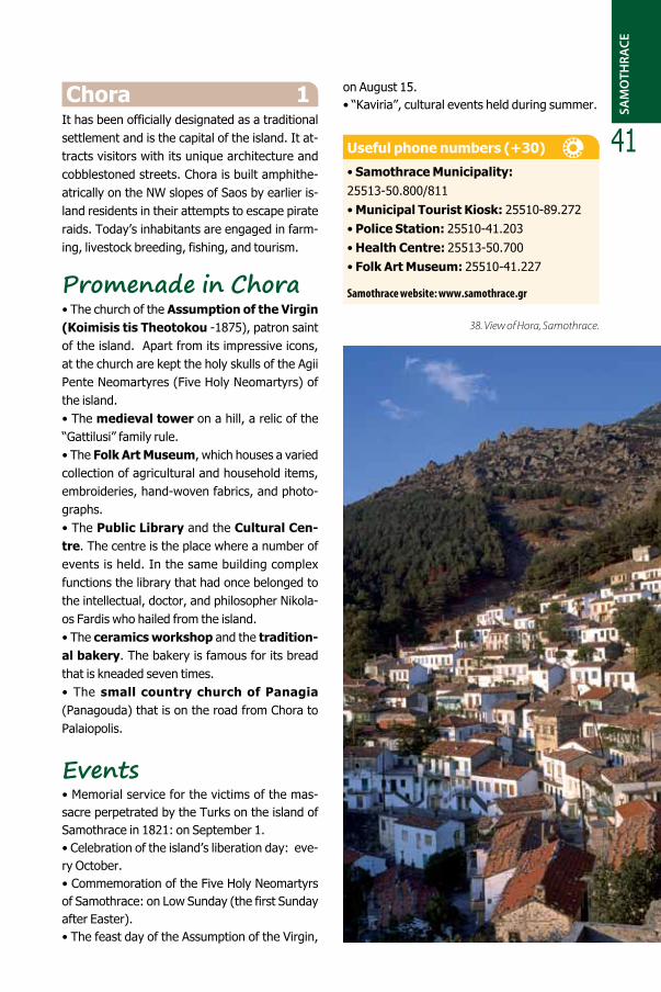
41Chora 1
It has been officially designated as a traditional settlement and is the capital of the island. It at-tracts visitors with its unique architecture and cobblestoned streets. Chora is built amphithe-atrically on the NW slopes of Saos by earlier is-land residents in their attempts to escape pirate raids. Today’s inhabitants are engaged in farm-ing, livestock breeding, fishing, and tourism.
Promenade in Chora• The church of the Assumption of the Virgin (Koimisis tis Theotokou -1875), patron saint of the island. Apart from its impressive icons, at the church are kept the holy skulls of the Agii Pente Neomartyres (Five Holy Neomartyrs) of the island.• The medieval tower on a hill, a relic of the “Gattilusi” family rule.• The Folk Art Museum, which houses a varied collection of agricultural and household items, embroideries, hand-woven fabrics, and photo-graphs.• The Public Library and the Cultural Cen-tre. The centre is the place where a number of events is held. In the same building complex functions the library that had once belonged to the intellectual, doctor, and philosopher Nikola-os Fardis who hailed from the island. • The ceramics workshop and the tradition-al bakery. The bakery is famous for its bread that is kneaded seven times.• The small country church of Panagia (Panagouda) that is on the road from Chora to Palaiopolis.
Events • Memorial service for the victims of the mas-sacre perpetrated by the Turks on the island of Samothrace in 1821: on September 1. • Celebration of the island’s liberation day: eve-ry October.• Commemoration of the Five Holy Neomartyrs of Samothrace: on Low Sunday (the first Sunday after Easter). • The feast day of the Assumption of the Virgin,
on August 15.• “Kaviria”, cultural events held during summer.
Useful phone numbers (+30)
• Samothrace Municipality: 25513-50.800/811• Municipal Tourist Kiosk: 25510-89.272• Police Station: 25510-41.203• Health Centre: 25513-50.700• Folk Art Museum: 25510-41.227
Samothrace website: www.samothrace.gr
38. View of Hora, Samothrace.
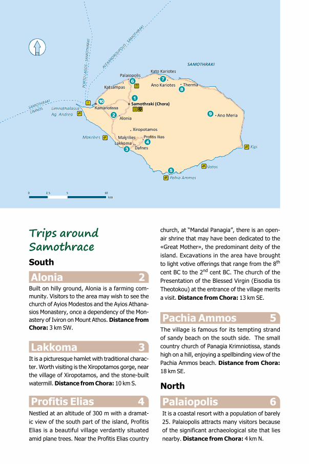
Trips aroundSamothraceSouth
Alonia 2Built on hilly ground, Alonia is a farming com-munity. Visitors to the area may wish to see the church of Ayios Modestos and the Ayios Athana-sios Monastery, once a dependency of the Mon-astery of Iviron on Mount Athos. Distance from Chora: 3 km SW.
Lakkoma 3It is a picturesque hamlet with traditional charac-ter. Worth visiting is the Xiropotamos gorge, near the village of Xiropotamos, and the stone-built watermill. Distance from Chora: 10 km S.
Profitis Elias 4Nestled at an altitude of 300 m with a dramat-ic view of the south part of the island, Profitis Elias is a beautiful village verdantly situated amid plane trees. Near the Profitis Elias country
church, at “Mandal Panagia”, there is an open-air shrine that may have been dedicated to the «Great Mother», the predominant deity of the island. Excavations in the area have brought to light votive offerings that range from the 8th cent BC to the 2nd cent BC. The church of the Presentation of the Blessed Virgin (Eisodia tis Theotokou) at the entrance of the village merits a visit. Distance from Chora: 13 km SE.
Pachia Ammos 5
The village is famous for its tempting strand of sandy beach on the south side. The small country church of Panagia Krimniotissa, stands high on a hill, enjoying a spellbinding view of the Pachia Ammos beach. Distance from Chora: 18 km SE.
North
Palaiopolis 6It is a coastal resort with a population of barely 25. Palaiopolis attracts many visitors because of the significant archaeological site that lies nearby. Distance from Chora: 4 km N.
ALEXANDROUPOLIS
- SAM
OTHRAKI
PORT
O L
AGO
S - S
AMO
THRA
KI
SAMOTHRAKI
LIMNOS!P
! !
!
!
!
!!
!!
!
!
!P
!
Samothraki (Chora)Kamariotissa
Makrilies Profitis Ilias
Katsampas Ano Kariotes Therma
Kato KariotesPalaiopolis
DafnesLakkoma
Xiropotamos
Alonia Ano Meria
Kipi
Pahia Ammos
Makrilies
LimnothalassaAg. Andrea
Vatos
SAMOTHRAKI
0 5 102.5
N[
km
43
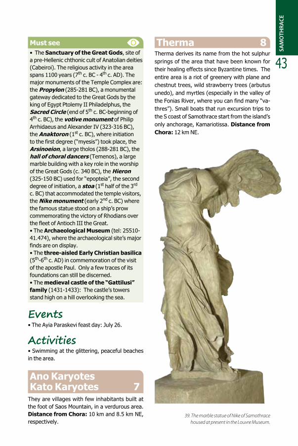
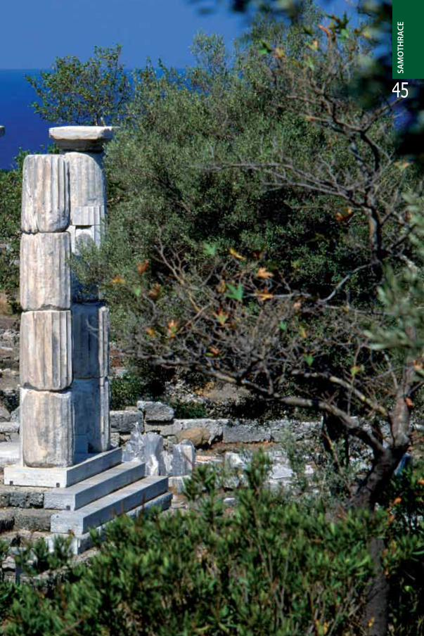
Must see• The Sanctuary of the Great Gods, site of a pre-Hellenic chthonic cult of Anatolian deities (Cabeiroi). The religious activity in the area spans 1100 years (7th c. BC - 4th c. AD). The major monuments of the Temple Complex are: the Propylon (285-281 BC), a monumental gateway dedicated to the Great Gods by the king of Egypt Ptolemy II Philadelphus, the Sacred Circle (end of 5th c. BC-beginning of 4th c. BC), the votive monument of Philip Arrhidaeus and Alexander IV (323-316 BC), the Anaktoron (1st c. BC), where initiation to the first degree (“myesis”) took place, the Arsinoeion, a large tholos (288-281 BC), the hall of choral dancers (Temenos), a large marble building with a key role in the worship of the Great Gods (c. 340 BC), the Hieron (325-150 BC) used for “epopteia”, the second degree of initiation, a stoa (1st half of the 3rd c. BC) that accommodated the temple visitors, the Nike monument (early 2nd c. BC) where the famous statue stood on a ship’s prow commemorating the victory of Rhodians over the fleet of Antioch III the Great.• The Archaeological Museum (tel: 25510-41.474), where the archaeological site’s major finds are on display. • The three-aisled Early Christian basilica (5th-6th c. AD) in commemoration of the visit of the apostle Paul. Only a few traces of its foundations can still be discerned. • The medieval castle of the “Gattilusi” family (1431-1433): The castle’s towers stand high on a hill overlooking the sea.
Events • The Ayia Paraskevi feast day: July 26.
Activities• Swimming at the glittering, peaceful beaches in the area.
Ano Karyotes Kato Karyotes 7
They are villages with few inhabitants built at the foot of Saos Mountain, in a verdurous area. Distance from Chora: 10 km and 8.5 km NE, respectively.
Therma 8Therma derives its name from the hot sulphur springs of the area that have been known for their healing effects since Byzantine times. The entire area is a riot of greenery with plane and chestnut trees, wild strawberry trees (arbutus unedo), and myrtles (especially in the valley of the Fonias River, where you can find many “va-thres”). Small boats that run excursion trips to the S coast of Samothrace start from the island’s only anchorage, Kamariotissa. Distance from Chora: 12 km NE.
SAM
OTH
RACE
39. The marble statue of Nike of Samothracehoused at present in the Louvre Museum.
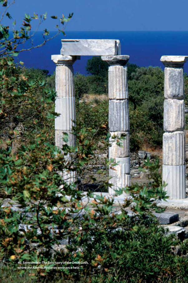
40. Samothrace: The Sanctuary of the Great Gods,where the Kaviria Mysteries were once held.
SAM
OTH
RACE
45

Must see• “Gria Vathra” (Old Lady’s Basin). It is a beautiful location with an abundance of mountain spring waters and lush vegetation.•The archaeological site on a low hill, at “Keramidariaʺ.• The Monastery of the Transfiguration of the Savior (Metamorfosis tou Sotiros), where a part of the ruined catholicon still stands.The monastery had once been a dependency
of the Mount Athos Iviron Monastery. • The geological striations at “Tis Griasta Pania”, the beaches Yali and Vato, as wellas the waterfall “Kremasta Nera”, that can be visited during a conducted sea tour on theSE side of the island.
Events• Festivities taking place on the feast of the As-sumption of the Virgin: on August 15
41. Vathra (natural pool) at Mount Saos, Samothrace Island.
47Activities• Hydrotherapy at the Therma hot springs spa (tel: 25510-98229); their waters are used in cases of chronic arthritis, skin diseases, gyneco-logical disorders, osteopathic disease, as well as liver complaints and kidney disorders. • Hiking to Feggari peak of Saos Mountain.• Mountain climbing and canyoning. • Swimming at the area’s beaches and at the beach of Yali and Vato by small boat.
East
Ano Meria 9It consists of many small settlements (Isomata, Mnimoria, Reboutzadika, and Kerassia) that are spread out in the district. Distance from Chora: 18.5 km E.
Must see• The valley and the waterfalls of Fonias River.• The medieval tower of Fonias dated to the years of the “Gattilusi” rule, near the river’s estuary.• The Ayia Paraskevi country church, at the area’s beach.
Activities• Swimming at Kipoi and the area’s beaches. • Hiking on the riverside route from the Fonias River estuary to the waterfalls. It takes 45 min-utes to reach the first waterfall (Kleidosi). Its rock pool is ideal for swimming. Should hikers wish they may continue for another 30 minutes to the second waterfall that entails a greater de-gree of difficulty. To reach the remaining wa-terfalls visitors must be experienced in climb-ing and outfitted with the appropriate climbing equipment.
West
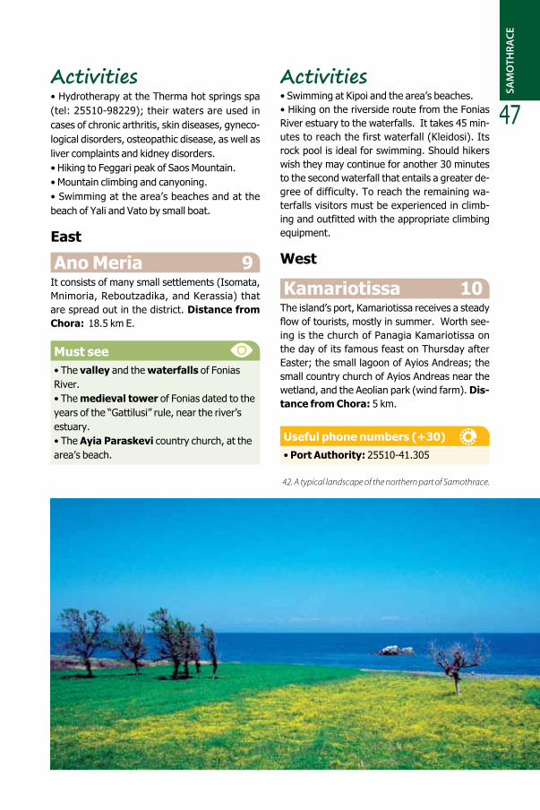
Kamariotissa 10The island’s port, Kamariotissa receives a steady flow of tourists, mostly in summer. Worth see-ing is the church of Panagia Kamariotissa on the day of its famous feast on Thursday after Easter; the small lagoon of Ayios Andreas; the small country church of Ayios Andreas near the wetland, and the Aeolian park (wind farm). Dis-tance from Chora: 5 km.
Useful phone numbers (+30)• Port Authority: 25510-41.305
SAM
OTH
RACE
42. A typical landscape of the northern part of Samothrace.
Publication Supervision:
Publication Coordination:
Greek Text:
Translation:
Design Supervision:
Page Layout -Colour Proofs:
English LayoutAdaptation:
Photo credits:
Photo Editing:
Maps:
Print:
ISBN:
Copyright:
ANGELA VARELA Director, Directorateof Market Research and Advertising
ELENI MITRAKIHead, Departmentof Publications & Audiovisual Media
YANNIS RAGOS
COM N. PRATSINIS – K. ZISSIMOU O.E.
KATERINA KOUREBANA – MARIA MANDREKA
V+O COMMUNICATION
LTH advertising
Front Cover, 2, 28: P. MATSOUKA – 14: E. BELLIYIANNI – 11: A. BONETTI – 23: G. CHANDRINOS – 15: G. FAFALIS – 19, 27: FOTOKINISI – 22, 38, 40: N. KONTOS – 17: K. KOUZOUNI – 41: A. MAGOULAS – 1: N. MARKOU – 18: G. POULOPOULOS –3, 9, 32: B. SFYRAS – 4, 12, 13, 20, 21, 24, 25, 26,29, 30, 31, 33, 34, 35, 36 : Y. SKOULAS – 8: P. STOLIS – 5, 6, 7, 11, 37, 39, 42: GNTO ARCHIVES
KATERINA KOUZOUNI
GEODATA S.A.
PRESSIOUS ARVANITIDIS S.A.
978-960-534-050-6
GREEK NATIONAL TOURISM ORGANISATION
THIS PUBLICATION IS NOT FOR SALE
GREEK NATIONAL TOURISM ORGANISATION www.visitgreece.gr
PUBLICATION:GREEK NATIONAL TOURISM ORGANISATION
NOVEMBER 2016 (SECOND EDITION)

GREEK NATIONAL TOURISM ORGANISATION
∆ΩΡΕΑΝ
ΑΝΤΙΤΥΠ
Ο
FREE
COPY
PUBLICA
TION
GRATUIT
E
EJEMPLA
R
GRATUIT
O
GRATIS-
AUSGAB
E
Распростр
аняется
бесплатно
ITA
ESP
FRA
OPUSCOLO
GRATUIT
O
THRA
CE