Μaria Manousaki - Université Clermont...
66
Μaria Manousaki Geologist, MSc Earthquake Planning & Protection Organization (EPPO) Emergency Planning-Prevention Department Ministry of Infrastructure & Transport [email protected] Nicolosi, Italy 5 14 May 2019 | ETNA INTERNATIONAL SUMMER SCHOOL
Transcript of Μaria Manousaki - Université Clermont...
Μaria Manousaki Geologist, MSc
Earthquake Planning & Protection Organization (EPPO) Emergency Planning-Prevention Department
Ministry of Infrastructure & Transport [email protected]
Nicolosi, Italy5 14 May 2019
|
ETNA INTERNATIONAL SUMMER SCHOOL
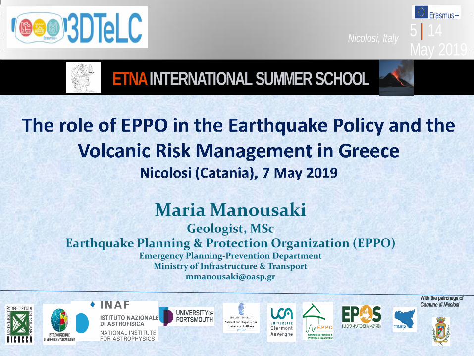
Seismicity of Mediterranean region 1900-2013
https://pubs.usgs.gov/of/2010/1083/q/ofr20101083q.pdf
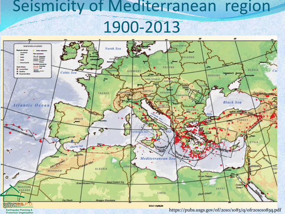
Geodynamic setting of the Aegean
Papazachos et al. , 2001
Earthquake Planning and Protection Organization
(EPPO)
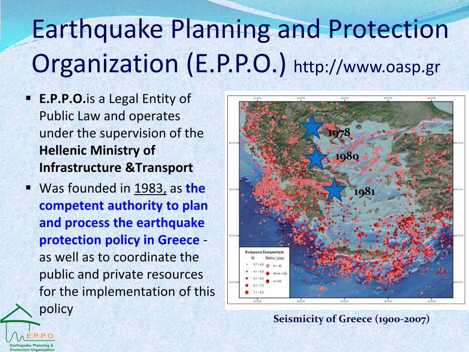
E.P.P.O.is a Legal Entity of Public Law and operates under the supervision of the Hellenic Ministry of Infrastructure &Transport
Was founded in 1983, as the competent authority to plan and process the earthquake protection policy in Greece - as well as to coordinate the public and private resources for the implementation of this policy
Earthquake Planning and Protection Organization (E.P.P.O.) http://www.oasp.gr
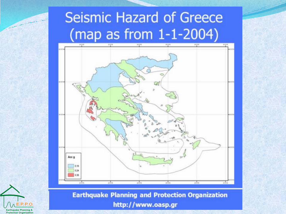
Seismicity of Greece (1900-2007)
1978
1980
1981
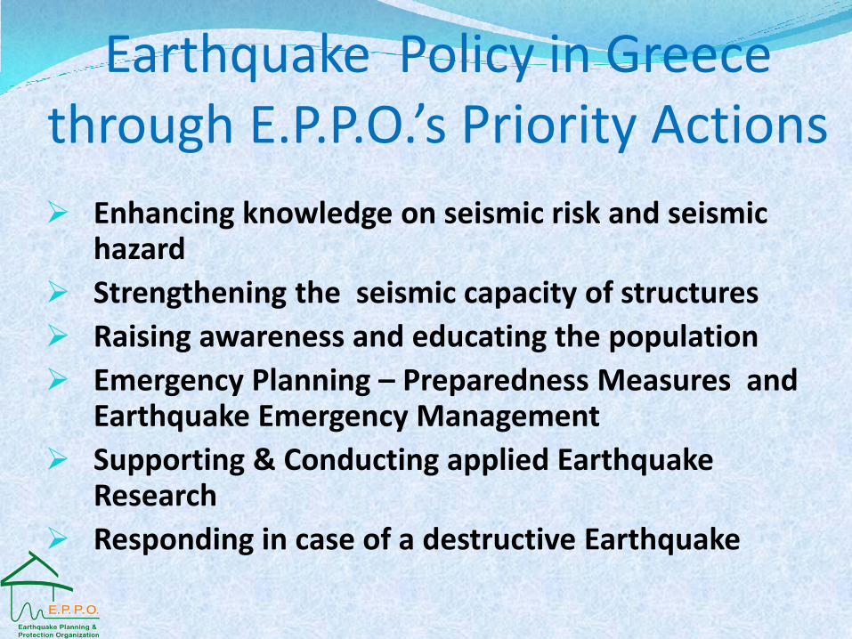
Earthquake Policy in Greece through E.P.P.O.’s Priority Actions
Enhancing knowledge on seismic risk and seismic hazard
Strengthening the seismic capacity of structures
Raising awareness and educating the population
Emergency Planning – Preparedness Measures and Earthquake Emergency Management
Supporting & Conducting applied Earthquake Research
Responding in case of a destructive Earthquake
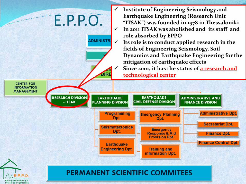
E.P.P.O. STRUCTURE Institute of Engineering Seismology and
Earthquake Engineering (Research Unit “ITSAK”) was founded in 1978 in Thessaloniki
In 2011 ITSAK was abolished and its staff and role absorbed by EPPO
Its role is to conduct applied research in the fields of Engineering Seismology, Soil Dynamics and Earthquake Engineering for the mitigation of earthquake effects
Since 2001, it has the status of a research and technological center
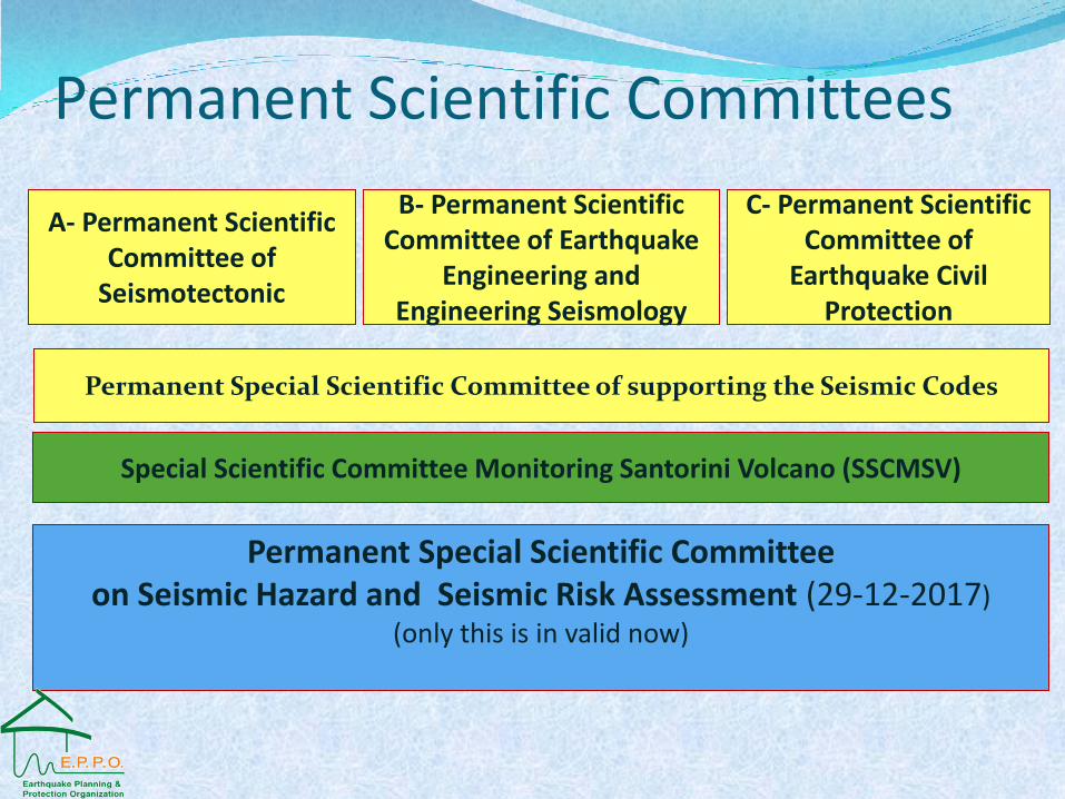
Permanent Special Scientific Committee on Seismic Hazard and Seismic Risk Assessment (29-12-2017)
(only this is in valid now)
Permanent Special Scientific Committee of supporting the Seismic Codes
C- Permanent Scientific Committee of
Earthquake Civil Protection
Β- Permanent Scientific Committee of Earthquake
Engineering and Engineering Seismology
Α- Permanent Scientific Committee of
Seismotectonic
Special Scientific Committee Monitoring Santorini Volcano (SSCMSV)
Permanent Scientific Committees
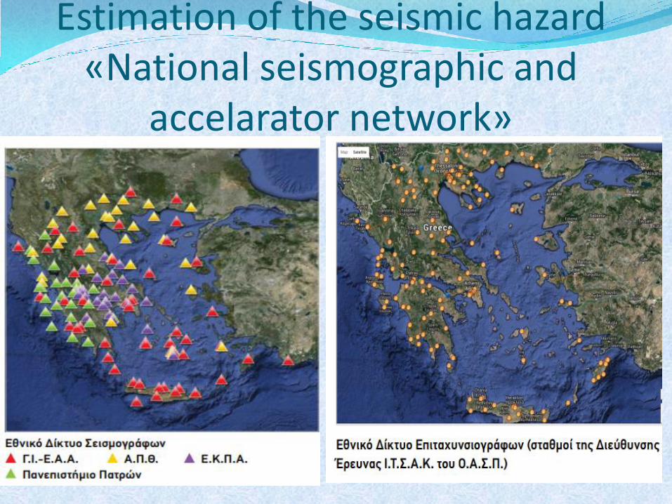
Estimation of the seismic hazard «National seismographic and
accelarator network»
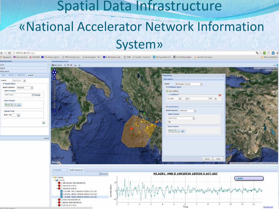
Spatial Data Infrastructure
«National Accelerator Network Information
System»
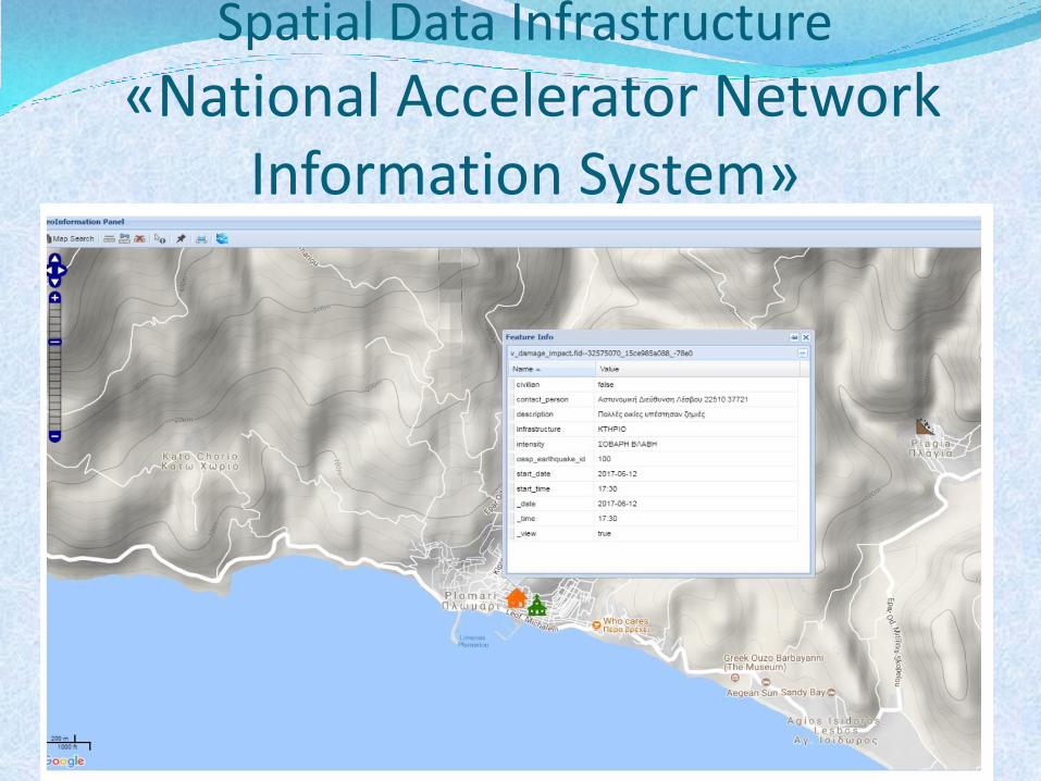
Spatial Data Infrastructure
«National Accelerator Network Information System»
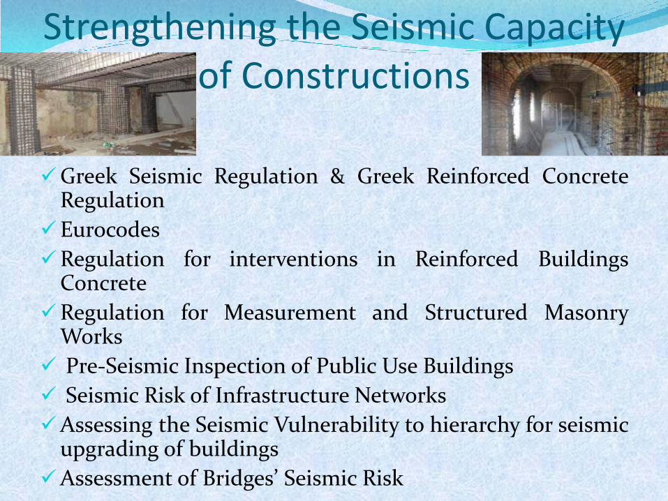
Greek Seismic Regulation & Greek Reinforced Concrete Regulation
Eurocodes
Regulation for interventions in Reinforced Buildings Concrete
Regulation for Measurement and Structured Masonry Works
Pre-Seismic Inspection of Public Use Buildings
Seismic Risk of Infrastructure Networks
Assessing the Seismic Vulnerability to hierarchy for seismic upgrading of buildings
Assessment of Bridges’ Seismic Risk
Strengthening the Seismic Capacity of Constructions
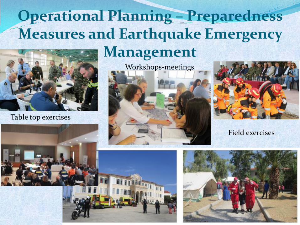
Operational Planning – Preparedness Measures and Earthquake Emergency
Management Workshops-meetings
Field exercises
Table top exercises
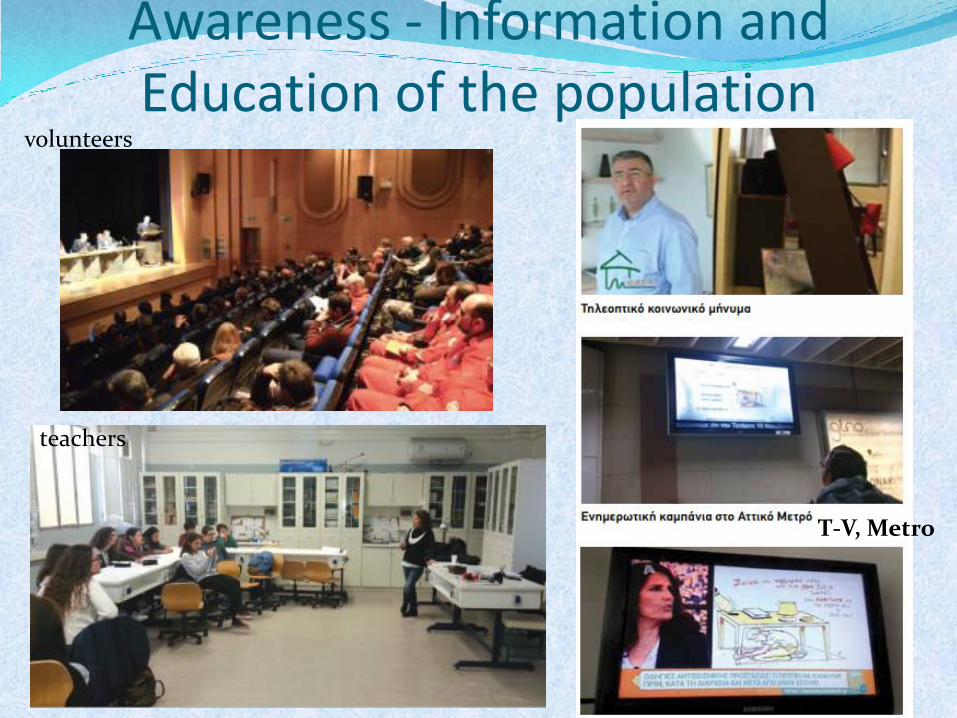
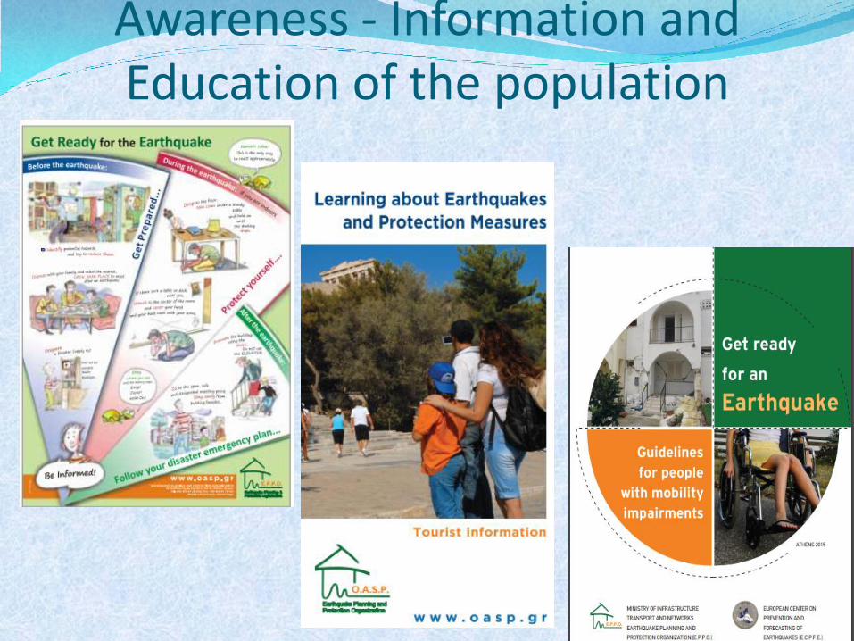
Awareness - Information and Education of the population
volunteers
teachers
T-V, Metro
Awareness - Information and Education of the population
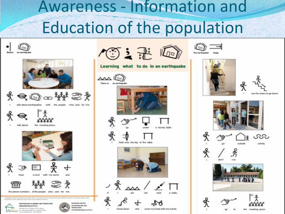
Awareness - Information and Education of the population
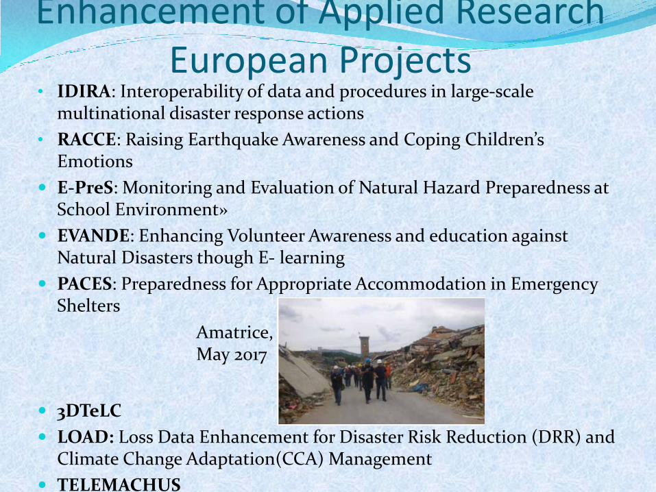
Enhancement of Applied Research European Projects
• IDIRA: Interoperability of data and procedures in large-scale multinational disaster response actions
• RACCE: Raising Earthquake Awareness and Coping Children’s Emotions
E-PreS: Monitoring and Evaluation of Natural Hazard Preparedness at School Environment»
EVANDE: Enhancing Volunteer Awareness and education against Natural Disasters though E- learning
PACES: Preparedness for Appropriate Accommodation in Emergency Shelters
3DTeLC
LOAD: Loss Data Enhancement for Disaster Risk Reduction (DRR) and Climate Change Adaptation(CCA) Management
TELEMACHUS
Amatrice, May 2017
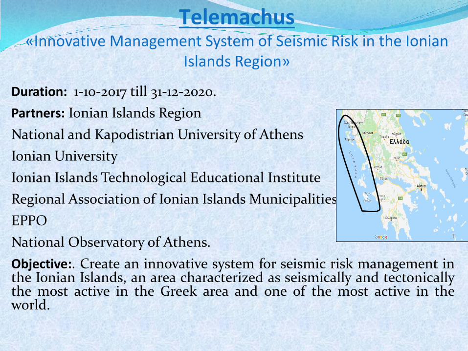
Duration: 1-10-2017 till 31-12-2020.
Partners: Ionian Islands Region
• National and Kapodistrian University of Athens
Ionian University
Ionian Islands Technological Educational Institute
Regional Association of Ionian Islands Municipalities
EPPO
National Observatory of Athens.
Objective:. Create an innovative system for seismic risk management in the Ionian Islands, an area characterized as seismically and tectonically the most active in the Greek area and one of the most active in the world.
Τelemachus «Innovative Management System of Seismic Risk in the Ionian
Islands Region»
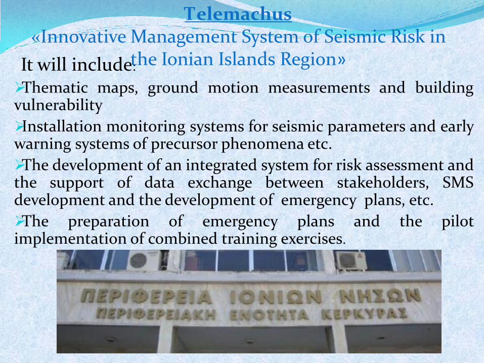
It will include:
Thematic maps, ground motion measurements and building vulnerability
Installation monitoring systems for seismic parameters and early warning systems of precursor phenomena etc.
The development of an integrated system for risk assessment and the support of data exchange between stakeholders, SMS development and the development of emergency plans, etc.
The preparation of emergency plans and the pilot implementation of combined training exercises.
Τelemachus «Innovative Management System of Seismic Risk in
the Ionian Islands Region»
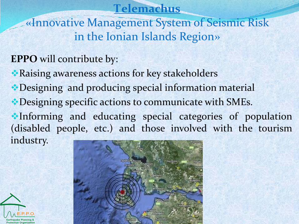
EPPO will contribute by:
Raising awareness actions for key stakeholders
Designing and producing special information material
Designing specific actions to communicate with SMEs.
Informing and educating special categories of population (disabled people, etc.) and those involved with the tourism industry.
Τelemachus «Innovative Management System of Seismic Risk
in the Ionian Islands Region»
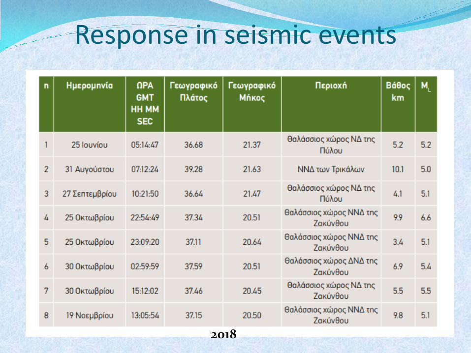
Response in seismic events
2018
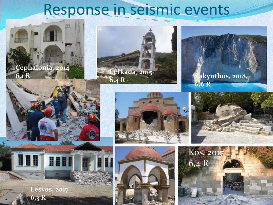
Response in seismic events
Cephalonia, 2014 6,1 R
Lefkada, 2015 6,4 R
Lesvos, 2017 6,3 R
Kos, 2017 6,4 R
Zakynthos, 2018, 6,6 R
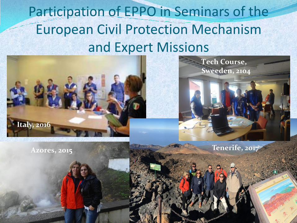
Participation of EPPO in Seminars of the European Civil Protection Mechanism
and Expert Missions
Italy, 2016
Azores, 2015 Tenerife, 2017
Τech Course, Sweeden, 2104
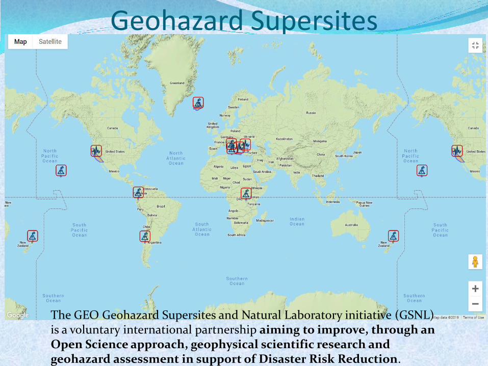
Geohazard Supersites
The GEO Geohazard Supersites and Natural Laboratory initiative (GSNL) is a voluntary international partnership aiming to improve, through an Open Science approach, geophysical scientific research and geohazard assessment in support of Disaster Risk Reduction.
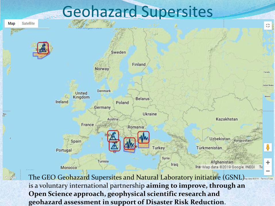
Geohazard Supersites
The GEO Geohazard Supersites and Natural Laboratory initiative (GSNL) is a voluntary international partnership aiming to improve, through an Open Science approach, geophysical scientific research and geohazard assessment in support of Disaster Risk Reduction.
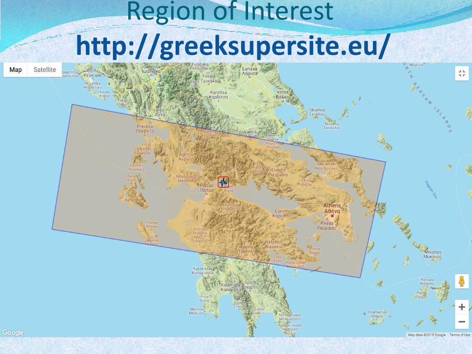
Region of Interest http://greeksupersite.eu/
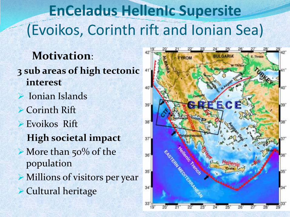
EnCeladus HellenIc Supersite (Evoikos, Corinth rift and Ionian Sea)
Motivation:
3 sub areas of high tectonic interest
Ionian Islands
Corinth Rift
Evoikos Rift
High societal impact
More than 50% of the population
Millions of visitors per year
Cultural heritage
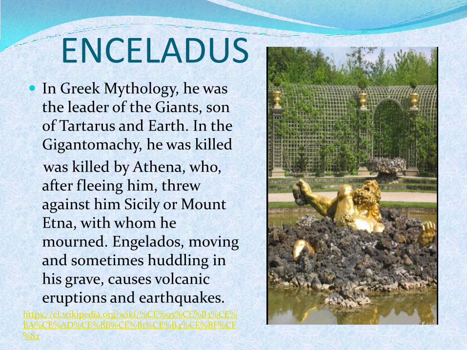
ENCELADUS In Greek Mythology, he was
the leader of the Giants, son of Tartarus and Earth. In the Gigantomachy, he was killed
was killed by Athena, who, after fleeing him, threw against him Sicily or Mount Etna, with whom he mourned. Engelados, moving and sometimes huddling in his grave, causes volcanic eruptions and earthquakes.
https://el.wikipedia.org/wiki/%CE%95%CE%B3%CE%BA%CE%AD%CE%BB%CE%B1%CE%B4%CE%BF%CF%82
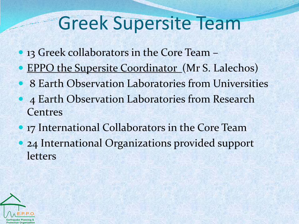
Greek Supersite Team
13 Greek collaborators in the Core Team –
EPPO the Supersite Coordinator (Mr S. Lalechos)
8 Earth Observation Laboratories from Universities
4 Earth Observation Laboratories from Research Centres
17 International Collaborators in the Core Team
24 International Organizations provided support letters
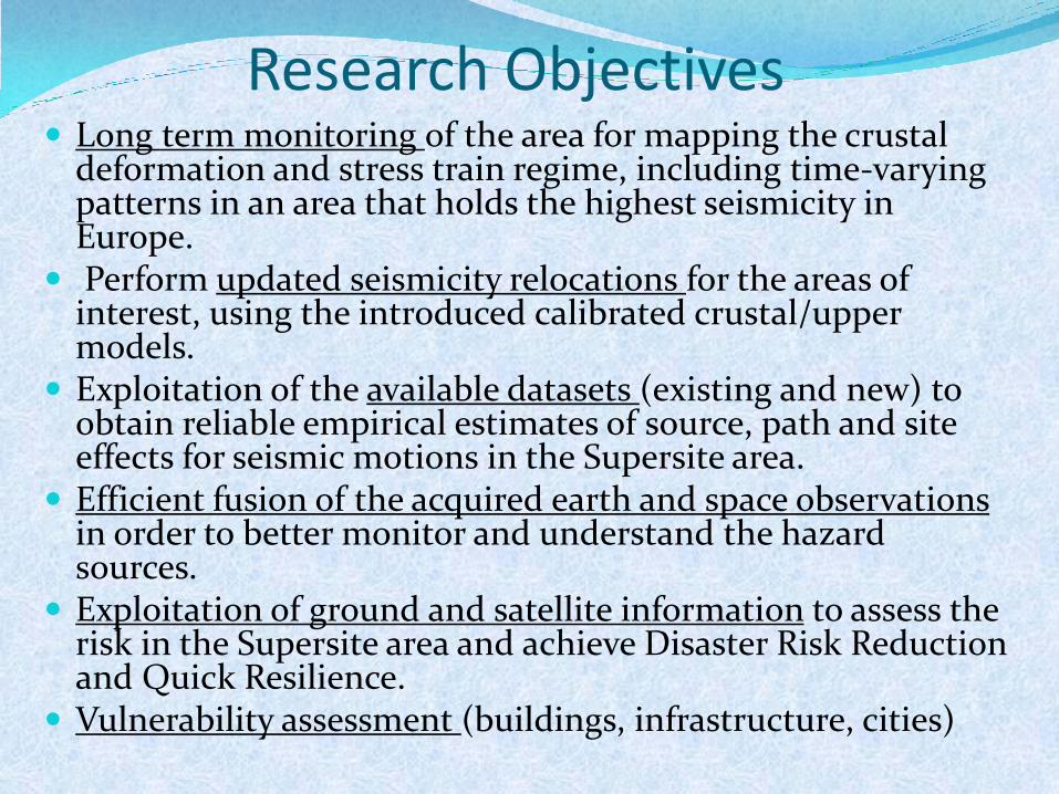
Research Objectives Long term monitoring of the area for mapping the crustal
deformation and stress train regime, including time-varying patterns in an area that holds the highest seismicity in Europe.
Perform updated seismicity relocations for the areas of interest, using the introduced calibrated crustal/upper models.
Exploitation of the available datasets (existing and new) to obtain reliable empirical estimates of source, path and site effects for seismic motions in the Supersite area.
Efficient fusion of the acquired earth and space observations in order to better monitor and understand the hazard sources.
Exploitation of ground and satellite information to assess the risk in the Supersite area and achieve Disaster Risk Reduction and Quick Resilience.
Vulnerability assessment (buildings, infrastructure, cities)
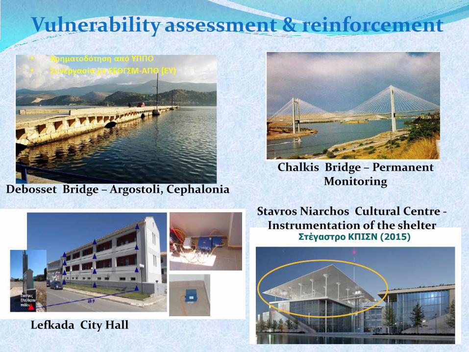
Vulnerability assessment & reinforcement
Lefkada City Hall
Chalkis Bridge – Permanent Monitoring
Stavros Niarchos Cultural Centre - Instrumentation of the shelter
Debosset Bridge – Argostoli, Cephalonia
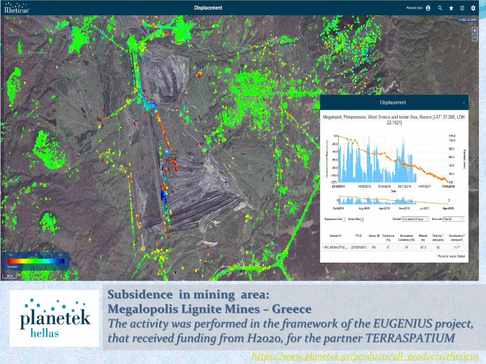
Subsidence in mining area: Megalopolis Lignite Mines – Greece The activity was performed in the framework of the EUGENIUS project, that received funding from H2020, for the partner TERRASPATIUM
https://www.planetek.gr/products/all_products/rheticus
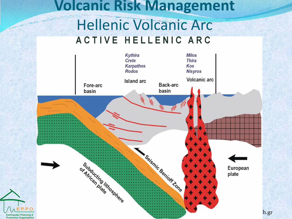
Volcanic Risk Management Hellenic Volcanic Arc
www.geo.auth.gr
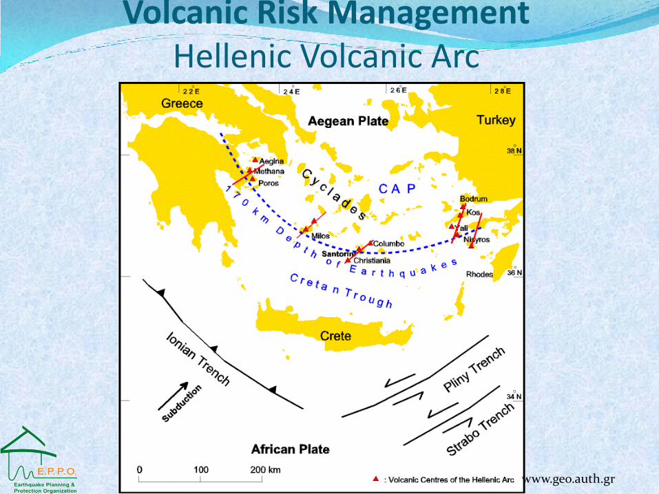
Volcanic Risk Management Hellenic Volcanic Arc
www.geo.auth.gr
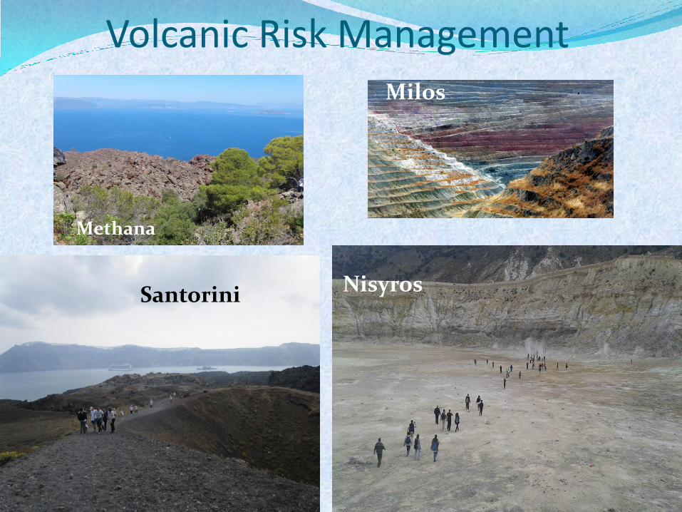
Volcanic Risk Management
Methana
Santorini Nisyros
Milos
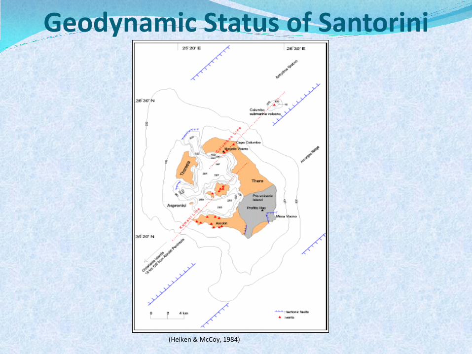
Geodynamic Status of Santorini
(Heiken & McCoy, 1984)
Geodynamic Status of Santorini
(Heiken & McCoy, 1984)
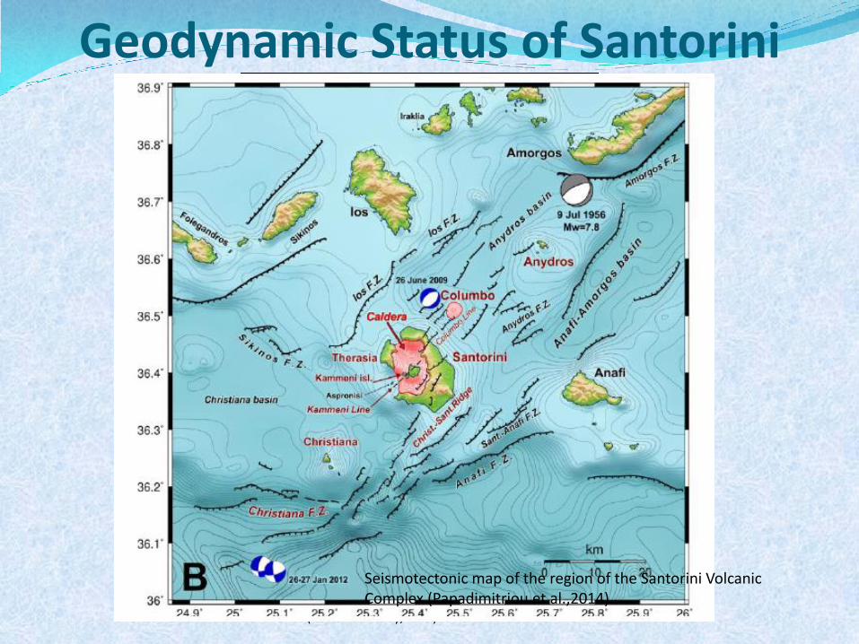
Seismotectonic map of the region of the Santorini Volcanic Complex (Papadimitriou et al.,2014)
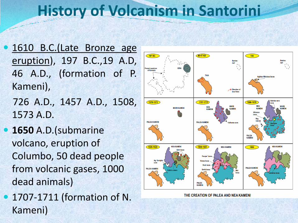
History of Volcanism in Santorini
1610 Β.C.(Late Bronze age eruption), 197 Β.C.,19 A.D, 46 A.D., (formation of P. Kameni),
726 A.D., 1457 A.D., 1508, 1573 A.D.
1650 A.D.(submarine volcano, eruption of Columbo, 50 dead people from volcanic gases, 1000 dead animals)
1707-1711 (formation of N. Kameni)
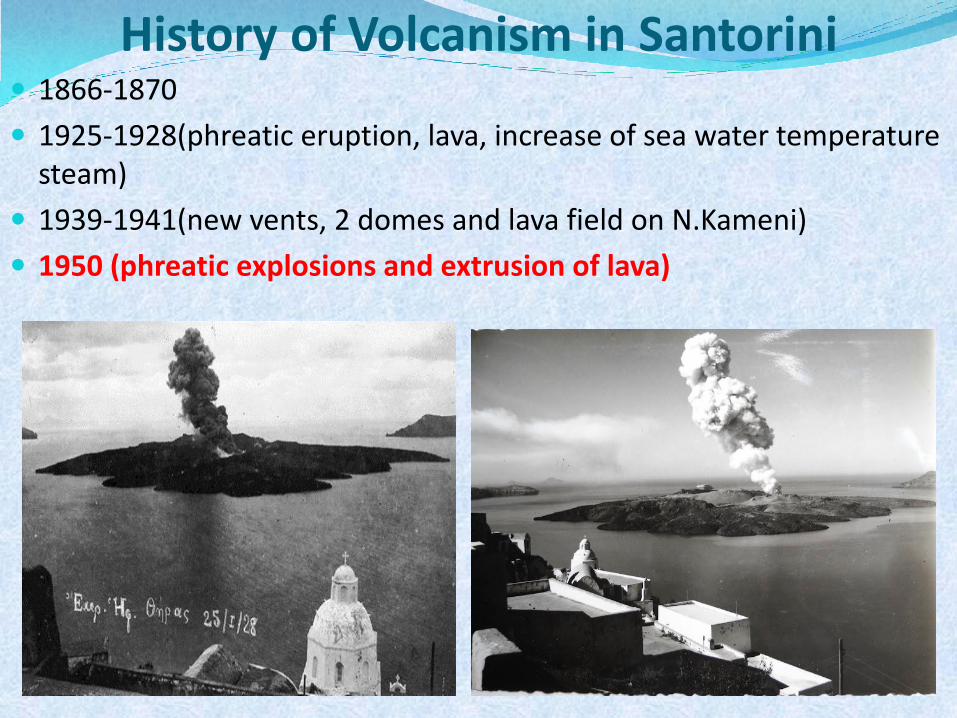
History of Volcanism in Santorini 1866-1870
1925-1928(phreatic eruption, lava, increase of sea water temperature steam)
1939-1941(new vents, 2 domes and lava field on N.Kameni)
1950 (phreatic explosions and extrusion of lava)
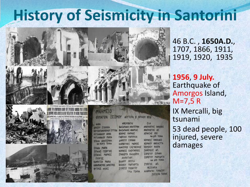
History of Seismicity in Santorini
46 B.C. , 1650A.D., 1707, 1866, 1911, 1919, 1920, 1935
1956, 9 July.
Earthquake of Amorgos Island, M=7,5 R
ΙΧ Mercalli, big tsunami
53 dead people, 100 injured, severe damages
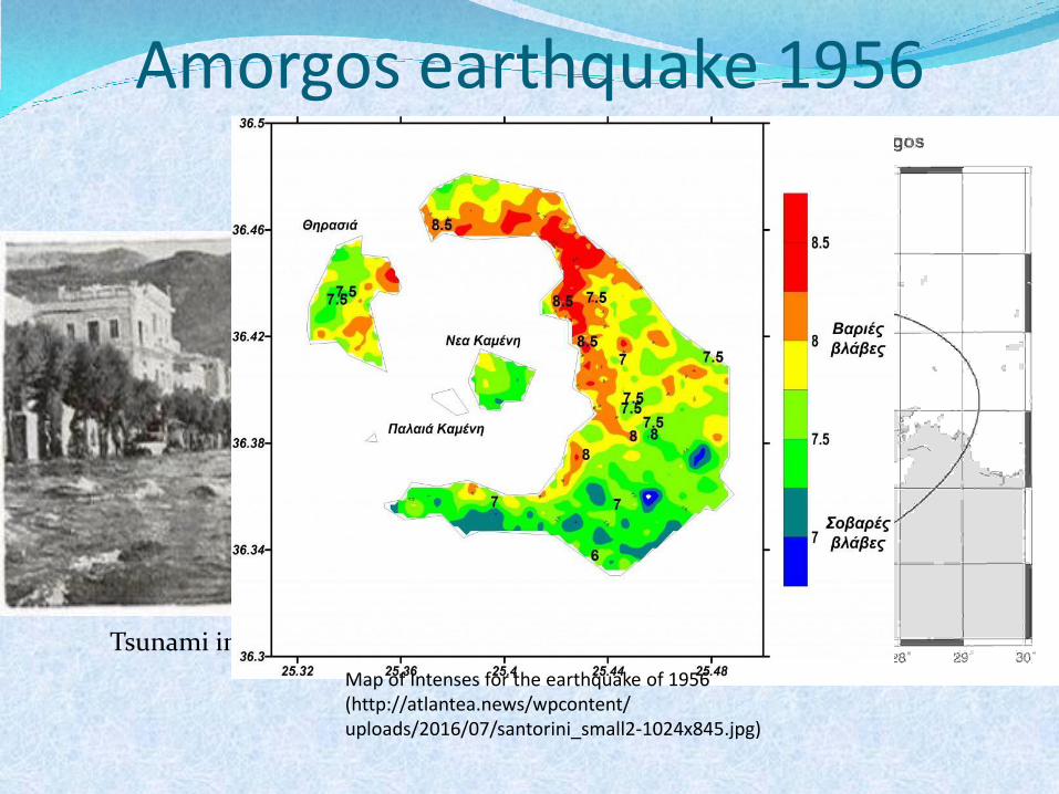
Amorgos earthquake 1956
Tsunami in Amorgos port
Map of Intenses for the earthquake of 1956 (http://atlantea.news/wpcontent/ uploads/2016/07/santorini_small2-1024x845.jpg)
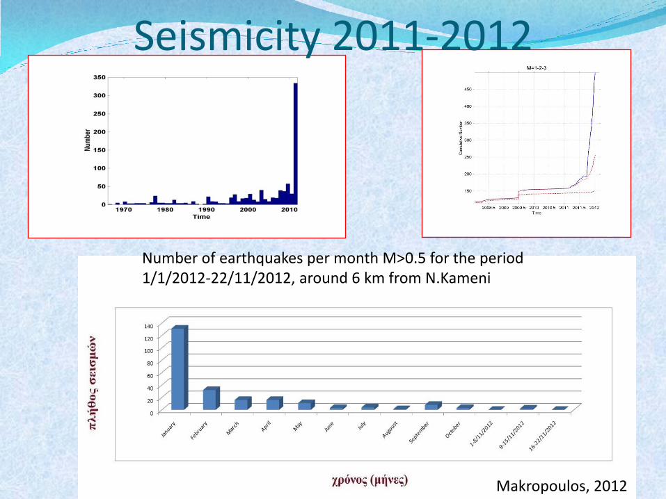
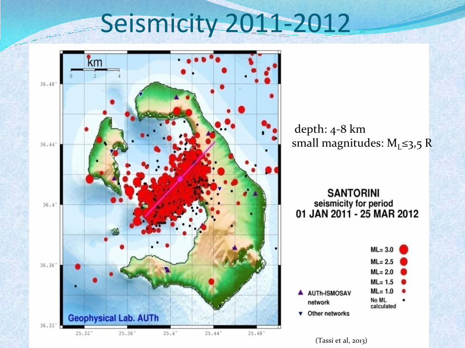
Seismicity 2011-2012
Number of earthquakes per month M>0.5 for the period 1/1/2012-22/11/2012, around 6 km from N.Kameni
Makropoulos, 2012
Seismicity 2011-2012
(Tassi et al, 2013)
depth: 4-8 km small magnitudes: ML≤3,5 R
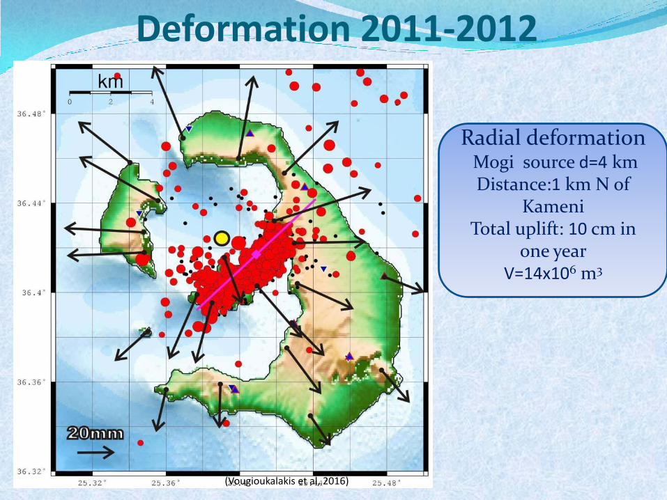
Deformation 2011-2012
(Vougioukalakis et al, 2016)
Radial deformation Mogi source d=4 km Distance:1 km N of
Kameni Total uplift: 10 cm in
one year V=14x106 m3
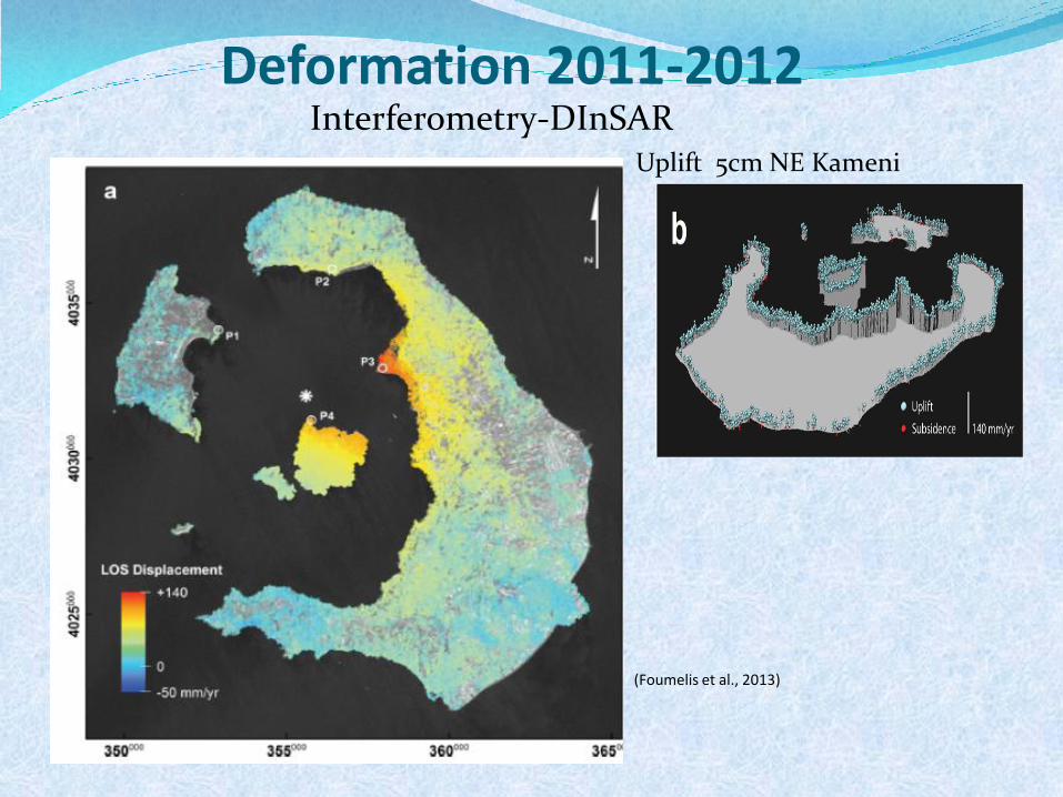
Deformation 2011-2012 Interferometry-DInSAR
(Foumelis et al., 2013)
Uplift 5cm NE Kameni
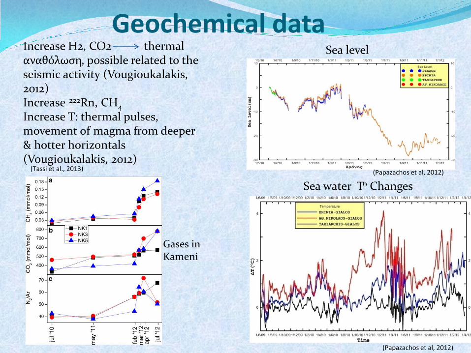
Geochemical data
(Papazachos et al, 2012)
Sea level
(Papazachos et al, 2012)
Sea water Το Changes
(Tassi et al., 2013)
Gases in Kameni
Increase Η2, CO2 thermal αναθόλωση, possible related to the seismic activity (Vougioukalakis, 2012) Increase 222Rn, CH4 Increase Τ: thermal pulses, movement of magma from deeper & hotter horizontals (Vougioukalakis, 2012)
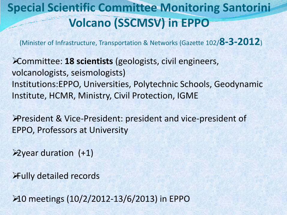
Special Scientific Committee Monitoring Santorini Volcano (SSCMSV) in EPPO
(Minister of Infrastructure, Transportation & Networks (Gazette 102/8-3-2012)
Committee: 18 scientists (geologists, civil engineers, volcanologists, seismologists) Institutions:EPPO, Universities, Polytechnic Schools, Geodynamic Institute, HCMR, Ministry, Civil Protection, IGME President & Vice-President: president and vice-president of EPPO, Professors at University
2year duration (+1)
Fully detailed records
10 meetings (10/2/2012-13/6/2013) in EPPO
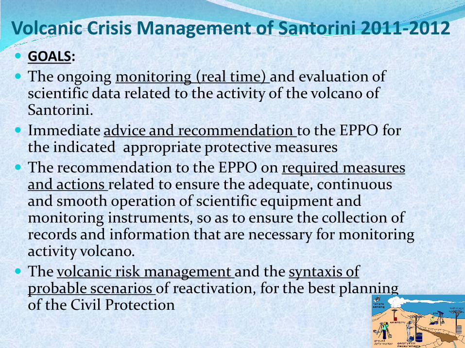
Volcanic Crisis Management of Santorini 2011-2012
GOALS:
The ongoing monitoring (real time) and evaluation of scientific data related to the activity of the volcano of Santorini.
Immediate advice and recommendation to the EPPO for the indicated appropriate protective measures
The recommendation to the EPPO on required measures and actions related to ensure the adequate, continuous and smooth operation of scientific equipment and monitoring instruments, so as to ensure the collection of records and information that are necessary for monitoring activity volcano.
The volcanic risk management and the syntaxis of probable scenarios of reactivation, for the best planning of the Civil Protection
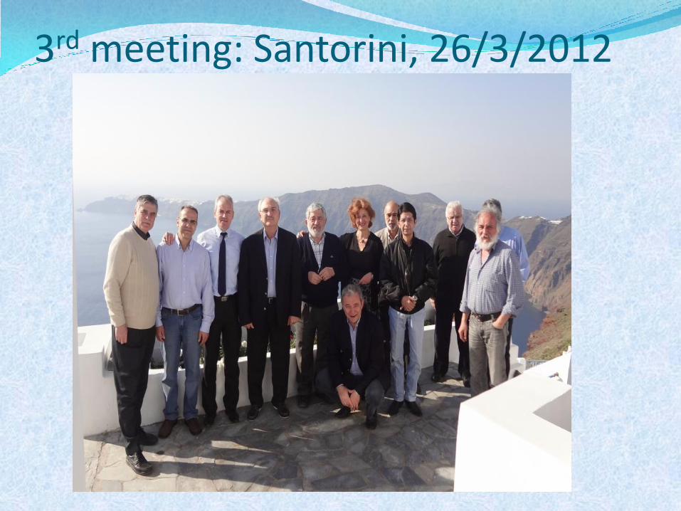
3rd meeting: Santorini, 26/3/2012
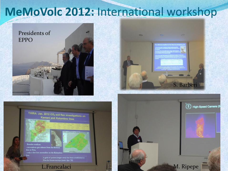
MeMoVolc 2012: International workshop
Presidents of EPPO
L.Francalaci
S. Barberi
M. Ripepe
4 sub-Committies:
Seismology, Deformation, Physicochemical changes, Civil Protection
Updating of all the members of the Committee for the state of the volcano from the 4 coordinators of the sub-committees
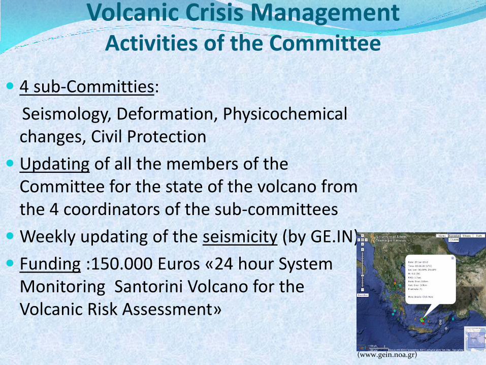
Weekly updating of the seismicity (by GE.IN)
Funding :150.000 Εuros «24 hour System Monitoring Santorini Volcano for the Volcanic Risk Assessment»
Volcanic Crisis Management Activities of the Committee
(www.gein.noa.gr)
Volcanic Crisis Management Activities of the Committee
Distribution of the budget to the 4 sub-committees according to their priorities
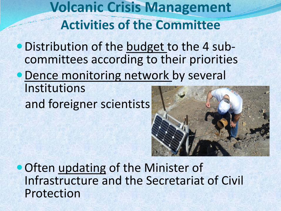
Dence monitoring network by several Institutions
and foreigner scientists Often updating of the Minister of
Infrastructure and the Secretariat of Civil Protection
Volcanic Crisis Management Activities of the Committee
Cooperation in terms of counceling with foreigner
scientists (Italian, French, British team)
Use of thermal camera in the lifeguard helicopter for digital infrared aerial photos
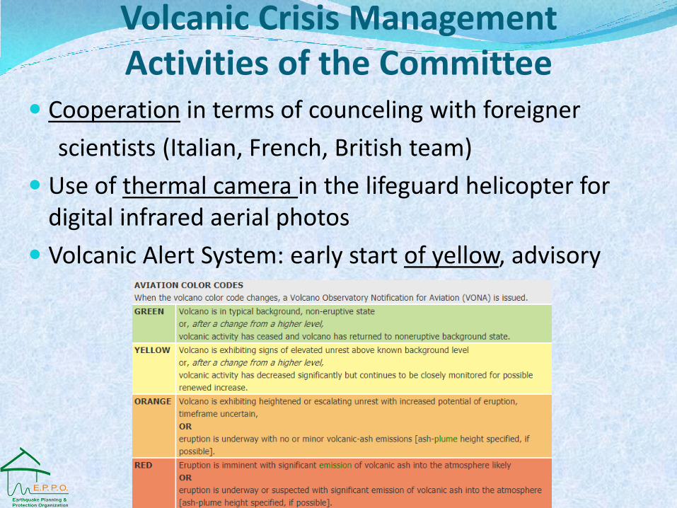
Volcanic Alert System: early start of yellow, advisory
Volcanic Crisis Management Activities of the Committee
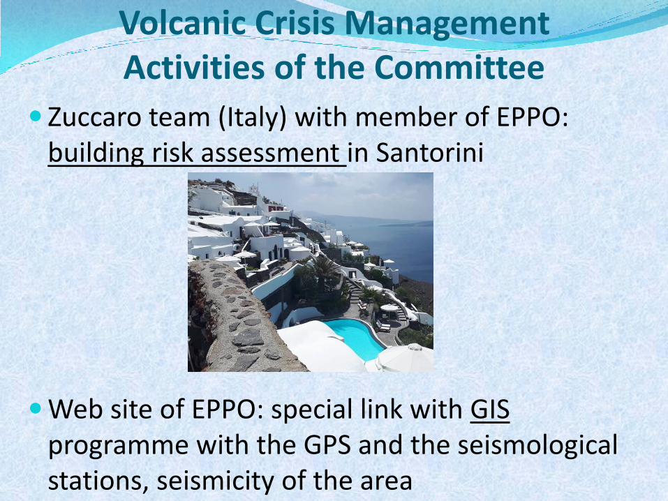
Zuccaro team (Italy) with member of EPPO: building risk assessment in Santorini
Web site of EPPO: special link with GIS programme with the GPS and the seismological stations, seismicity of the area
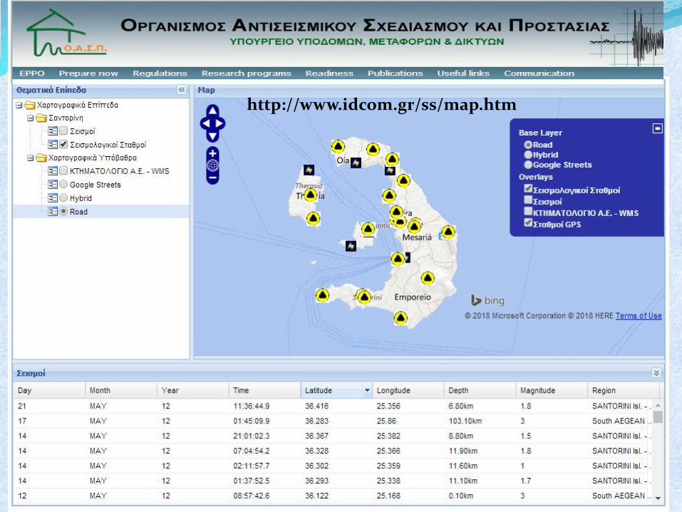
http://www.idcom.gr/ss/map.htm
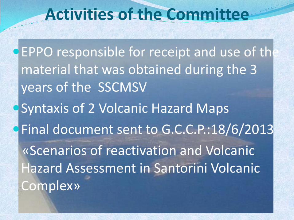
Activities of the Committee
EPPO responsible for receipt and use of the material that was obtained during the 3 years of the SSCMSV
Syntaxis of 2 Volcanic Hazard Maps
Final document sent to G.C.C.P.:18/6/2013
«Scenarios of reactivation and Volcanic Hazard Assessment in Santorini Volcanic Complex»
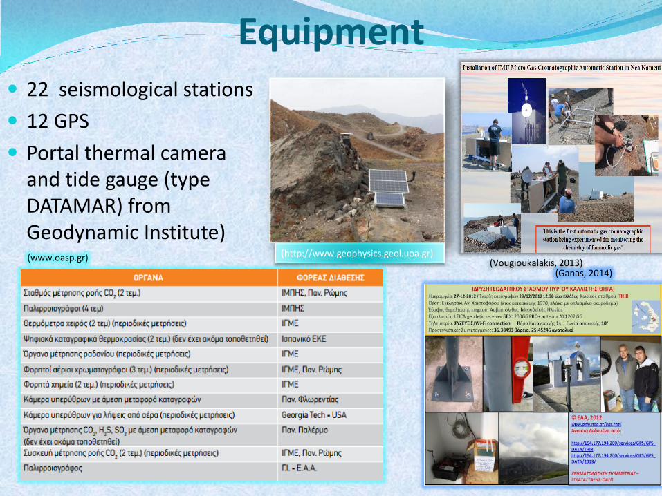
Equipment
22 seismological stations
12 GPS
Portal thermal camera and tide gauge (type DATAMAR) from Geodynamic Institute)
(http://www.geophysics.geol.uoa.gr) (www.oasp.gr)
(Ganas, 2014) (Vougioukalakis, 2013)
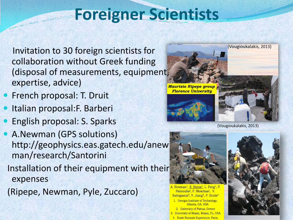
Foreigner Scientists
(Vougioukalakis, 2013)
(Vougioukalakis, 2013)
Invitation to 30 foreign scientists for collaboration without Greek funding (disposal of measurements, equipment, expertise, advice)
French proposal: Τ. Druit
Italian proposal:F. Barberi
English proposal: S. Sparks
A.Newman (GPS solutions) http://geophysics.eas.gatech.edu/anewman/research/Santorini
Installation of their equipment with their expenses
(Ripepe, Newman, Pyle, Zuccaro)
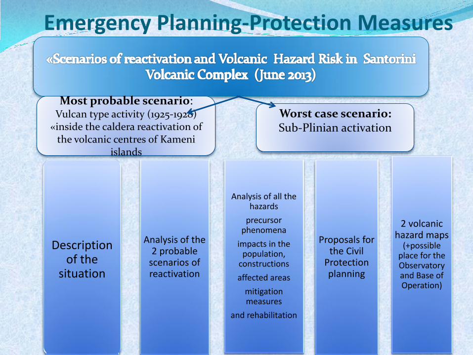
Emergency Planning-Protection Measures
Most probable scenario: Vulcan type activity (1925-1928)
«inside the caldera reactivation of the volcanic centres of Kameni
islands
Description of the
situation
Analysis of the 2 probable
scenarios of reactivation
Analysis of all the hazards
precursor phenomena
impacts in the population,
constructions
affected areas
mitigation measures
and rehabilitation
Proposals for the Civil
Protection planning
2 volcanic hazard maps
(+possible place for the Observatory and Base of Operation)
Worst case scenario: Sub-Plinian activation
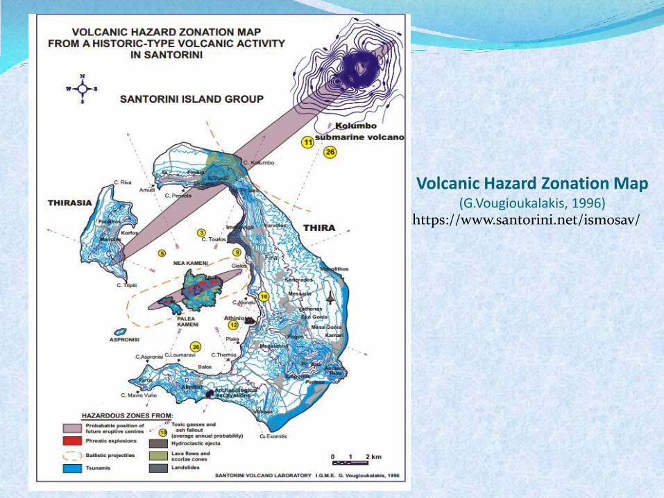
Volcanic Hazard Zonation Map (G.Vougioukalakis, 1996)
https://www.santorini.net/ismosav/
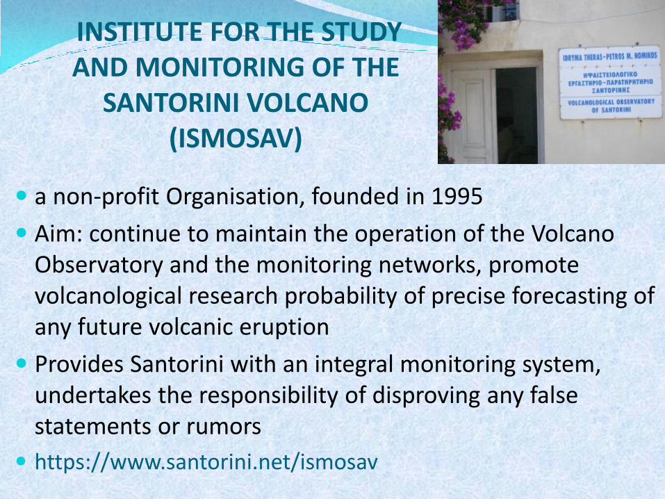
INSTITUTE FOR THE STUDY AND MONITORING OF THE
SANTORINI VOLCANO (ISMOSAV)
a non-profit Organisation, founded in 1995
Aim: continue to maintain the operation of the Volcano Observatory and the monitoring networks, promote volcanological research probability of precise forecasting of any future volcanic eruption
Provides Santorini with an integral monitoring system, undertakes the responsibility of disproving any false statements or rumors
https://www.santorini.net/ismosav
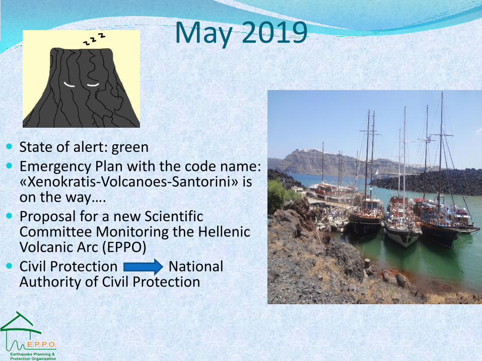
May 2019
State of alert: green Emergency Plan with the code name:
«Xenokratis-Volcanoes-Santorini» is on the way….
Proposal for a new Scientific Committee Monitoring the Hellenic Volcanic Arc (EPPO)
Civil Protection National Authority of Civil Protection
References • Vougioukalakis, G., Sparks, R.S.J., Pyle, D., Druitt, T., Barberi, F., Papazachos,
C., Fytikas, M. (2016). Volcanic Hazard Assessment at Santorini Volcano: A review and a synthesis in the light of the 2011-2012 Santorini unrest. Proceedings of 14th Congress Geological Society of Greece. Conference, Thessaloniki, Vol:L
• Λζκκασ, Ε. (2015). «Γεωδυναμικζσ καταςτροφζσ». Πρόγραμμα Μεταπτυχιακών Σπουδών Διαχείριςθ Περιβάλλοντοσ, Καταςτροφών και Κρίςεων.
• Παπαηάχοσ, Β. & Παπαηάχου Κ. (1989). Οι ςειςμοί τθσ Ελλάδασ. Ζιτθ.
• Proceedings : 1-10 meetings (2012-2013), E.P.P.O.
• Final report Papazachos, 2012
• Final report Stiros, 2015
• www.oasp.gr
http://www.santorini.net/ismosav
https://geo-gsnl.org/
http://greeksupersite.eu/
• Photographic archive E.P.P.O., personal archive
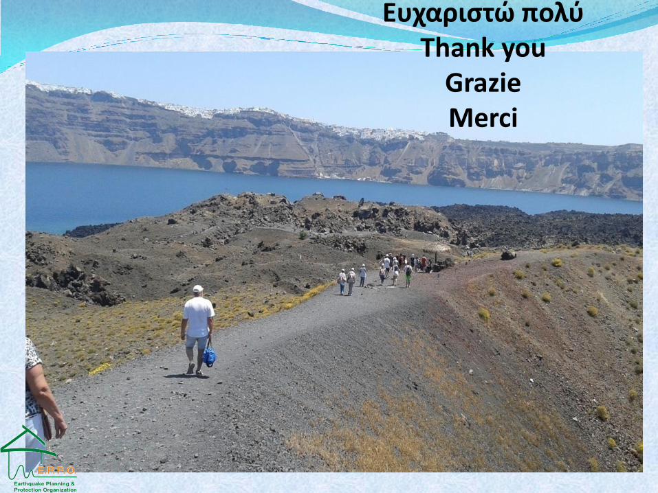
Ευχαριςτώ πολφ Thank you
Grazie Merci
Ευχαριςτώ πολφ Thank you
Grazie Merci
Santorini loves Etna