ΑΡΧΑΙΟΛΟΓΙΚΟ...
23
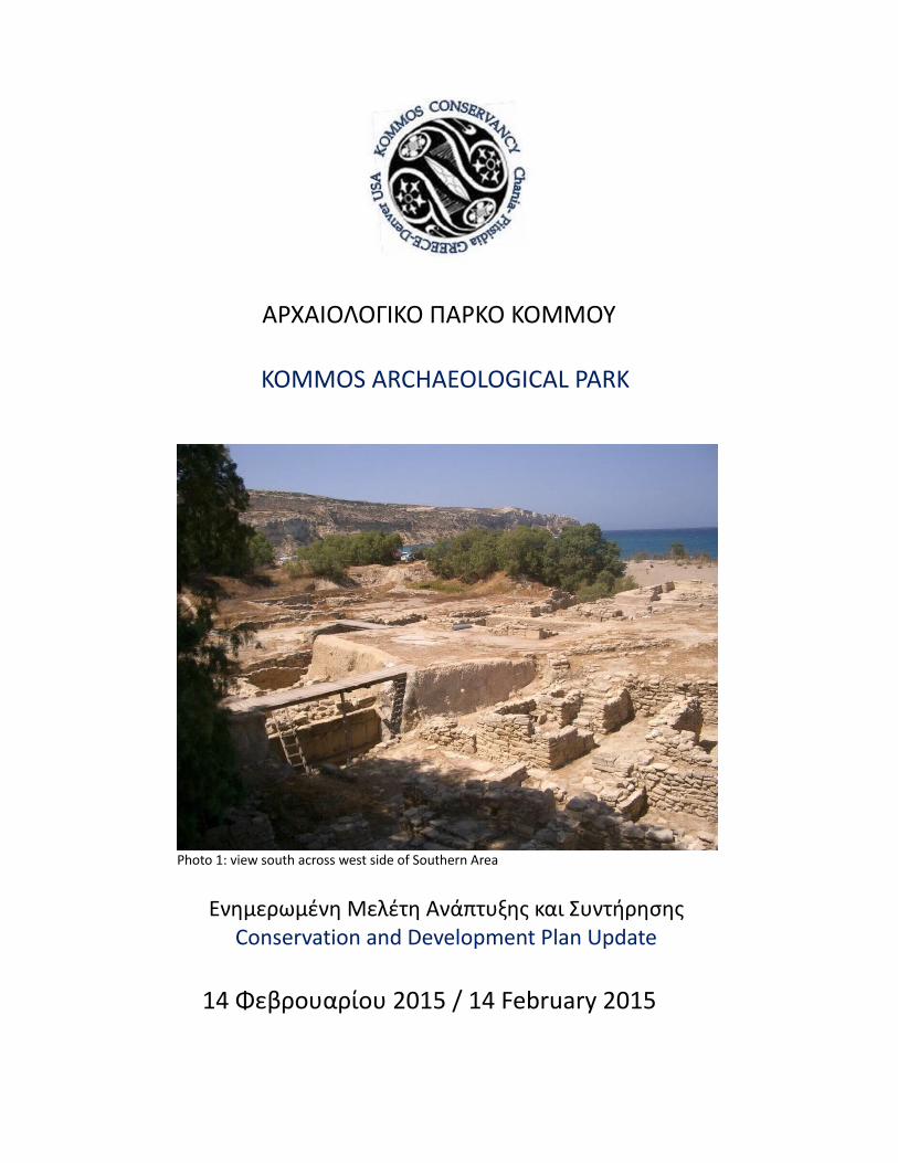
ΑΡΧΑΙΟΛΟΓΙΚΟ ΠΑΡΚΟ ΚΟΜΜΟΥ KOMMOS ARCHAEOLOGICAL PARK Photo 1: view south across west side of Southern Area Ενημερωμένη Μελέτη Ανάπτυξης και Συντήρησης Conservation and Development Plan Update 14 Φεβρουαρίου 2015 / 14 February 2015
Transcript of ΑΡΧΑΙΟΛΟΓΙΚΟ...
ΑΡΧΑΙΟΛΟΓΙΚΟ ΠΑΡΚΟ ΚΟΜΜΟΥ
KOMMOS ARCHAEOLOGICAL PARK
Photo 1: view south across west side of Southern Area
Ενημερωμένη Μελέτη Ανάπτυξης και Συντήρησης Conservation and Development Plan Update
14 Φεβρουαρίου 2015 / 14 February 2015
ΑΡΧΑΙΟΛΟΓΙΚΟ ΠΑΡΚΟ ΚΟΜΜΟΥ KOMMOS ARCHAEOLOGICAL PARK
Table of Contents 1 Photograph Index 2
Introduction 4
I.) Drainage Control – Erosion and Alluvium 4 Ia.) Well and Sump Pump and/or roof 4 1b.) Translucent Poly-Carbonite Shed Roof Structures 5 1c.) Concrete Lined Swale 6 1d.) Unstabilized Western Perimeter 7 1e.) Outlet Protection 7
II.) WIND CONTROL / Aeolian Sand Deposition and 8 Abrasion IIa.) Unmanaged Deposition 8 IIb.) Abraded Surface Deterioration 9 IIc.) Natural Wind Fence 9
III.) SCARP REINFORCEMENT AND ANCIENT WALL 11 STABILIZATION IIIa.) Three Ongoing Masonry Stabilization Types 11 IIIb.) Mortar Formulations 12 III c.) Masonry Beyond Mortar 12
IV.) SITE ACCESS AND VISITATION 13 (DISABLED & UNIVERSAL) IVa.) Orientation and Access Control 13 IVb.) Sales, Restrooms and Medical First Aid 14 IVc.) Public Walkways, Viewing Areas and Refreshment 15
V.) ALLOWANCE FOR FUTURE EXCAVATION AND 16 RESEARCH
VI.) ASSOCIATED EXTERNAL CONSIDERATIONS 17
Page 1 of 22
PHOTOGRAPH INDEX & APPENDIX All photographs by J.C. Stratis unless otherwise credited
Photo #01 : view south across west side of Southern Area cover
Photo #02a: sub surface collection well and pump location below bridged walkway - 02 July 2005 5
Photo #2b: sub surface collection well and pump location (close up) below bridged walkway - 02 July 2005 19
Photo #03: Sonia Mavrommati 2007 Roof shelter rendering over Greek temples 6 & 21
Photo #4: View north, up east perimeter fence and raised beach access road east of site. 6
Photo #5: disturbed beach area with piled stone slabs at eastern edge of beach just south of Kommos site 7
Photo #6: south fence & stone pile across beach access road at beach 8
Photo #7: south of beach access road at the outlet protection Location 8
Photo #8: west fence wind caused sand build-up 8
Photo #9: west fence tamarisk sprig & drip line (no longer operational) 8
Photo #10: Greek temple stone deterioration 9
Photo #11: north western portion of Southern Area – sand build up within the site at western fence line 10
Photo #12: western fence and erosion of built-up grade 11
Photo #13: Kostis Nikakis and work crew July 2013 12
Page 2 of 22
Photo #14: arrow spans across proposed parking area from 1998 Conservation and Development plan. Photo provided by the Phaistos Municipal mayoral administration of Maria Petrakogiorgi Anyfantaki 2013 14
Photo #15: Three Kommos excavated areas view south, provided by the Phaistos Municipal 2013 mayoral administration of Maria Petrakogiorgi- Anyfantaki 16
Photo #16: A public beach park conversion with concentric berm & shade Tamarisk trees & teaching circle 17
Photo #17: erosion at Built-up grade S.W. of fence 18
Photo #18: Erosion of Greek Temple stone 18
Photo #19: Invasive Plant Removal Team 12/02/14 18
Photo #20: N.E. corner Bldg P stairs (ca: 1400 BC) 18
Photo #21: Temple Roof shelter preliminary foundation plan 2006 / S. Mavrommati 20
Figure 2: Temple roof shelter cross section drawing 2006 / S. Mavrommati 20
Photo #22: Roof shelter over kiln in south stoa - 2006 S. Mavrommati 21
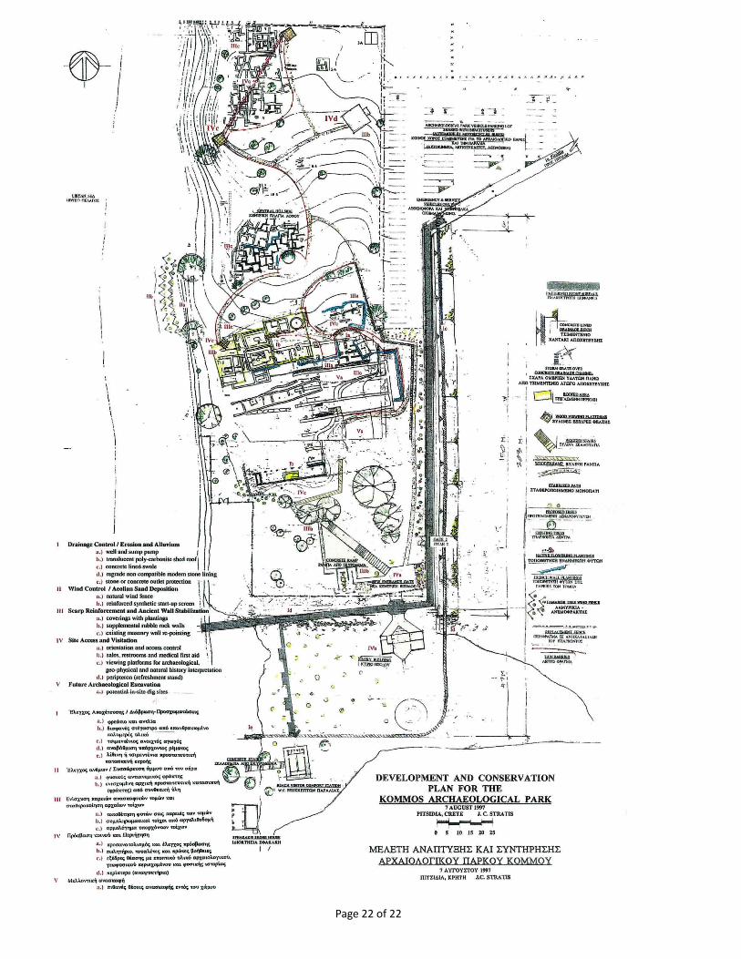
Figure 1: Schematic Site Master Plan 22
Page 3 of 22
2015 UPDATED CONSERVATION AND DEVELOPMENT PLAN for the Kommos Archaeological Site – Pitsidia Crete Greece 14 February 2015 by James Stratis for Kommos Conservancy
INTRODUCTION
This updated assessment and conservation plan has been produced nine years and six months after the last submittal (14 June 2005) to the 23 rd
Ephorate of Prehistoric and Classical Antiques, Heraklion Crete. That stabilization plan was modeled after the initial Kommos Archaeological Park Development and Conservation Plan dated 05 March 1998 by James Stratis, Cultural Resource Manager and Joseph Shaw, Co-Director of Kommos Excavations. This 2015 review and update follows the same five archaeological site conservation categories as represented previously and confirmed over the subsequent years as a useful conceptual outline to inform more intensive design development and construction documentation planning. The images in this report were taken by James Stratis unless otherwise stated. These images and others, organized by the sections indicated below are available through the Kommos Conservancy web site (http://www.kommosconservancy.org/documents-2/gallery/ ) and Flickr account.
I.) Drainage Control – Erosion and Alluvium II.) Wind Control – Aeolian Sand Deposition III.) Scarp Reinforcement and Ancient Wall Stabilization IV.) Site Access and Visitation V.) Allowance for Future Excavation
I.) DRAINAGE CONTROL – EROSION AND ALLUVIUM
Ia.) WELL AND SUMP PUMP AND/OR ROOF
Following several years of observation it has been confirmed by the author and the local site watchman Sifis Fasoulakis that the drainage at the exposed eastern section of the Minoan road does adequately drain, eliminating any need for a sump pump or roof covering for area 1a indicated in the 2005 updated conservation plan.
Page 4 of 22
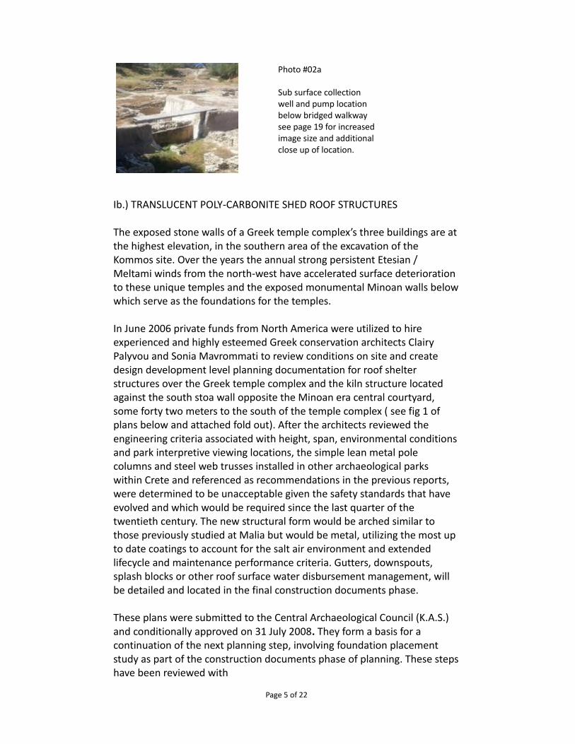
Ib.) TRANSLUCENT POLY-CARBONITE SHED ROOF STRUCTURES
The exposed stone walls of a Greek temple complex’s three buildings are at the highest elevation, in the southern area of the excavation of the Kommos site. Over the years the annual strong persistent Etesian / Meltami winds from the north-west have accelerated surface deterioration to these unique temples and the exposed monumental Minoan walls below which serve as the foundations for the temples.
In June 2006 private funds from North America were utilized to hire experienced and highly esteemed Greek conservation architects Clairy Palyvou and Sonia Mavrommati to review conditions on site and create design development level planning documentation for roof shelter structures over the Greek temple complex and the kiln structure located against the south stoa wall opposite the Minoan era central courtyard, some forty two meters to the south of the temple complex ( see fig 1 of plans below and attached fold out). After the architects reviewed the engineering criteria associated with height, span, environmental conditions and park interpretive viewing locations, the simple lean metal pole columns and steel web trusses installed in other archaeological parks within Crete and referenced as recommendations in the previous reports, were determined to be unacceptable given the safety standards that have evolved and which would be required since the last quarter of the twentieth century. The new structural form would be arched similar to those previously studied at Malia but would be metal, utilizing the most up to date coatings to account for the salt air environment and extended lifecycle and maintenance performance criteria. Gutters, downspouts, splash blocks or other roof surface water disbursement management, will be detailed and located in the final construction documents phase.
These plans were submitted to the Central Archaeological Council (K.A.S.) and conditionally approved on 31 July 2008. They form a basis for a continuation of the next planning step, involving foundation placement study as part of the construction documents phase of planning. These steps have been reviewed with
Page 5 of 22
Photo #02a
Sub surface collection well and pump location below bridged walkway see page 19 for increased image size and additional close up of location.
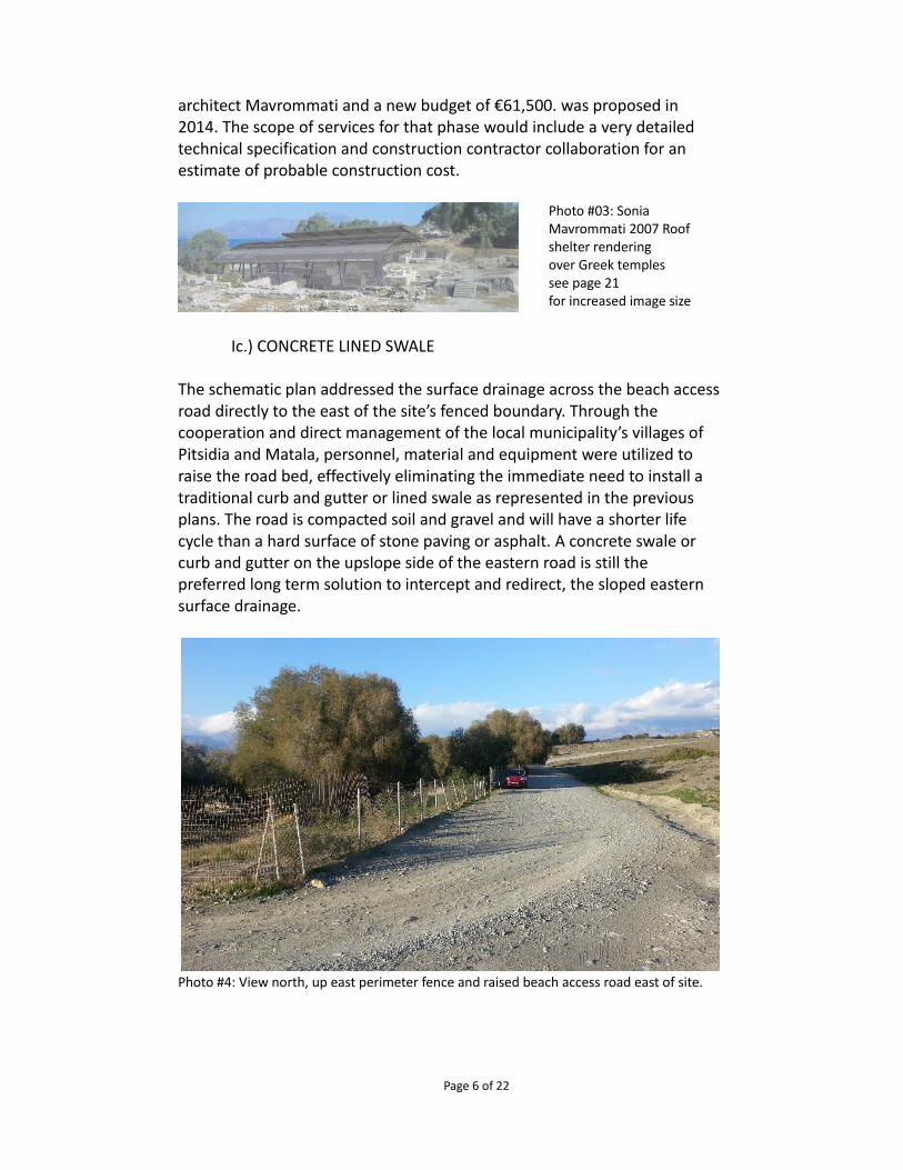
architect Mavrommati and a new budget of €61,500. was proposed in 2014. The scope of services for that phase would include a very detailed technical specification and construction contractor collaboration for an estimate of probable construction cost.
Ic.) CONCRETE LINED SWALE
The schematic plan addressed the surface drainage across the beach access road directly to the east of the site’s fenced boundary. Through the cooperation and direct management of the local municipality’s villages of Pitsidia and Matala, personnel, material and equipment were utilized to raise the road bed, effectively eliminating the immediate need to install a traditional curb and gutter or lined swale as represented in the previous plans. The road is compacted soil and gravel and will have a shorter life cycle than a hard surface of stone paving or asphalt. A concrete swale or curb and gutter on the upslope side of the eastern road is still the preferred long term solution to intercept and redirect, the sloped eastern surface drainage.
Photo #4: View north, up east perimeter fence and raised beach access road east of site.
Page 6 of 22
Photo #03: Sonia Mavrommati 2007 Roof shelter rendering over Greek temples see page 21 for increased image size

Id.) UNSTABILIZED WESTERN PERIMETER
Managing the erosion and alluvium deposition was only determined necessary and addressed in past studies within the Southern Area. Since the original treatment recommendations, other well intended but illegal efforts focused on the seaward western side of the site have occurred. The placement of large stone slabs to enhance the stability of the toe of the western slopes at the beach could be a beneficial treatment, however, the beach is a protected turtle nesting area and proper planning and permitting are required by law. The extent to which the sea is rising should be documented and mitigation treatments should be considered and incorporated into a future long range site maintenance and archaeological park management plans.
Photo #5: disturbed beach area with piled stone slabs at eastern edge of beach just south of Kommos site
Ie.) OUTLET PROTECTION
At the southern fence line to the Kommos site the beach access road turns to the west parallel to the fence. It is due south of this road where large stones have been piled up, but at the point where the parking area meets the beach, seen in photo 5 above, the concrete lined swale 1c above had been proposed in our earlier schematic master plan to drain onto the beach through an engineered reinforced (protection) outlet. The design intent was to intercept all surface drainage east of the Kommos site and redirect it to this managed outflow. The road bed raised by the municipality and the piled up stones at the northern edge of the private parking area south of the fenced archaeological site, appear to adequately address the overflow into the site as documented in the original conservation plan. The outlet at the beach is unengineered and unmanaged and should still have outlet protection.
Page 7 of 22
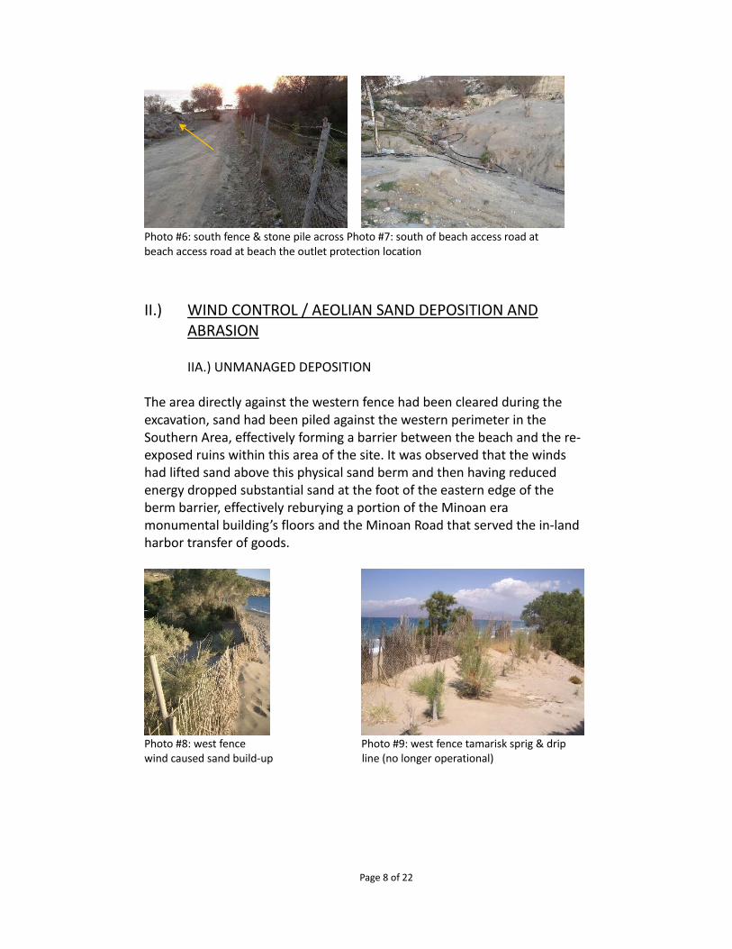
Photo #6: south fence & stone pile across Photo #7: south of beach access road at beach access road at beach the outlet protection location
II.) WIND CONTROL / AEOLIAN SAND DEPOSITION AND ABRASION
IIA.) UNMANAGED DEPOSITION
The area directly against the western fence had been cleared during the excavation, sand had been piled against the western perimeter in the Southern Area, effectively forming a barrier between the beach and the re-exposed ruins within this area of the site. It was observed that the winds had lifted sand above this physical sand berm and then having reduced energy dropped substantial sand at the foot of the eastern edge of the berm barrier, effectively reburying a portion of the Minoan era monumental building’s floors and the Minoan Road that served the in-land harbor transfer of goods.
Photo #8: west fence Photo #9: west fence tamarisk sprig & drip wind caused sand build-up line (no longer operational)
Page 8 of 22
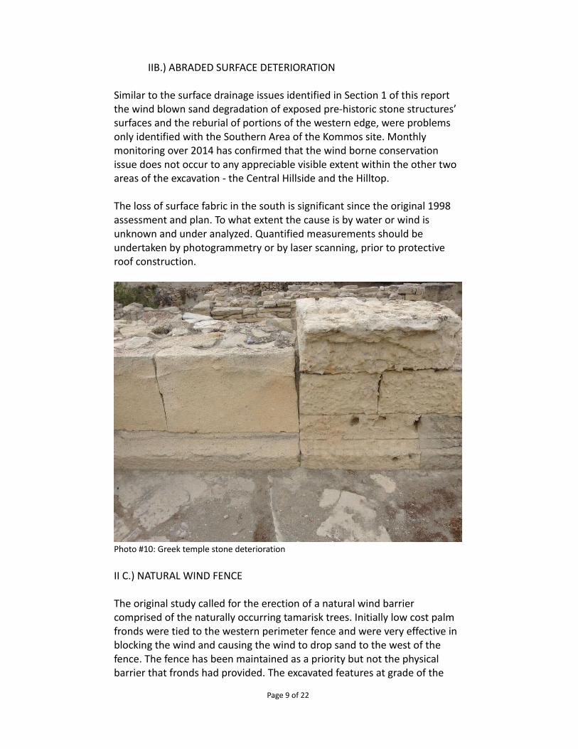
IIB.) ABRADED SURFACE DETERIORATION
Similar to the surface drainage issues identified in Section 1 of this report the wind blown sand degradation of exposed pre-historic stone structures’ surfaces and the reburial of portions of the western edge, were problems only identified with the Southern Area of the Kommos site. Monthly monitoring over 2014 has confirmed that the wind borne conservation issue does not occur to any appreciable visible extent within the other two areas of the excavation - the Central Hillside and the Hilltop.
The loss of surface fabric in the south is significant since the original 1998 assessment and plan. To what extent the cause is by water or wind is unknown and under analyzed. Quantified measurements should be undertaken by photogrammetry or by laser scanning, prior to protective roof construction.
Photo #10: Greek temple stone deterioration
II C.) NATURAL WIND FENCE
The original study called for the erection of a natural wind barrier comprised of the naturally occurring tamarisk trees. Initially low cost palm fronds were tied to the western perimeter fence and were very effective in blocking the wind and causing the wind to drop sand to the west of the fence. The fence has been maintained as a priority but not the physical barrier that fronds had provided. The excavated features at grade of the
Page 9 of 22
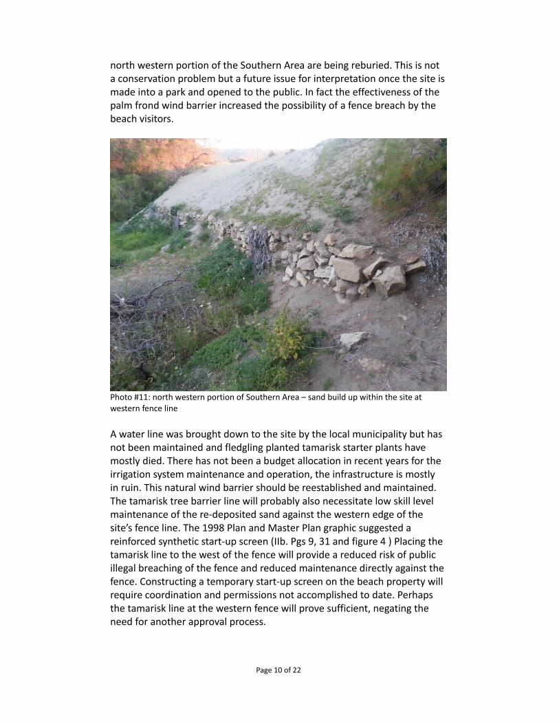
north western portion of the Southern Area are being reburied. This is not a conservation problem but a future issue for interpretation once the site is made into a park and opened to the public. In fact the effectiveness of the palm frond wind barrier increased the possibility of a fence breach by the beach visitors.
Photo #11: north western portion of Southern Area – sand build up within the site at western fence line
A water line was brought down to the site by the local municipality but has not been maintained and fledgling planted tamarisk starter plants have mostly died. There has not been a budget allocation in recent years for the irrigation system maintenance and operation, the infrastructure is mostly in ruin. This natural wind barrier should be reestablished and maintained.The tamarisk tree barrier line will probably also necessitate low skill level maintenance of the re-deposited sand against the western edge of the site’s fence line. The 1998 Plan and Master Plan graphic suggested a reinforced synthetic start-up screen (IIb. Pgs 9, 31 and figure 4 ) Placing the tamarisk line to the west of the fence will provide a reduced risk of public illegal breaching of the fence and reduced maintenance directly against the fence. Constructing a temporary start-up screen on the beach property will require coordination and permissions not accomplished to date. Perhaps the tamarisk line at the western fence will prove sufficient, negating the need for another approval process.
Page 10 of 22
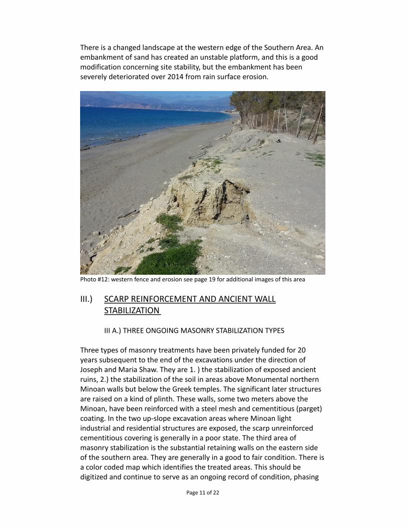
There is a changed landscape at the western edge of the Southern Area. An embankment of sand has created an unstable platform, and this is a good modification concerning site stability, but the embankment has been severely deteriorated over 2014 from rain surface erosion.
Photo #12: western fence and erosion see page 19 for additional images of this area
III.) SCARP REINFORCEMENT AND ANCIENT WALL STABILIZATION
III A.) THREE ONGOING MASONRY STABILIZATION TYPES
Three types of masonry treatments have been privately funded for 20 years subsequent to the end of the excavations under the direction of Joseph and Maria Shaw. They are 1. ) the stabilization of exposed ancient ruins, 2.) the stabilization of the soil in areas above Monumental northern Minoan walls but below the Greek temples. The significant later structures are raised on a kind of plinth. These walls, some two meters above the Minoan, have been reinforced with a steel mesh and cementitious (parget) coating. In the two up-slope excavation areas where Minoan light industrial and residential structures are exposed, the scarp unreinforced cementitious covering is generally in a poor state. The third area of masonry stabilization is the substantial retaining walls on the eastern side of the southern area. They are generally in a good to fair condition. There is a color coded map which identifies the treated areas. This should be digitized and continue to serve as an ongoing record of condition, phasing
Page 11 of 22
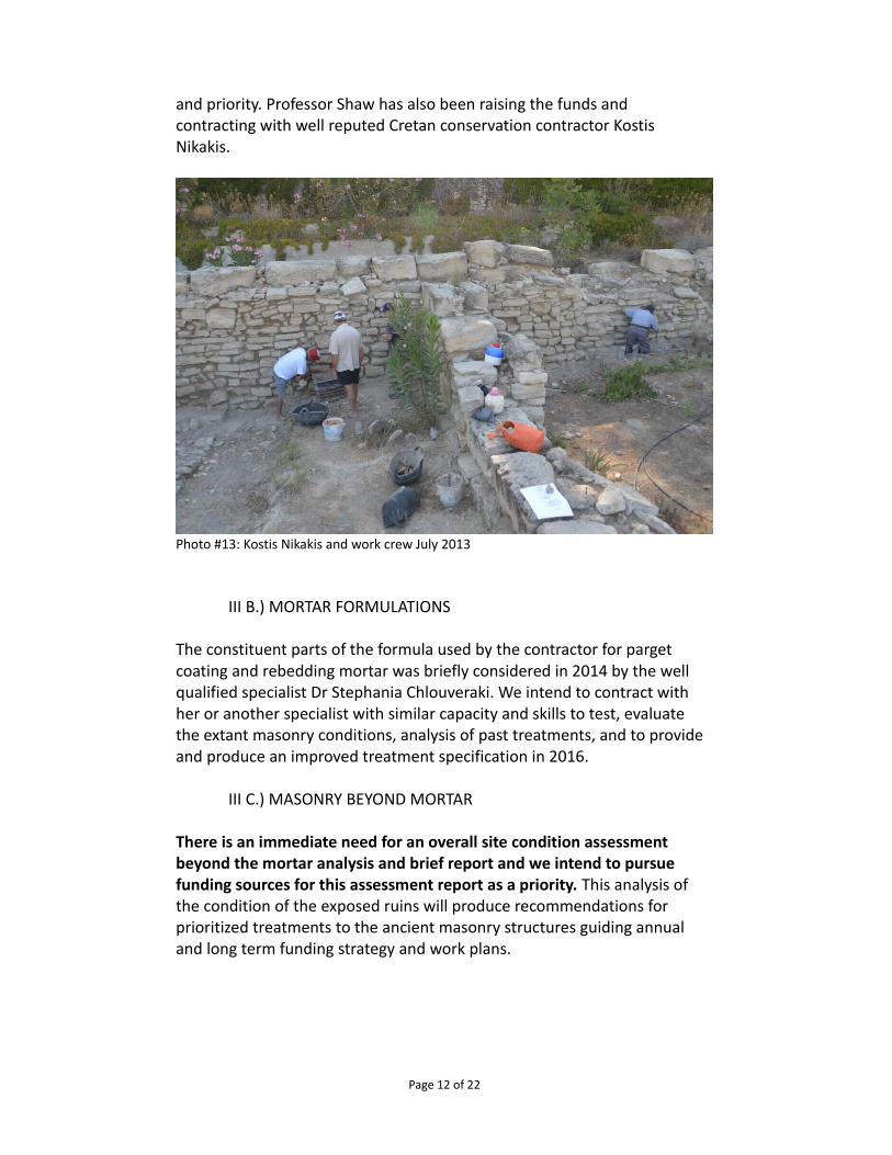
and priority. Professor Shaw has also been raising the funds and contracting with well reputed Cretan conservation contractor Kostis Nikakis.
Photo #13: Kostis Nikakis and work crew July 2013
III B.) MORTAR FORMULATIONS
The constituent parts of the formula used by the contractor for parget coating and rebedding mortar was briefly considered in 2014 by the well qualified specialist Dr Stephania Chlouveraki. We intend to contract with her or another specialist with similar capacity and skills to test, evaluate the extant masonry conditions, analysis of past treatments, and to provide and produce an improved treatment specification in 2016.
III C.) MASONRY BEYOND MORTAR
There is an immediate need for an overall site condition assessment beyond the mortar analysis and brief report and we intend to pursue funding sources for this assessment report as a priority. This analysis of the condition of the exposed ruins will produce recommendations for prioritized treatments to the ancient masonry structures guiding annual and long term funding strategy and work plans.
Page 12 of 22
The larger concern is associated with making the Kommos site useful beyond the benefits of the scholastic community. This involves creating a viable archaeological park development as a means of providing future stewardship, through demonstrable public benefit. Towards this vision we have communicated with Master Plan architect Eleni Chlepa and have coordinated a scope of work for construction documentation and estimate of probable construction cost. The park conceptual master plan of 1998 included consideration of public life safety and amenities associated with the park use at Kommos. These are listed below and are consistent with past observations and design concepts represented in the 1998 & 2005 schematic conceptual plans.
IV.) SITE ACCESS AND VISITATION (DISABLED & UNIVERSAL)
IV A.) ORIENTATION AND ACCESS CONTROL
IV A1) Vehicular parking Consistent with the previously submitted 1998 and 2005 conceptual master plan, provision for buses, campers, 84-92 cars and motorcycles has been schematically located outside the upper north-eastern fence line on private property, in an area of approximately 4200 square meters. Advantageous provisions for bicycles and perhaps other compact non-motorized vehicles can be located with installed racks closer to the entry building complex. All vehicular parking should be coordinated with the municipality of Pitsidia, the entity which manages the Kommos beach.
IV A2) Perimeter security fencing Concrete embedded steel post with 650 meters of welded wire mesh fencing continues to be maintained through private funding efforts. A similar replacement fence should be including in the future construction documents, and as with all future planned improvements, early and often communication with the 23rd Ephorate should be contractually required, during all planning phases.
IV A3) Entry gate(s) – public private There exist three entry gates into the site and that number continues to be proposed for the park development. The principal access gate is now located approximately 22 meters north of the south east fenced corner of the site. This will be relocated to align with the archaeological park entry complex. This has been schematically illustrated 10 meters west of the southeast corner, opening onto a flattened platea where controlled access and egress to and from the park is shown to begin and end.
Page 13 of 22
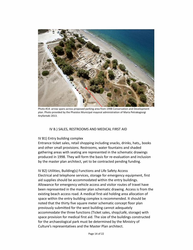
Photo #14: arrow spans across proposed parking area from 1998 Conservation and Development plan. Photo provided by the Phaistos Municipal mayoral administration of Maria Petrakogiorgi Anyfantaki 2013.
IV B.) SALES, RESTROOMS AND MEDICAL FIRST AID
IV B1) Entry building complex Entrance ticket sales, retail shopping including snacks, drinks, hats,, books and other small provisions. Restrooms, water fountains and shaded gathering areas with seating are represented in the schematic drawings produced in 1998. They will form the basis for re-evaluation and inclusion by the master plan architect, yet to be contracted pending funding.
IV B2) Utilities, Building(s) Functions and Life Safety Access Electrical and telephone services, storage for emergency equipment, first aid supplies should be accommodated within the entry buildings. Allowance for emergency vehicle access and visitor routes of travel have been represented in the master plan schematic drawing. Access is from the existing beach access road. A medical first-aid holding area allocation of space within the entry building complex is recommended. It should be noted that the thirty five square meter schematic concept floor plan previously submitted for the west building cannot adequately accommodate the three functions (Ticket sales, shop/café, storage) with space provision for medical first aid. The size of the buildings constructed for the archaeological park must be determined by the Ministry of Culture’s representatives and the Master Plan architect.
Page 14 of 22
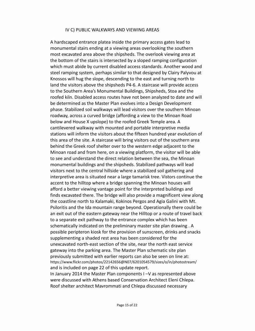
IV C) PUBLIC WALKWAYS AND VIEWING AREAS
A hardscaped entrance platea inside the primary access gates lead to monumental stairs ending at a viewing areas overlooking the southern most excavated area above the shipsheds. The overlook viewing area at the bottom of the stairs is intersected by a sloped ramping configuration which must abide by current disabled access standards. Another wood and steel ramping system, perhaps similar to that designed by Clairy Palyvou at Knossos will hug the slope, descending to the east and turning north to land the visitors above the shipsheds P4-6. A staircase will provide access to the Southern Area’s Monumental Buildings, Shipsheds, Stoa and the roofed kiln. Disabled access routes have not been analyzed to date and will be determined as the Master Plan evolves into a Design Development phase. Stabilized soil walkways will lead visitors over the southern Minoan roadway, across a curved bridge (affording a view to the Minoan Road below and House X upslope) to the roofed Greek Temple area. A cantilevered walkway with mounted and portable interpretive media stations will inform the visitors about the fifteen hundred year evolution of this area of the site. A staircase will bring visitors out of the southern area behind the Greek roof shelter over to the western edge adjacent to the Minoan road and from here, on a viewing platform, the visitor will be able to see and understand the direct relation between the sea, the Minoan monumental buildings and the shipsheds. Stabilized pathways will lead visitors next to the central hillside where a stabilized soil gathering and interpretive area is situated near a large tamarisk tree. Vistors continue the accent to the hilltop where a bridge spanning the Minoan houses will afford a better viewing vantage point for the interpreted buildings and finds excavated there. The bridge will also provide a magnificent view along the coastline north to Kalamaki, Kokinos Pergos and Agia Galini with Mt. Psiloritis and the Ida mountain range beyond. Operationally there could be an exit out of the eastern gateway near the Hilltop or a route of travel back to a separate exit pathway to the entrance complex which has been schematically indicated on the preliminary master site plan drawing . A possible peripteron kiosk for the provision of sunscreen, drinks and snacks supplementing a shaded rest area has been considered for the unexcavated north-east section of the site, near the north east service gateway into the parking area. The Master Plan schematic site plan previously submitted with earlier reports can also be seen on line at: https://www.flickr.com/photos/22142656@N07/6201054579/sizes/o/in/photostream/ and is included on page 22 of this update report. In January 2014 the Master Plan components I –V as represented above were discussed with Athens based Conservation Architect Eleni Chlepa. Roof shelter architect Mavrommati and Chlepa discussed necessary
Page 15 of 22
engineering services for the roof shelter and all of the components of the master plan and a new budget for the archaeological park improvements including the two roof shelters was created. The attached €278,455. Budget was posted on the Kommos web site and the budget with the associated detailed scope of work will continue to inform our fund raising efforts. http://www.kommosconservancy.org/documents-2/budget/
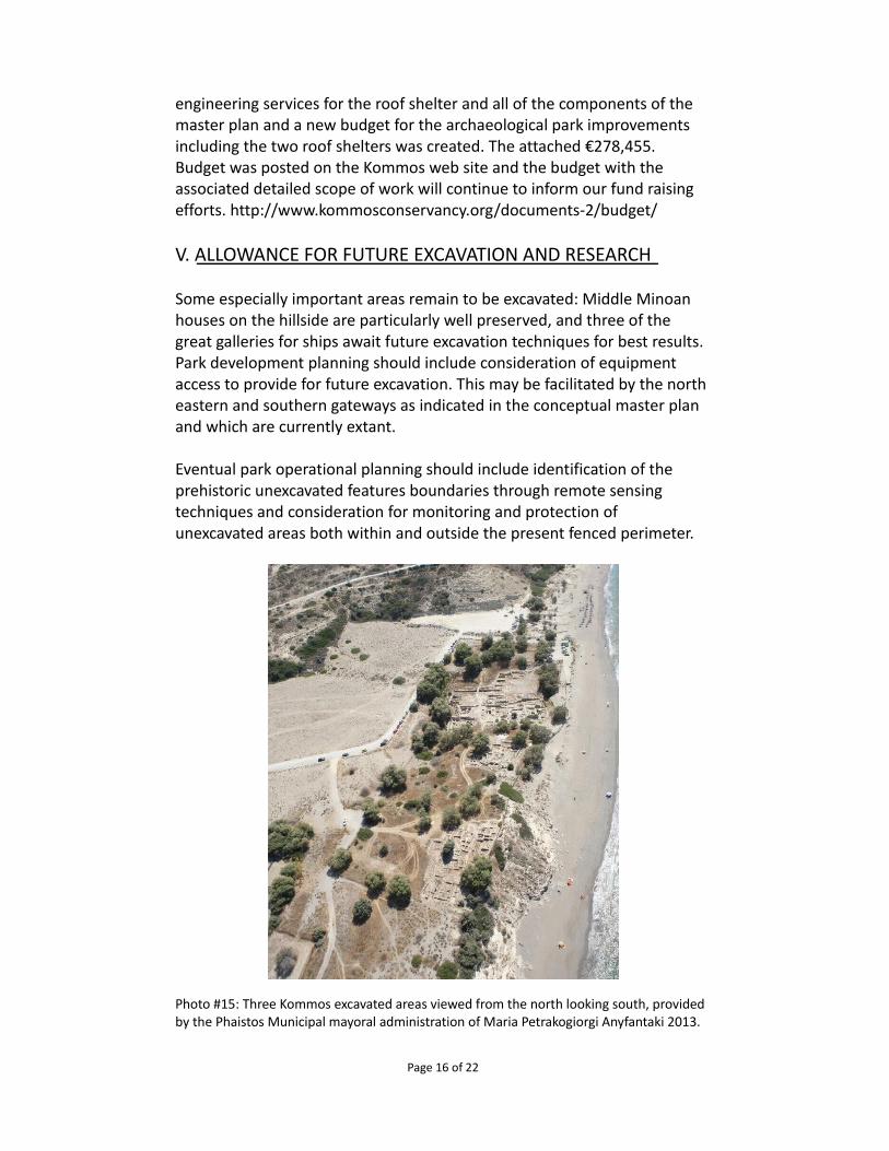
V. ALLOWANCE FOR FUTURE EXCAVATION AND RESEARCH
Some especially important areas remain to be excavated: Middle Minoan houses on the hillside are particularly well preserved, and three of the great galleries for ships await future excavation techniques for best results. Park development planning should include consideration of equipment access to provide for future excavation. This may be facilitated by the north eastern and southern gateways as indicated in the conceptual master plan and which are currently extant.
Eventual park operational planning should include identification of the prehistoric unexcavated features boundaries through remote sensing techniques and consideration for monitoring and protection of unexcavated areas both within and outside the present fenced perimeter.
Photo #15: Three Kommos excavated areas viewed from the north looking south, provided by the Phaistos Municipal mayoral administration of Maria Petrakogiorgi Anyfantaki 2013.
Page 16 of 22
VI. ASSOCIATED EXTERNAL CONSIDERTIONS
Other related independent efforts directly adjacent and thereby potentially associated with the Kommos archaeological site have involved the support of local elected Mayors and councils of Pitsidia/ Matala, Tymbaki and Moires. The local Pitsidia historical group may be interested in serving in a limited site stewardship capacity by providing site monitoring recordation and communication.
An introduction through the local municipality in January 2014 provided an opportunity to discuss the park conceptual plans with the local community through an open public illustrated presentation.
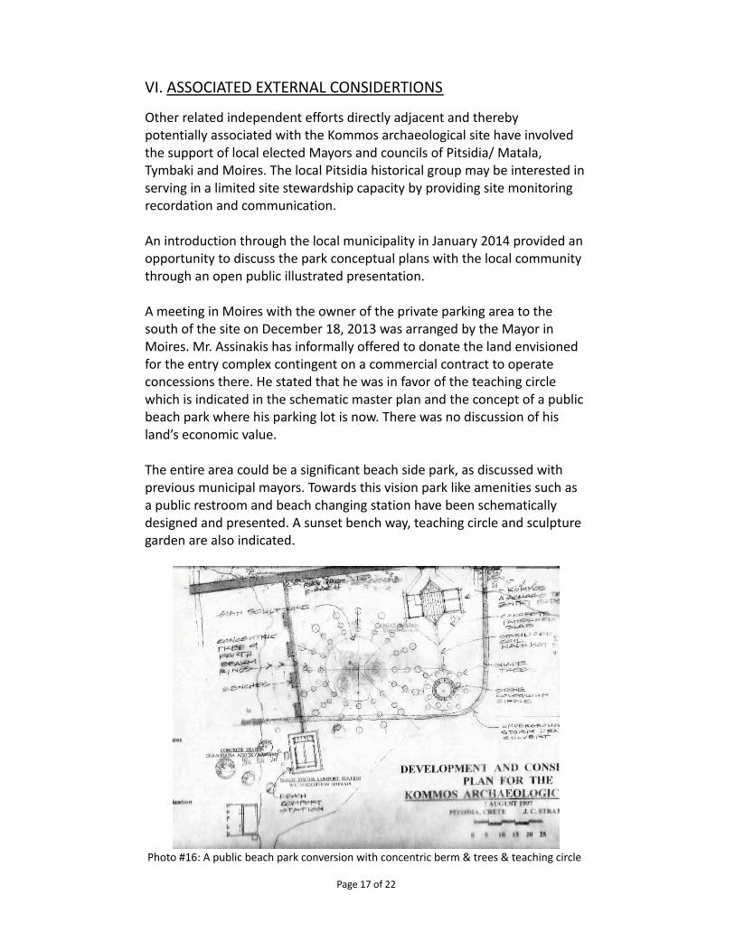
A meeting in Moires with the owner of the private parking area to the south of the site on December 18, 2013 was arranged by the Mayor in Moires. Mr. Assinakis has informally offered to donate the land envisioned for the entry complex contingent on a commercial contract to operate concessions there. He stated that he was in favor of the teaching circle which is indicated in the schematic master plan and the concept of a public beach park where his parking lot is now. There was no discussion of his land’s economic value.
The entire area could be a significant beach side park, as discussed with previous municipal mayors. Towards this vision park like amenities such as a public restroom and beach changing station have been schematically designed and presented. A sunset bench way, teaching circle and sculpture garden are also indicated.
Photo #16: A public beach park conversion with concentric berm & trees & teaching circle
Page 17 of 22
The Kommos Conservancy maintains an information and educational web site ( www.KommosConservancy.org )and has a regular presence on web based social media outlets, such as Facebook, Twitter and Pinterest. Our mission is dedicated to the conservation and educational outreach about the Kommos archaeological site. We have engaged the support of past and present elected officials. We believe that an archaeological park is a necessary step in assisting the future stewardship and maintenance for Kommos. We are actively engaged in partnership and fundraising towards a long term commitment.
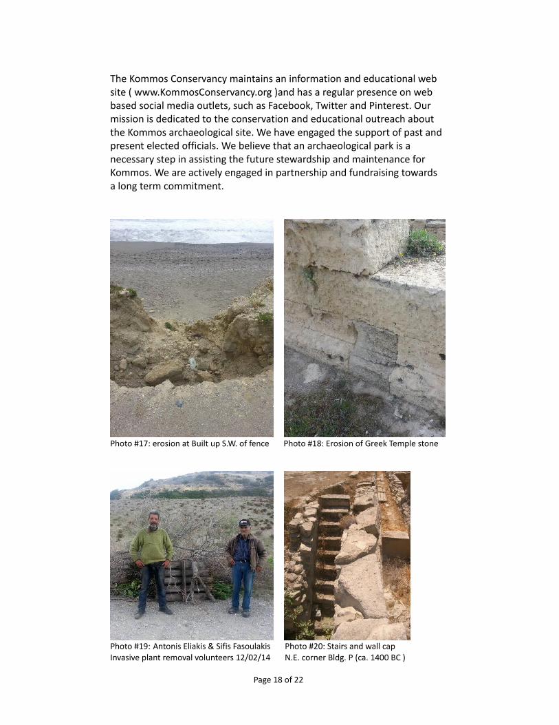
Photo #17: erosion at Built up S.W. of fence Photo #18: Erosion of Greek Temple stone
Photo #19: Antonis Eliakis & Sifis Fasoulakis Photo #20: Stairs and wall cap Invasive plant removal volunteers 12/02/14 N.E. corner Bldg. P (ca. 1400 BC )
Page 18 of 22
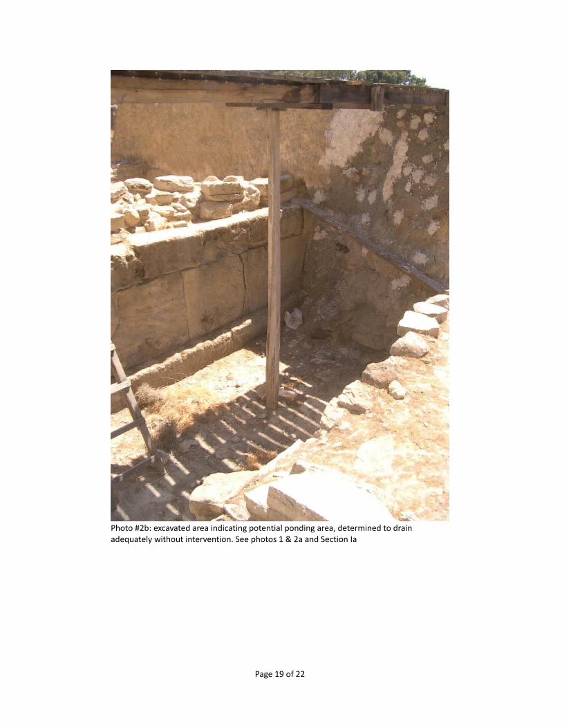
Photo #2b: excavated area indicating potential ponding area, determined to drain adequately without intervention. See photos 1 & 2a and Section Ia
Page 19 of 22
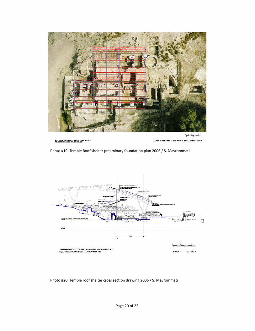
Photo #19: Temple Roof shelter preliminary foundation plan 2006 / S. Mavrommati
Photo #20: Temple roof shelter cross section drawing 2006 / S. Mavrommati
Page 20 of 22

Photo #03 Roof shelter view north west from viewing area above shipsheds / Southern Area, superimposed shelter image by S. Mavrommati 2006
Photo #21: Superimposed roof shelter over kiln in south stoa - 2006 S. Mavrommati
Page 21 of 22
Page 22 of 22


![JCP & Seong Chan Park [arXiv: 1512.08117]](https://static.fdocument.org/doc/165x107/62e400489ee3a251ff620048/jcp-amp-seong-chan-park-arxiv-151208117.jpg)